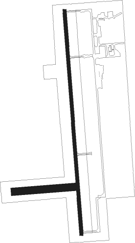
Alva - Alva Regional
Airport details
| Country | United States of America |
| State | Oklahoma |
| Region | K4 |
| Airspace | Kansas City Ctr |
| Municipality | Alva |
| Elevation | 1474ft (449m) |
| Timezone | GMT -6 |
| Coordinates | 36.77337, -98.67019 |
| Magnetic var | |
| Type | land |
| Available since | X-Plane v10.40 |
| ICAO code | KAVK |
| IATA code | n/a |
| FAA code | AVK |
Communication
| Alva Regional AWOS 3 | 121.125 |
| Alva Regional CTAF/UNICOM | 122.800 |
| Alva Regional VANCE Approach/Departure | 119.775 |
Nearby Points of Interest:
Central National Bank
-Ingersoll Tile Elevator
-Cherokee Friends Church
-Salt Plains National Wildlife Refuge
Nearby beacons
| code | identifier | dist | bearing | frequency |
|---|---|---|---|---|
| ANY | ANTHONY TACAN | 33.3 | 52° | 112.90 |
| END | VANCE (ENID) VORTAC | 44.4 | 120° | 115.40 |
| ODG | WOODRING (ENID) VOR/DME | 48.8 | 114° | 109 |
| EI | GARFY (ENID) NDB | 51.9 | 120° | 341 |
| IFI | KINGFISHER VORTAC | 66.4 | 145° | 114.70 |
Instrument approach procedures
| runway | airway (heading) | route (dist, bearing) |
|---|---|---|
| RW18 | SPIRY (216°) | SPIRY ZOKOF (6mi, 270°) 3300ft |
| RW18 | WADAT (144°) | WADAT ZOKOF (6mi, 90°) 3300ft |
| RW18 | ZOKOF (180°) | ZOKOF 3300ft |
| RNAV | ZOKOF 3300ft ZIXIN (5mi, 180°) 3300ft KAVK (6mi, 180°) 1524ft (5822mi, 110°) 1738ft HINEN (5823mi, 290°) 3300ft HINEN (turn) | |
| RW36 | ANEME (36°) | ANEME HINEN (6mi, 90°) 3300ft |
| RW36 | FASPA (325°) | FASPA HINEN (6mi, 270°) 3300ft |
| RW36 | HINEN (0°) | HINEN 3300ft |
| RNAV | HINEN 3300ft CADAP (5mi, 0°) 3300ft AURAL (4mi, 0°) 2080ft KAVK (2mi, 0°) 1509ft (5822mi, 110°) 1721ft ZOKOF (5821mi, 291°) 3300ft ZOKOF (turn) |
Disclaimer
The information on this website is not for real aviation. Use this data with the X-Plane flight simulator only! Data taken with kind consent from X-Plane 12 source code and data files. Content is subject to change without notice.

