Wilkes-barre/scranton - Wilkes Barre Scranton Intl
Airport details
| Country | United States of America |
| State | Pennsylvania |
| Region | K6 |
| Airspace | New York Ctr |
| Municipality | Luzerne County |
| Elevation | 959ft (292m) |
| Timezone | GMT -5 |
| Coordinates | 41.33847, -75.72339 |
| Magnetic var | |
| Type | land |
| Available since | X-Plane v10.40 |
| ICAO code | KAVP |
| IATA code | AVP |
| FAA code | AVP |
Communication
| Wilkes Barre Scranton Intl ATIS | 111.600 |
| Wilkes Barre Scranton Intl UNICOM | 122.950 |
| Wilkes Barre Scranton Intl Ground Control | 121.900 |
| Wilkes Barre Scranton Intl Tower | 120.100 |
| Wilkes Barre Scranton Intl Approach/Departure | 126.300 |
| Wilkes Barre Scranton Intl Approach/Departure | 124.500 |
Approach frequencies
| ILS-cat-I | RW04 | 109.9 | 18.00mi |
| ILS-cat-I | RW22 | 109.9 | 18.00mi |
| 3° GS | RW04 | 109.9 | 18.00mi |
| 3° GS | RW22 | 109.9 | 18.00mi |
Nearby Points of Interest:
Roger Williams Public School No. 10
-Delaware, Lackawanna and Western Railroad Yard-Dickson Manufacturing Co. Site
-Lackawanna Avenue Commercial Historic District
-Harrison Avenue Bridge
-Dime Bank Building
-Scranton
-Lackawanna County Courthouse
-Ad-Lin Building
-Grand Army of the Republic Building
-First Church of Christ, Scientist
-Scranton City Hall
-Finch Building
-Albright Memorial Building
-James Madison School
-Dickson Works
-Terence V. Powderly House
-Century Club of Scranton
-Florence Apartments
-Scranton Armory
-Joseph Cassese House
-Tripp Family Homestead
-Wyoming Monument
-Scranton Lace Company
-Swetland Homestead
-North Scranton Junior High School
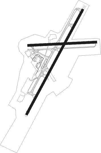
Runway info
Runway 4 / 22  | ||
| length | 2287m (7503ft) | |
| bearing | 40° / 220° | |
| width | 46m (150ft) | |
| surface | asphalt | |
| blast zone | 61m (200ft) / 122m (400ft) | |
| Runway 10 / 28 | ||
| length | 1308m (4291ft) | |
| bearing | 91° / 271° | |
| width | 46m (150ft) | |
| surface | asphalt | |
| blast zone | 66m (217ft) / 0m (0ft) | |
Nearby beacons
| code | identifier | dist | bearing | frequency |
|---|---|---|---|---|
| LVZ | WILKES-BARRE VORTAC | 4.2 | 153° | 111.60 |
| FJC | ALLENTOWN VORTAC | 38.7 | 156° | 117.50 |
| STW | STILLWATER VOR/DME | 43.7 | 112° | 109.60 |
| ETX | EAST TEXAS VOR/DME | 45.5 | 177° | 110.20 |
| MIP | MILTON VORTAC | 46.5 | 252° | 109.20 |
| HNK | HANCOCK VOR/DME | 47.1 | 29° | 116.80 |
| BWZ | BROADWAY (SCHOOLEY'S MT) VOR/DME | 52.1 | 121° | 114.20 |
| CFB | BINGHAMTON VOR/DME | 52.5 | 333° | 112.20 |
| DNY | DE LANCEY VOR/DME | 61 | 42° | 112.10 |
| RAV | RAVINE VORTAC | 61.6 | 228° | 114.60 |
| SBJ | SOLBERG VOR/DME | 63.5 | 128° | 112.90 |
| BZJ | BELLGROVE (INDIANTOWN GAP) NDB | 66 | 223° | 328 |
Departure and arrival routes
| Transition altitude | 18000ft |
| Transition level | 18000ft |
| SID end points | distance | outbound heading | |
|---|---|---|---|
| RW04 | |||
| AVP8 | 30mi | 167° | |
| RW22 | |||
| AVP8 | 30mi | 167° | |
| RW28 | |||
| AVP8 | 30mi | 167° | |
Instrument approach procedures
| runway | airway (heading) | route (dist, bearing) |
|---|---|---|
| RW04 | ROXXE (40°) | ROXXE 4000ft |
| RNAV | ROXXE 4000ft HAZNN (6mi, 40°) 3900ft YEGXE (3mi, 40°) 2820ft PISTE (3mi, 40°) 2020ft KAVP (4mi, 40°) 1015ft (4764mi, 119°) 1162ft JIDPU (4759mi, 299°) 4000ft JIDPU (turn) | |
| RW22 | JIDPU (221°) | JIDPU 4000ft |
| RNAV | JIDPU 4000ft JODIE (3mi, 221°) 3300ft KONAA (3mi, 221°) 2900ft KAVP (7mi, 221°) 962ft (4764mi, 119°) 1900ft LOPEZ (4776mi, 299°) 4000ft LOPEZ (turn) |
Disclaimer
The information on this website is not for real aviation. Use this data with the X-Plane flight simulator only! Data taken with kind consent from X-Plane 12 source code and data files. Content is subject to change without notice.