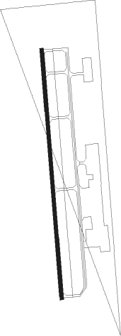
Altus - Altus/quartz Mountain Regl
Airport details
| Country | United States of America |
| State | Oklahoma |
| Region | K4 |
| Airspace | Ft Worth Ctr |
| Municipality | Altus |
| Elevation | 1433ft (437m) |
| Timezone | GMT -6 |
| Coordinates | 34.69881, -99.33847 |
| Magnetic var | |
| Type | land |
| Available since | X-Plane v10.32 |
| ICAO code | KAXS |
| IATA code | AXS |
| FAA code | AXS |
Communication
| Altus/Quartz Mountain Regl AWOS 3 | 118.825 |
| Altus/Quartz Mountain Regl CTAF/UNICOM | 122.800 |
| Altus/Quartz Mountain Regl Approach/Departure | 125.100 |
Nearby Points of Interest:
W.C. Baker House
-Jackson County Courthouse
-Greer County Courthouse
-Doan's Adobe House
-Downtown Hobart Historic District
-Hobart City Hall
-Tillman County Courthouse
-Hollis City Hall and Jail
Nearby beacons
| code | identifier | dist | bearing | frequency |
|---|---|---|---|---|
| LTS | ALTUS VORTAC | 3.9 | 118° | 109.80 |
| HBR | HOBART VORTAC | 16.9 | 59° | 111.80 |
| BFV | BURNS FLAT (CLINTON) VORTAC | 32.9 | 14° | 110 |
| BZ | FOSSI (CLINTON) NDB | 45.6 | 10° | 393 |
| LAW | LAWTON VOR/DME | 47.3 | 102° | 109.40 |
| CDS | CHILDRESS VORTAC | 51 | 251° | 117 |
| SPS | WICHITA FALLS VORTAC | 56.4 | 134° | 112.70 |
| SHP | SHEPPARD (WICHITA FALLS) TACAN | 60.2 | 130° | 110.80 |
| SKB | SCOTLAND (WICHITA FALLS) NDB | 69.3 | 137° | 344 |
| GTH | DME | 74.2 | 227° | 114.50 |
Instrument approach procedures
| runway | airway (heading) | route (dist, bearing) |
|---|---|---|
| RW17 | ADOBE (82°) | ADOBE SAVTE (15mi, 23°) 4000ft ITCHY (6mi, 90°) 4000ft |
| RW17 | HBR (239°) | HBR MEWGI (8mi, 285°) 4000ft ITCHY (6mi, 270°) 4000ft |
| RNAV | ITCHY 4000ft KAYQA (6mi, 180°) 3400ft FABIR (3mi, 180°) 2420ft KAXS (3mi, 180°) 1473ft (5866mi, 109°) 2000ft ADOBE (5877mi, 289°) 4000ft ADOBE (turn) | |
| RW35 | ADOBE (82°) | ADOBE AKYAL (12mi, 149°) 4000ft NAMTE (6mi, 90°) 4000ft |
| RW35 | HBR (239°) | HBR LAGSY (24mi, 202°) 4000ft NAMTE (6mi, 270°) 4000ft |
| RNAV | NAMTE 4000ft RARDE (6mi, 360°) 3400ft SEBOE (3mi, 360°) 2400ft KAXS (3mi, 360°) 1453ft (5866mi, 109°) 2100ft ADOBE (5877mi, 289°) 4000ft ADOBE (turn) |
Disclaimer
The information on this website is not for real aviation. Use this data with the X-Plane flight simulator only! Data taken with kind consent from X-Plane 12 source code and data files. Content is subject to change without notice.
