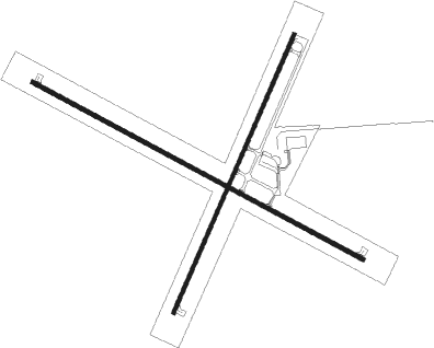
Colorado City - Colorado City Muni
Airport details
| Country | United States of America |
| State | Arizona |
| Region | K2 |
| Airspace | Los Angeles Ctr |
| Municipality | Colorado City |
| Elevation | 4874ft (1486m) |
| Timezone | GMT -7 |
| Coordinates | 36.95995, -113.01389 |
| Magnetic var | |
| Type | land |
| Available since | X-Plane v10.40 |
| ICAO code | KAZC |
| IATA code | n/a |
| FAA code | AZC |
Communication
| Colorado City Muni AWOS 3 | 118.375 |
| Colorado City Muni CTAF/UNICOM | 122.700 |
Nearby Points of Interest:
Deseret Telegraph and Post Office
-Big House
-South Campground Comfort Station
-Zion Nature Center-Zion Inn
-Oak Creek Historic District
-Pine Creek Residential Historic District
-Canyon Overlook Trail
-Zion – Mount Carmel Highway
-Kaibab Indian Reservation
-Zion Lodge–Birch Creek Historic District
-East Entrance Residence
-East Entrance Checking Station
-Emerald Pools Trail
-Grotto Residence
-Grotto Camping Ground South Comfort Station
-Grotto Camping Ground North Comfort Station
-Hurricane Canal
-Hidden Canyon Trail
-Cable Mountain Draw Works
-Cable Creek Bridge
-East Rim Trail
-Riverside Walk
-John Steele House
-Kanab Lodge
-Kanab Hotel and Cafe

Nearby beacons
| code | identifier | dist | bearing | frequency |
|---|---|---|---|---|
| AZC | COLORADO CITY NDB | 0.2 | 89° | 403 |
| UTI | ST GEORGE VOR/DME | 24.4 | 277° | 108.60 |
| EHK | ENOCH VOR/DME | 49.7 | 356° | 117.30 |
| BCE | BRYCE CANYON VORTAC | 55.3 | 44° | 112.80 |
| GCN | GRAND CANYON VOR/DME | 73.2 | 139° | 111.65 |
Instrument approach procedures
| runway | airway (heading) | route (dist, bearing) |
|---|---|---|
| RW11 | JITKA (104°) | JITKA JAGUK (17mi, 95°) 8200ft |
| RW11 | MATZO (138°) | MATZO JAGUK (11mi, 168°) 8200ft |
| RNAV | JAGUK 8200ft HAPER (2mi, 117°) 7200ft KEMBE (2mi, 117°) 7100ft LERBE (4mi, 117°) 5680ft KAZC (3mi, 117°) 4900ft (6498mi, 108°) 5104ft MGHEE (6488mi, 288°) 9100ft MGHEE (turn) | |
| RW29 | JALMA (296°) | JALMA HITAR (11mi, 296°) 11100ft GLIME (15mi, 295°) 10100ft MGHEE (5mi, 297°) 9100ft |
| RW29 | JITKA (104°) | JITKA MGHEE (43mi, 108°) 9100ft MGHEE (turn) 9100ft |
| RW29 | KACIR (268°) | KACIR MGHEE (26mi, 252°) 9100ft |
| RW29 | MATZO (138°) | MATZO CUDIL (23mi, 129°) 9900ft MGHEE (13mi, 129°) 9100ft MGHEE (turn) 9100ft |
| RNAV | MGHEE 9100ft PECHS (6mi, 297°) 7600ft ZARED (4mi, 297°) 6200ft KAZC (5mi, 297°) 4894ft (6498mi, 108°) 6600ft ZUXOS (6499mi, 288°) MGHEE (12mi, 97°) 9100ft MGHEE (turn) |
Disclaimer
The information on this website is not for real aviation. Use this data with the X-Plane flight simulator only! Data taken with kind consent from X-Plane 12 source code and data files. Content is subject to change without notice.