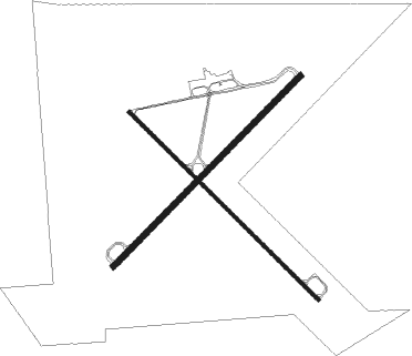
Battle Mountain
Airport details
| Country | United States of America |
| State | Nevada |
| Region | K2 |
| Airspace | Salt Lake City Ctr |
| Municipality | Lander County |
| Elevation | 4532ft (1381m) |
| Timezone | GMT -8 |
| Coordinates | 40.60663, -116.87289 |
| Magnetic var | |
| Type | land |
| Available since | X-Plane v10.40 |
| ICAO code | KBAM |
| IATA code | BAM |
| FAA code | BAM |
Communication
| Battle Mountain AWOS THREE | 119.450 |
| Battle Mountain CTAF/UNICOM | 122.800 |
Nearby beacons
| code | identifier | dist | bearing | frequency |
|---|---|---|---|---|
| BAM | BATTLE MOUNTAIN VORTAC | 3.1 | 233° | 112.20 |
| INA | WINNEMUCCA VOR/DME | 46.2 | 287° | 108.20 |
Instrument approach procedures
| runway | airway (heading) | route (dist, bearing) |
|---|---|---|
| RW04 | BAM (53°) | BAM DIYLA (11mi, 231°) 8900ft DIYLA (turn) 8900ft |
| RW04 | RAJKO (72°) | RAJKO DIYLA (10mi, 98°) 8900ft |
| RNAV | DIYLA 8900ft EBREQ (7mi, 48°) 6600ft ZOLPI (4mi, 56°) 5400ft SIHEJ (2mi, 57°) 4824ft (6612mi, 109°) 5500ft DIYLA (6623mi, 289°) 8900ft DIYLA (turn) 8900ft | |
| RW22 | BAM (53°) | BAM HEPOR (17mi, 59°) 8500ft HEPOR (turn) 8500ft |
| RW22 | JOKNA (264°) | JOKNA HEPOR (14mi, 285°) 8500ft |
| RW22 | UHYUV (242°) | UHYUV HEPOR (9mi, 244°) 8500ft |
| RNAV | HEPOR 8500ft WOGID (6mi, 242°) 6900ft ZOWIE (5mi, 237°) 5400ft KBAM (3mi, 241°) 4582ft (6611mi, 109°) 4753ft OQSUL (6620mi, 289°) RAJKO (12mi, 265°) 11900ft RAJKO (turn) 11900ft |
Disclaimer
The information on this website is not for real aviation. Use this data with the X-Plane flight simulator only! Data taken with kind consent from X-Plane 12 source code and data files. Content is subject to change without notice.

