Bennettsville - Marlboro County
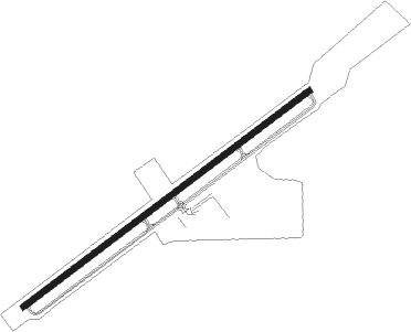
Airport details
| Country | United States of America |
| State | South Carolina |
| Region | K7 |
| Airspace | Jacksonville Ctr |
| Municipality | Marlboro County |
| Elevation | 145ft (44m) |
| Timezone | GMT -5 |
| Coordinates | 34.62171, -79.73436 |
| Magnetic var | |
| Type | land |
| Available since | X-Plane v10.40 |
| ICAO code | KBBP |
| IATA code | BTN |
| FAA code | BBP |
Communication
| Marlboro County Marlboro AWOS | 123.825 |
| Marlboro County Marlboro CTAF | 122.800 |
| Marlboro County Marlboro CTAF(Tower) | 122.800 |
| Marlboro County Florence App/Dep | 118.600 |
Nearby Points of Interest:
Appin
-Magnolia House
-Jennings-Brown House
-Robertson-Easterling-McLaurin House
-Manship Farmstead
-McLaurin-Roper-McColl Farmstead
-Robert Smalls School
-McLaurin House
-Pegues Place
-John Blue House
-Selkirk Farm
-Seaboard Air Line Railway Depot in Patrick
-Main Street Commercial Historic District
-E. Hervey Evans House
-Thomas J. Gill House
-Covington Plantation House
-Villa Nova
-James W. Hamer House
-Naval Health Clinic Charleston
-East Main Street Historic District (Chesterfield, South Carolina)
-St. Paul's Methodist Church
-U. S. Post Office and Federal Building
-West Main Street Historic District (Chesterfield, South Carolina)
-Rockingham County Courthouse
-Richmond County Courthouse
Nearby beacons
| code | identifier | dist | bearing | frequency |
|---|---|---|---|---|
| BES | BENNETTSVILLE NDB | 0.1 | 142° | 230 |
| UDG | DARLINGTON NDB | 13.1 | 221° | 245 |
| ME | MAXTN (MAXTON) NDB | 15.8 | 69° | 257 |
| DLC | DILLON NDB | 20.8 | 115° | 274 |
| HVS | HARTSVILLE NDB | 23 | 241° | 341 |
| FLO | FLORENCE VORTAC | 23.6 | 169° | 115.20 |
| CTF | CHESTERFIELD VOR/DME | 26.7 | 273° | 108.20 |
| FL | ALCOT (FLORENCE) NDB | 27.5 | 195° | 335 |
| JB | JIGEL (LUMBERTON) NDB | 29.8 | 97° | 384 |
| SDZ | SANDHILLS (SOUTHERN PINES VORTAC | 36.3 | 14° | 111.80 |
| CFY | EVANS (LAKE CITY) NDB | 46 | 182° | 420 |
| FAY | FAYETTEVILLE VOR/DME | 47.6 | 67° | 108.80 |
| POB | POPE (FAYETTEVILLE) TACAN | 48.1 | 53° | 113.80 |
| SMS | SUMTER NDB | 48.9 | 225° | 252 |
| POB | POPE (FAYETTEVILLE) NDB | 52.8 | 52° | 338 |
| SSC | SHAW (SUMTER) TACAN | 53 | 229° | 110.10 |
| VU | ALLER (ALBEMARLE) NDB | 54.8 | 338° | 346 |
| FGP | FORT BRAGG NDB | 55 | 61° | 393 |
| HYW | HORRY (CONWAY) NDB | 56.6 | 143° | 370 |
Instrument approach procedures
| runway | airway (heading) | route (dist, bearing) |
|---|---|---|
| RW07 | LONCI (62°) | LONCI 2500ft |
| RW07 | SAGPE (41°) | SAGPE 2500ft LONCI (5mi, 322°) 2500ft |
| RW07 | WILSI (81°) | WILSI 2500ft LONCI (5mi, 142°) 2500ft |
| RNAV | LONCI 2500ft DUGVE (7mi, 62°) 1900ft KBBP (6mi, 62°) 178ft LADKE (13mi, 62°) 2500ft LADKE (turn) | |
| RW25 | DATNE (261°) | DATNE 2500ft LADKE (5mi, 323°) 2500ft |
| RW25 | HAMAT (222°) | HAMAT 2500ft LADKE (5mi, 142°) 2500ft |
| RW25 | LADKE (242°) | LADKE 2500ft |
| RNAV | LADKE 2500ft ASODY (7mi, 242°) 1900ft KBBP (6mi, 242°) 199ft LONCI (13mi, 242°) 2500ft LONCI (turn) |
Disclaimer
The information on this website is not for real aviation. Use this data with the X-Plane flight simulator only! Data taken with kind consent from X-Plane 12 source code and data files. Content is subject to change without notice.