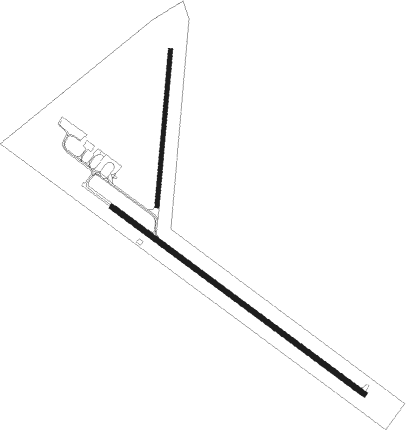
Beeville - Beeville Muni
Airport details
| Country | United States of America |
| State | Texas |
| Region | K4 |
| Airspace | Houston Oceanic Ctr |
| Municipality | Bee County |
| Elevation | 268ft (82m) |
| Timezone | GMT -6 |
| Coordinates | 28.36422, -97.79195 |
| Magnetic var | |
| Type | land |
| Available since | X-Plane v10.40 |
| ICAO code | KBEA |
| IATA code | n/a |
| FAA code | BEA |
Communication
| Beeville Muni AWOS | 118.675 |
| Beeville Muni CTAF/UNICOM | 122.800 |
Nearby Points of Interest:
Mission Nuestra Señora del Espíritu Santo de Zúñiga
-Dr. L.W. and Martha E.S. Chilton House
Nearby beacons
| code | identifier | dist | bearing | frequency |
|---|---|---|---|---|
| THX | THREE RIVERS VORTAC | 20.7 | 291° | 111.40 |
| NOG | ORANGE GROVE TACAN | 31.1 | 208° | 133.60 |
| CRP | CORPUS CHRISTI VORTAC | 33.2 | 143° | 115.50 |
| ALI | ALICE VOR | 39.4 | 200° | 114.50 |
| NGP | TRUAX (CORPUS CHRISTI) TACAN | 48.5 | 144° | 114 |
| NQI | KINGSVILLE TACAN | 51.9 | 181° | 117.80 |
| VCT | VICTORIA VOR/DME | 53.6 | 57° | 109 |
| SSF | STINSON (SAN ANTONIO) VOR | 63.7 | 324° | 108.40 |
Instrument approach procedures
| runway | airway (heading) | route (dist, bearing) |
|---|---|---|
| RW12 | CUVUM (152°) | CUVUM NEYIB (6mi, 217°) 2000ft |
| RW12 | NEYIB (127°) | NEYIB 2000ft |
| RW12 | THX (111°) | THX NEYIB (10mi, 94°) 2000ft |
| RW12 | ZAMLI (101°) | ZAMLI NEYIB (6mi, 44°) 2000ft |
| RNAV | NEYIB 2000ft ECEPA (6mi, 127°) 2000ft KBEA (6mi, 127°) 308ft (5817mi, 106°) 518ft JOSUK (5808mi, 286°) 2000ft JOSUK (turn) | |
| RW30 | JOSUK (308°) | JOSUK 2000ft |
| RW30 | KATLE (343°) | KATLE JOSUK (8mi, 44°) 2000ft |
| RW30 | LOKKI (284°) | LOKKI JOSUK (6mi, 228°) 2000ft |
| RW30 | SINTO (335°) | SINTO JOSUK (9mi, 15°) 2000ft |
| RNAV | JOSUK 2000ft GUVLY (6mi, 308°) 2000ft KBEA (6mi, 308°) 287ft (5817mi, 106°) 517ft NEYIB (5825mi, 286°) 2000ft NEYIB (turn) |
Disclaimer
The information on this website is not for real aviation. Use this data with the X-Plane flight simulator only! Data taken with kind consent from X-Plane 12 source code and data files. Content is subject to change without notice.

