Benton Harbor - Southwest Michigan Regl
Airport details
| Country | United States of America |
| State | Michigan |
| Region | K5 |
| Airspace | Chicago Ctr |
| Municipality | Benton Harbor |
| Elevation | 643ft (196m) |
| Timezone | GMT -5 |
| Coordinates | 42.12853, -86.42614 |
| Magnetic var | |
| Type | land |
| Available since | X-Plane v10.40 |
| ICAO code | KBEH |
| IATA code | BEH |
| FAA code | BEH |
Communication
| Southwest Michigan Regl ASOS | 121.550 |
| Southwest Michigan Regl CTAF/UNICOM | 123.000 |
| Southwest Michigan Regl SOUTH BEND Clearance DEL | 119.700 |
| Southwest Michigan Regl KBEH | 128.800 |
| Southwest Michigan Regl SOUTH BEND Approach/Departure | 118.550 |
Approach frequencies
| ILS-cat-I | RW28 | 108.5 | 18.00mi |
| 3° GS | RW28 | 108.5 | 18.00mi |
Nearby Points of Interest:
House of David
-Fidelity Building
-Wendell P. and Harriet Rounds Robbins House
-Shiloh House
-Ninth District Lighthouse Depot
-St. Joseph North Pier Inner and Outer Lights
-St. Joseph North Pier Outer Light
-Rock S. Edwards Farmstead
-North Watervliet Road – Paw Paw Lake Outlet Bridge
-Berrien Springs Courthouse
-Old Berrien County Courthouse Complex
-Criffield-Whiteley House
-Moccasin Bluff Site
-Sandburg House
-Liberty Hyde Bailey Birthplace
-Marshall's Store
-Bangor Elevator
-Buchanan North and West Neighborhoods Historic District
-Buchanan Downtown Historic District
-Zinc Collar Pad Company Building
-Old U.S. Post Office
-Niles Downtown Historic District
-Henry A. Chapin House
-Ring Lardner House
-Fort St. Joseph
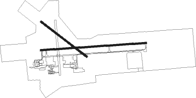
Runway info
Runway 10 / 28  | ||
| length | 1826m (5991ft) | |
| bearing | 90° / 270° | |
| width | 32m (106ft) | |
| surface | asphalt | |
| blast zone | 61m (200ft) / 61m (200ft) | |
| Runway 14 / 32 | ||
| length | 994m (3261ft) | |
| bearing | 124° / 304° | |
| width | 30m (100ft) | |
| surface | asphalt | |
Nearby beacons
| code | identifier | dist | bearing | frequency |
|---|---|---|---|---|
| ELX | KEELER VOR/DME | 13.5 | 87° | 116.60 |
| GIJ | GIPPER (NILES) VORTAC | 22.1 | 163° | 115.40 |
| PMM | PULLMAN VOR/DME | 24.7 | 44° | 112.10 |
| SB | MISHA (SOUTH BEND) NDB | 27 | 154° | 341 |
| AZO | KALAMAZOO VOR/DME | 39.3 | 83° | 109 |
| AZ | AUSTN (KALAMAZOO) NDB | 39.9 | 90° | 371 |
| GSH | GOSHEN VORTAC | 40.3 | 147° | 113.70 |
| VP | SEDLY (VALPARAISO) NDB | 45.4 | 214° | 212 |
| IRS | STURGIS NDB | 48.1 | 108° | 382 |
| OXI | KNOX VOR/DME | 49.4 | 195° | 115.60 |
| GY | GARIE (GARY) NDB | 52.3 | 238° | 236 |
| VIO | VICTORY VOR/DME | 57 | 55° | 115.95 |
| OLK | WEBSTER LAKE VOR | 67.3 | 134° | 110.40 |
Instrument approach procedures
| runway | airway (heading) | route (dist, bearing) |
|---|---|---|
| RW10 | TABGE (113°) | TABGE ZUYDU (9mi, 154°) 2500ft |
| RW10 | TAMPE (67°) | TAMPE ZUYDU (9mi, 26°) 2500ft |
| RW10 | ZUYDU (90°) | ZUYDU 2500ft |
| RNAV | ZUYDU 2500ft ADIYI (6mi, 90°) 2300ft KBEH (5mi, 90°) 662ft (5246mi, 116°) 881ft BLACO (5241mi, 296°) ELX (8mi, 85°) 2500ft ELX (turn) | |
| RW28 | HAPUR (285°) | HAPUR GIDPE (9mi, 308°) 2500ft |
| RW28 | WIPEP (260°) | WIPEP GIDPE (10mi, 247°) 2500ft |
| RNAV | GIDPE 2500ft MALLY (7mi, 270°) 2200ft WESUG (3mi, 270°) 1220ft KBEH (2mi, 271°) 694ft (5246mi, 116°) 849ft ZUYDU (5258mi, 296°) 2500ft ZUYDU (turn) |
Disclaimer
The information on this website is not for real aviation. Use this data with the X-Plane flight simulator only! Data taken with kind consent from X-Plane 12 source code and data files. Content is subject to change without notice.