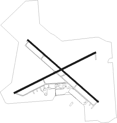
Scottsbluff - Western Nebraska Regional William B. Heilig Field
Airport details
| Country | United States of America |
| State | Nebraska |
| Region | K3 |
| Airspace | Denver Ctr |
| Municipality | Scotts Bluff County |
| Elevation | 3966ft (1209m) |
| Timezone | GMT -7 |
| Coordinates | 41.87403, -103.59564 |
| Magnetic var | |
| Type | land |
| Available since | X-Plane v10.40 |
| ICAO code | KBFF |
| IATA code | BFF |
| FAA code | BFF |
Communication
| Western Nebraska Regional William B. Heilig Field ASOS | 121.025 |
| Western Nebraska Regional William B. Heilig Field CTAF/UNICOM | 123.000 |
| Western Nebraska Regional William B. Heilig Field DENVER ApproachROACH | 127.950 |
| Western Nebraska Regional William B. Heilig Field DENVER DepartureARTURE | 127.950 |
Approach frequencies
| ILS-cat-I | RW30 | 109.3 | 18.00mi |
| ILS-cat-I | RW12 | 110.35 | 18.00mi |
| 3° GS | RW30 | 109.3 | 18.00mi |
| 3° GS | RW12 | 110.35 | 18.00mi |
Nearby Points of Interest:
Fontenelle Apartment House
-Midwest Theater
-Marquis Opera House
-Scotts Bluff County Courthouse
-Fort Mitchell, Nebraska
-Robidoux Pass
-C.C. Hampton Homestead
-Camp Clarke Bridge Site
-Morrill County Courthouse
-Courthouse and Jail Rocks
-South Torrington Union Pacific Depot

Nearby beacons
| code | identifier | dist | bearing | frequency |
|---|---|---|---|---|
| BFF | SCOTTSBLUFF VORTAC | 5.2 | 80° | 112.60 |
| TOR | TORRINGTON NDB | 27.4 | 289° | 293 |
| AIA | ALLIANCE VOR/DME | 36.9 | 77° | 111.80 |
| TST | TOADSTOOL VOR/DME | 43 | 22° | 113.40 |
| SNY | SIDNEY VOR/DME | 54.2 | 142° | 115.90 |
| CD | DAWES (CHADRON) NDB | 56.1 | 26° | 362 |
| HIN | WHITNEY (CHADRON) NDB | 61.5 | 28° | 275 |
Instrument approach procedures
| runway | airway (heading) | route (dist, bearing) |
|---|---|---|
| RW05 | MEILE (307°) | MEILE JAXOM (21mi, 272°) 7300ft PUREE (6mi, 335°) 6800ft |
| RW05 | PUREE (75°) | PUREE 6800ft |
| RW05 | WHARF (127°) | WHARF RANKE (12mi, 196°) 6800ft PUREE (5mi, 155°) 6800ft |
| RNAV | PUREE 6800ft CAMID (6mi, 76°) 6100ft JAGUS (3mi, 76°) 5240ft WOTMU (4mi, 76°) 3999ft (6011mi, 112°) 4400ft BFF (6005mi, 292°) 6900ft BFF (turn) | |
| RW12 | ALBIN (60°) | ALBIN SACOP (35mi, 41°) 7800ft LEDSE (5mi, 54°) 6900ft |
| RW12 | LEDSE (127°) | LEDSE 6900ft |
| RW12 | SPONS (212°) | SPONS AYAYI (14mi, 252°) 7000ft LEDSE (5mi, 234°) 6900ft |
| RNAV | LEDSE 6900ft CAPGA (6mi, 127°) 5700ft KBFF (6mi, 128°) 4019ft HAKAB (12mi, 127°) 6700ft HAKAB (turn) | |
| RW23 | KOBSE (253°) | KOBSE 6600ft |
| RW23 | MEILE (307°) | MEILE NITEE (11mi, 15°) 6600ft KOBSE (5mi, 332°) 6600ft |
| RW23 | WHARF (127°) | WHARF CUREX (21mi, 95°) 7200ft KOBSE (5mi, 152°) 6600ft |
| RNAV | KOBSE 6600ft AYANI (6mi, 253°) 5800ft KBFF (6mi, 253°) 4019ft GESBE (6mi, 253°) PUREE (7mi, 257°) 6700ft PUREE (turn) | |
| RW30 | AIA (257°) | AIA DIVPE (28mi, 243°) 6800ft HAKAB (5mi, 234°) 6700ft |
| RW30 | ALBIN (60°) | ALBIN FOBVO (38mi, 76°) 7800ft HAKAB (5mi, 54°) 6700ft |
| RW30 | HAKAB (307°) | HAKAB 6700ft |
| RNAV | HAKAB 6700ft CIYAR (6mi, 307°) 5700ft KBFF (6mi, 307°) 3997ft LEDSE (12mi, 307°) 6900ft LEDSE (turn) |
Disclaimer
The information on this website is not for real aviation. Use this data with the X-Plane flight simulator only! Data taken with kind consent from X-Plane 12 source code and data files. Content is subject to change without notice.