Seattle - Boeing Field King County Intl
Airport details
| Country | United States of America |
| State | Washington |
| Region | K1 |
| Airspace | Seattle Ctr |
| Municipality | Tukwila |
| Elevation | 20ft (6m) |
| Timezone | GMT -8 |
| Coordinates | 47.52370, -122.29459 |
| Magnetic var | |
| Type | land |
| Available since | X-Plane v10.40 |
| ICAO code | KBFI |
| IATA code | BFI |
| FAA code | BFI |
Communication
| Boeing Field King County Intl ATIS | 127.750 |
| Boeing Field King County Intl UNICOM | 122.950 |
| Boeing Field King County Intl Clearance DEL | 132.400 |
| Boeing Field King County Intl Ground Control | 121.900 |
| Boeing Field King County Intl Tower | 118.300 |
| Boeing Field King County Intl Tower | 120.600 |
| Boeing Field King County Intl SEATTLE Approach/Departure | 120.100 |
| Boeing Field King County Intl SEATTLE Approach/Departure | 120.400 |
| Boeing Field King County Intl SEATTLE Approach/Departure | 125.900 |
| Boeing Field King County Intl SEATTLE Approach/Departure | 119.200 |
| Boeing Field King County Intl SEATTLE Approach/Departure | 126.500 |
Approach frequencies
| ILS-cat-I | RW14R | 110.9 | 18.00mi |
| ILS-cat-I | RW32L | 110.9 | 18.00mi |
| 3.1° GS | RW32L | 110.9 | 18.00mi |
| 3° GS | RW14R | 110.9 | 18.00mi |
Nearby Points of Interest:
South Park Bridge
-Old Georgetown City Hall
-Columbia City Historic District
-Lake Washington Boulevard
-Ford Motor Company Assembly Plant
-Lakeview School
-Tukwila School
-El Centro de la Raza
-Jose Rizal Bridge
-Nihon Go Gakko
-Seattle Chinatown-International District
-Victorian Apartments
-Washington Hall
-Interurban Building
-Lyon Building
-Rector Hotel
-Hoge Building
-Arctic Building
-Colman Building
-Federal Office Building
-Daniels Recital Hall
-Fire Station No. 23
-National Building
-Rainier Club
-Federal Reserve Bank Building
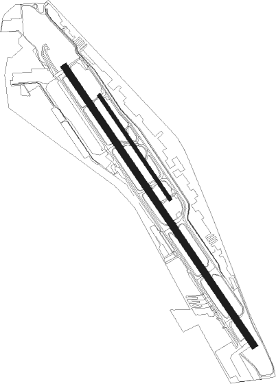
Runway info
Runway 14L / 32R  | ||
| length | 1130m (3707ft) | |
| bearing | 140° / 320° | |
| width | 30m (100ft) | |
| surface | asphalt | |
| displ threshold | 76m (249ft) / 114m (374ft) | |
| Runway 14R / 32L | ||
| length | 3047m (9997ft) | |
| bearing | 140° / 320° | |
| width | 61m (200ft) | |
| surface | asphalt | |
| displ threshold | 0m (0ft) / 268m (879ft) | |
| blast zone | 255m (837ft) / 58m (190ft) | |
Nearby beacons
| code | identifier | dist | bearing | frequency |
|---|---|---|---|---|
| SEA | SEATTLE VORTAC | 5.3 | 190° | 116.80 |
| TCM | MC CHORD (TACOMA) TACAN | 23.7 | 206° | 109.60 |
| PAE | PAINE (EVERETT) VOR/DME | 23.8 | 2° | 110.60 |
| AW | WATON (ARLINGTON) NDB | 33.6 | 14° | 382 |
| OLM | OLYMPIA VORTAC | 41.3 | 228° | 113.40 |
| CVV | PENN COVE VOR/DME | 46.6 | 329° | 117.20 |
| NUW | WHIDBEY ISLAND (OAK HARBO TACAN | 52 | 336° | 113.80 |
| BVS | SKAGIT/BAY VIEW (BURLINGTON) NDB | 56.9 | 353° | 240 |
| FHR | FRIDAY HARBOR NDB | 66.1 | 324° | 284 |
Departure and arrival routes
| Transition altitude | 18000ft |
| Transition level | 18000ft |
| SID end points | distance | outbound heading | |
|---|---|---|---|
| RW14R | |||
| NRVNA1 | 10mi | 140° | |
| STAR starting points | distance | inbound heading | |
|---|---|---|---|
| RW14 (ALL) | |||
| OLM2 | 41.3 | 48° | |
| JAWBN6 | 37.6 | 133° | |
| CHINS4 | 41.6 | 300° | |
| RW32 (ALL) | |||
| OLM2 | 41.3 | 48° | |
| JAWBN6 | 37.6 | 133° | |
| CHINS4 | 41.6 | 300° | |
Instrument approach procedures
| runway | airway (heading) | route (dist, bearing) |
|---|---|---|
| RW14RY | LOFAL (130°) | LOFAL JUGOK (14mi, 136°) 2900ft |
| RW14RY | PAE (182°) | PAE ZUVEN (9mi, 230°) 4000ft JUGOK (9mi, 208°) 2900ft |
| RNAV | JUGOK 2900ft FISEN (6mi, 112°) 1700ft ZAGRO (1mi, 140°) 1280ft KBFI (5mi, 138°) 68ft (6675mi, 111°) 422ft OCEZE (6675mi, 291°) 1500ft BLAKO (11mi, 127°) 6400ft BLAKO (turn) | |
| RW14RZ | LOFAL (130°) | LOFAL JUGOK (14mi, 136°) 2900ft JAMRO (3mi, 117°) 2100ft |
| RW14RZ | ZUVEN (156°) | ZUVEN FOGUL (4mi, 228°) 3400ft JAMRO (8mi, 163°) 2100ft |
| RNAV | JAMRO 2100ft COMMB (2mi, 111°) 1700ft ORABE (2mi, 124°) 1024ft KBFI (4mi, 138°) 68ft OCEZE (4mi, 141°) 1500ft BLAKO (11mi, 127°) 6400ft BLAKO (turn) |
Holding patterns
| STAR name | hold at | type | turn | heading* | altitude | leg | speed limit |
|---|---|---|---|---|---|---|---|
| CHINS4 | BRUKK | VHF | right | 116 (296)° | 1.0min timed | ICAO rules | |
| CHINS4 | RADDY | VHF | right | 104 (284)° | 1.0min timed | ICAO rules | |
| CHINS4 | SUNED | VHF | right | 108 (288)° | 1.0min timed | ICAO rules | |
| EPH8 | EPH | NDB | right | 66 (246)° | < 17999ft | 1.0min timed | ICAO rules |
| EPH8 | ODESS | VHF | right | 76 (256)° | < 17999ft | 1.0min timed | ICAO rules |
| EPH8 | SKYKO | VHF | left | 85 (265)° | 1.0min timed | ICAO rules | |
| GLASR1 | JAKSN | VHF | right | 75 (255)° | < 17999ft | 1.0min timed | ICAO rules |
| GLASR1 | LOSTT | VHF | right | 42 (222)° | < 17999ft | 1.0min timed | ICAO rules |
| GLASR1 | TEMPL | VHF | right | 77 (257)° | 18000ft - 45000ft | 1.5min timed | ICAO rules |
| JAWBN6 | JAWBN | VHF | right | 310 (130)° | < 17999ft | 1.0min timed | ICAO rules |
| OLM2 | BTG | NDB | right | 163 (343)° | 18000ft - 45000ft | 1.5min timed | ICAO rules |
| OLM2 | OLM | NDB | left | 151 (331)° | 1.0min timed | ICAO rules | |
| *) magnetic outbound (inbound) holding course | |||||||
Disclaimer
The information on this website is not for real aviation. Use this data with the X-Plane flight simulator only! Data taken with kind consent from X-Plane 12 source code and data files. Content is subject to change without notice.