Bakersfield - Meadows Field
Airport details
| Country | United States of America |
| State | California |
| Region | K2 |
| Airspace | Los Angeles Ctr |
| Municipality | CAL Fire Kern County |
| Elevation | 504ft (154m) |
| Timezone | GMT -8 |
| Coordinates | 35.43206, -119.04971 |
| Magnetic var | |
| Type | land |
| Available since | X-Plane v10.40 |
| ICAO code | KBFL |
| IATA code | BFL |
| FAA code | BFL |
Communication
| Meadows Field ATIS | 118.600 |
| Meadows Field CTAF | 118.100 |
| Meadows Field UNICOM | 122.950 |
| Meadows Field Ground Control | 121.700 |
| Meadows Field BAKERSFIELD Tower | 118.100 |
| Meadows Field BAKERSFIELD Approach | 118.800 |
| Meadows Field BAKERSFIELD Approach | 118.900 |
| Meadows Field BAKERSFIELD Departure | 126.450 |
Approach frequencies
| ILS-cat-I | RW30R | 111.9 | 18.00mi |
| 3° GS | RW30R | 111.9 | 18.00mi |
Nearby Points of Interest:
Jastro Building
-Tevis Block
-Bakersfield California Building
-Baker Branch Library
-Weedpatch Camp
-Santa Fe Passenger and Freight Depot
-Shafter Research Station
-Wasco Union High School
-The Forty Acres
-The Fort (Taft, California)
-Lakeview Gusher
-Tehachapi Loop
-Courtlandt Gross House
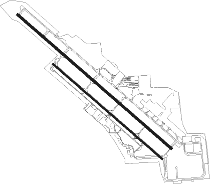
Runway info
Runway 12L / 30R  | ||
| length | 3307m (10850ft) | |
| bearing | 130° / 310° | |
| width | 46m (151ft) | |
| surface | asphalt | |
| displ threshold | 0m (0ft) / 1042m (3419ft) | |
| blast zone | 61m (200ft) / 61m (200ft) | |
| Runway 12R / 30L | ||
| length | 2350m (7710ft) | |
| bearing | 130° / 310° | |
| width | 30m (98ft) | |
| surface | asphalt | |
| displ threshold | 0m (0ft) / 457m (1499ft) | |
Nearby beacons
| code | identifier | dist | bearing | frequency |
|---|---|---|---|---|
| EHF | SHAFTER (BAKERSFIELD) VORTAC | 3.9 | 318° | 115.40 |
| TTE | TULE VOR/DME | 28.9 | 3° | 109.20 |
| GMN | GORMAN VORTAC | 38.8 | 163° | 116.10 |
| FLW | FELLOWS VOR/DME | 44.8 | 247° | 117.50 |
| AVE | AVENAL VOR/DME | 47.1 | 283° | 117.10 |
| LHS | LAKE HUGHES VORTAC | 50.6 | 148° | 114.35 |
| VIS | VISALIA VOR/DME | 59.9 | 335° | 109.40 |
| RZS | SAN MARCUS (SANTA BARBARA VORTAC | 65.7 | 218° | 114.90 |
| PMD | PALMDALE VORTAC | 68.2 | 129° | 114.50 |
| NLC | NAVY LEMOORE TACAN | 70.6 | 315° | 113.30 |
Departure and arrival routes
| Transition altitude | 18000ft |
| Transition level | 18000ft |
| SID end points | distance | outbound heading | |
|---|---|---|---|
| RW12 (ALL) | |||
| MARIC4 | 51mi | 148° | |
| MEADO4 | 84mi | 266° | |
| RW30 (ALL) | |||
| MARIC4 | 51mi | 148° | |
| MEADO4 | 84mi | 266° | |
| STAR starting points | distance | inbound heading | |
|---|---|---|---|
| ALL | |||
| FASTO2 | 13.3 | 310° | |
Instrument approach procedures
| runway | airway (heading) | route (dist, bearing) |
|---|---|---|
| RW12L | COREZ (106°) | COREZ HOTIL (12mi, 82°) 3400ft |
| RW12L | EHF (138°) | EHF HOTIL (10mi, 305°) 3400ft HOTIL (turn) 3400ft |
| RW12L | MARIC (49°) | MARIC HOTIL (21mi, 4°) 3400ft HOTIL (turn) 3400ft |
| RW12L | PONDD (151°) | PONDD HOTIL (14mi, 174°) 3400ft |
| RNAV | HOTIL 3400ft JIBOP (6mi, 129°) 2500ft HOVGA (3mi, 130°) 1440ft KBFL (4mi, 128°) 562ft (6805mi, 107°) 760ft ULEYE (6803mi, 287°) MARIC (16mi, 242°) 3000ft MARIC (turn) | |
| RW12R | COREZ (106°) | COREZ MOMUE (12mi, 83°) 3400ft |
| RW12R | EHF (138°) | EHF MOMUE (9mi, 305°) 3400ft MOMUE (turn) 3400ft |
| RW12R | MARIC (49°) | MARIC MOMUE (21mi, 4°) 3400ft MOMUE (turn) 3400ft |
| RW12R | PONDD (151°) | PONDD MOMUE (14mi, 174°) 3400ft |
| RNAV | MOMUE 3400ft WENTI (6mi, 129°) 2500ft TEDBE (3mi, 130°) 1440ft KBFL (4mi, 126°) 536ft (6805mi, 107°) 1000ft MARIC (6819mi, 286°) 3500ft MARIC (turn) | |
| RW30L | GMN (343°) | GMN AXONE (14mi, 360°) 9800ft ISARE (15mi, 357°) 3500ft |
| RW30L | GRAPE (344°) | GRAPE AXONE (5mi, 40°) 8000ft ISARE (15mi, 357°) 3500ft |
| RW30L | LOPES (319°) | LOPES AXONE (8mi, 270°) 8000ft ISARE (15mi, 357°) 3500ft |
| RNAV | ISARE 3500ft WILOG (6mi, 310°) 2500ft OJOXY (4mi, 310°) 1200ft KBFL (2mi, 316°) 518ft (6805mi, 107°) 1000ft STEBN (6807mi, 287°) 3000ft STEBN (turn) | |
| RW30R | GRAPE (344°) | GRAPE AXONE (5mi, 40°) 8000ft FASTO (14mi, 0°) 3500ft |
| RW30R | LOPES (319°) | LOPES AXONE (8mi, 270°) 8000ft FASTO (14mi, 0°) 3500ft |
| RNAV | FASTO 3500ft JUPEX (7mi, 310°) 2500ft HOYMI (4mi, 310°) 1200ft KBFL (2mi, 314°) 536ft (6805mi, 107°) 1000ft STEBN (6807mi, 287°) 3000ft STEBN (turn) |
Disclaimer
The information on this website is not for real aviation. Use this data with the X-Plane flight simulator only! Data taken with kind consent from X-Plane 12 source code and data files. Content is subject to change without notice.