Mobile - Mobile Downtown
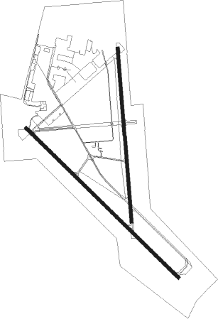
Airport details
| Country | United States of America |
| State | Alabama |
| Region | K7 |
| Airspace | Houston Oceanic Ctr |
| Municipality | Mobile |
| Elevation | 23ft (7m) |
| Timezone | GMT -6 |
| Coordinates | 30.63376, -88.07604 |
| Magnetic var | |
| Type | land |
| Available since | X-Plane v10.40 |
| ICAO code | KBFM |
| IATA code | BFM |
| FAA code | BFM |
Communication
| MOBILE DOWNTOWN ATIS | 135.575 |
| MOBILE DOWNTOWN CTAF | 118.800 |
| MOBILE DOWNTOWN UNICOM | 122.950 |
| MOBILE DOWNTOWN Ground Control | 121.700 |
| MOBILE DOWNTOWN DOWNTOWN Tower | 118.800 |
| MOBILE DOWNTOWN Approach/Departure | 118.500 |
Approach frequencies
| ILS-cat-I | RW32 | 108.5 | 18.00mi |
| 3° GS | RW32 | 108.5 | 18.00mi |
Nearby Points of Interest:
Martin Lindsey House
-Miller-O'Donnell House
-Paterson House (Mobile, Alabama)
-Azalea Court Apartments
-George Fearn House
-U. J. Cleveland House
-Oakleigh Historic Complex
-Monterey Place
-Carlen House
-South Lafayette Street Creole Cottages
-Gates-Daves House
-Greene-Marston House
-Wade Askew House
-Joseph M. Walker House
-Protestant Children's Home
-George Levy House
-Raphael Semmes House
-J. E. Paterson House
-Arthur VanderSys House
-Tschiener House
-Jacob VanderSys House
-Amelia Stewart House
-Ernest Megginson House
-Convent of Mercy
-Vickers and Schumacher Buildings

Nearby beacons
| code | identifier | dist | bearing | frequency |
|---|---|---|---|---|
| BFM | BROOKLEY (MOBILE) VORTAC | 1.6 | 136° | 112.80 |
| MOB | WISLE (MOBILE) NDB | 13.9 | 299° | 248 |
| SJI | SEMMES (MOBILE) VORTAC | 15.6 | 288° | 115.30 |
| GCV | GREENE CO. (LEAKESVILLE) VORTAC | 34.9 | 319° | 115.70 |
| NUN | SAUFLEY (PENSACOLA) VOR | 39.4 | 102° | 108.80 |
| NPA | PENSACOLA TACAN | 42.6 | 110° | 117.20 |
| BIX | KEESLER (BILOXI) TACAN | 46.2 | 255° | 111.80 |
| PKZ | PICKENS (PENSACOLA) NDB | 47.9 | 102° | 326 |
| MVC | MONROEVILLE VORTAC | 62 | 41° | 116.80 |
Instrument approach procedures
| runway | airway (heading) | route (dist, bearing) |
|---|---|---|
| RW14 | NOTNE (134°) | NOTNE 2100ft |
| RNAV | NOTNE 2100ft HUTIP (7mi, 135°) 1500ft UFYAH (1mi, 135°) 1020ft KBFM (3mi, 131°) 76ft (5306mi, 109°) 280ft ROKGO (5297mi, 289°) 1700ft ROKGO (turn) | |
| RW18 | WORIR (182°) | WORIR 2100ft |
| RNAV | WORIR 2100ft ZERDA (7mi, 178°) 1800ft SOYTO (2mi, 180°) 1020ft KBFM (4mi, 190°) 75ft (5306mi, 109°) 275ft POCIP (5305mi, 289°) 2000ft POCIP (turn) | |
| RW32 | ROKGO (315°) | ROKGO 1700ft |
| RNAV | ROKGO 1700ft LURDE (7mi, 315°) 1700ft KBFM (7mi, 316°) 74ft (5306mi, 109°) 800ft WORIR (5306mi, 289°) 2000ft WORIR (turn) | |
| RW36 | POCIP (357°) | POCIP 2000ft |
| RNAV | POCIP 2000ft KUBEC (7mi, 360°) 1800ft OJMEM (2mi, 360°) 1020ft KBFM (4mi, 351°) 75ft (5306mi, 109°) 308ft WORIR (5306mi, 289°) 2100ft WORIR (turn) |
Disclaimer
The information on this website is not for real aviation. Use this data with the X-Plane flight simulator only! Data taken with kind consent from X-Plane 12 source code and data files. Content is subject to change without notice.