Borger - Hutchinson Co
Airport details
| Country | United States of America |
| State | Texas |
| Region | K4 |
| Airspace | Albuquerque Ctr |
| Municipality | Hutchinson County |
| Elevation | 3055ft (931m) |
| Timezone | GMT -6 |
| Coordinates | 35.70089, -101.39367 |
| Magnetic var | |
| Type | land |
| Available since | X-Plane v10.40 |
| ICAO code | KBGD |
| IATA code | BGD |
| FAA code | BGD |
Communication
| Hutchinson Co ASOS | 118.325 |
| Hutchinson Co CTAF/UNICOM | 123.000 |
| Hutchinson Co AMARILLO Approach/Departure | 119.500 |
Nearby Points of Interest:
Gray County Courthouse
-Central Fire Station (Pampa, Texas)
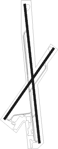
Runway info
Runway 17 / 35  | ||
| length | 1925m (6316ft) | |
| bearing | 178° / 358° | |
| width | 30m (100ft) | |
| surface | asphalt | |
| Runway 3 / 21 | ||
| length | 1189m (3901ft) | |
| bearing | 46° / 226° | |
| width | 30m (100ft) | |
| surface | asphalt | |
Nearby beacons
| code | identifier | dist | bearing | frequency |
|---|---|---|---|---|
| BGD | BORGER VORTAC | 6.4 | 6° | 108.60 |
| PNH | PANHANDLE VORTAC | 31.7 | 213° | 116.60 |
| AM | PANDE (AMARILLO) NDB | 38.9 | 217° | 251 |
| PYX | PERRYTON NDB | 53 | 42° | 266 |
Instrument approach procedures
| runway | airway (heading) | route (dist, bearing) |
|---|---|---|
| RW17 | BROKE (270°) | BROKE LEYEN (20mi, 301°) 5000ft JISAM (6mi, 269°) 5000ft |
| RW17 | EXELL (85°) | EXELL CERIP (32mi, 66°) 5400ft JISAM (6mi, 89°) 5000ft |
| RW17 | JISAM (178°) | JISAM 6000ft JISAM (turn) 5000ft |
| RNAV | JISAM 5000ft IBIGE (5mi, 178°) 4900ft TUKKO (4mi, 178°) 3700ft KBGD (3mi, 178°) 3056ft (5960mi, 109°) 3263ft CUKAS (5961mi, 289°) 5100ft CUKAS (turn) | |
| RW35 | BROKE (270°) | BROKE PIVOC (19mi, 239°) 5100ft CUKAS (6mi, 269°) 5100ft |
| RW35 | CUKAS (358°) | CUKAS 6000ft CUKAS (turn) 5100ft |
| RW35 | PNH (33°) | PNH HUBUT (19mi, 36°) 5100ft CUKAS (6mi, 89°) 5100ft |
| RNAV | CUKAS 5100ft WAMGO (6mi, 358°) 4900ft FIDLI (3mi, 358°) 3800ft KBGD (3mi, 358°) 3096ft (5960mi, 109°) 3305ft JISAM (5959mi, 289°) 5000ft JISAM (turn) |
Disclaimer
The information on this website is not for real aviation. Use this data with the X-Plane flight simulator only! Data taken with kind consent from X-Plane 12 source code and data files. Content is subject to change without notice.