Bainbridge - Decatur County Industrial
Airport details
| Country | United States of America |
| State | Georgia |
| Region | K7 |
| Airspace | Jacksonville Ctr |
| Municipality | Decatur County |
| Elevation | 141ft (43m) |
| Timezone | GMT -5 |
| Coordinates | 30.97160, -84.63692 |
| Magnetic var | |
| Type | land |
| Available since | X-Plane v10.40 |
| ICAO code | KBGE |
| IATA code | BGE |
| FAA code | BGE |
Communication
| Decatur County Industrial AWOS 3 | 121.125 |
| Decatur County Industrial CTAF/UNICOM | 122.975 |
| Decatur County Industrial TALLAHASSEE Approach/Departure | 128.700 |
Approach frequencies
| ILS-cat-I | RW27 | 111.35 | 18.00mi |
| 3° GS | RW27 | 111.35 | 18.00mi |
Nearby Points of Interest:
Decatur County Courthouse
-Bainbridge Commercial Historic District
-J. W. Callahan House
-Seminole County Courthouse
-Joshua Davis House
-Gretna School
-Cairo Commercial Historic District
-Quincy Library
-Quincy Historic District
-E. C. Love House
-Judge P. W. White House
-E. B. Shelfer House
-John Lee McFarlin House
-Stockton-Curry House
-Dr. Malcolm Nicholson Farmhouse
-Willoughby Gregory House
-Baker County Courthouse
-Bannerman Plantation
-James Price McRee House
-Robert Lee Norton House
-Great Oaks
-Pender's Store
-Erwin House
-Susina Plantation
-Blakely Court Square Historic District
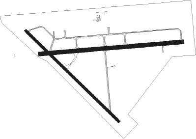
Runway info
Runway 9 / 27  | ||
| length | 1677m (5502ft) | |
| bearing | 90° / 270° | |
| width | 46m (150ft) | |
| surface | asphalt | |
| blast zone | 0m (0ft) / 46m (151ft) | |
| Runway 14 / 32 | ||
| length | 1524m (5000ft) | |
| bearing | 134° / 314° | |
| width | 30m (100ft) | |
| surface | asphalt | |
| blast zone | 31m (102ft) / 43m (141ft) | |
Nearby beacons
| code | identifier | dist | bearing | frequency |
|---|---|---|---|---|
| LYZ | WILLIS (BAINBRIDGE) NDB | 5.7 | 90° | 359 |
| CYR | CAIDY (CAIRO) NDB | 25.1 | 100° | 338 |
| MAI | MARIANNA VORTAC | 27.4 | 249° | 114 |
| SZW | SEMINOLE VORTAC | 28.3 | 148° | 117.50 |
| SMY | SOYYA (MARIANNA) NDB | 30.8 | 260° | 329 |
| GTP | PATON (THOMASVILLE) NDB | 41.7 | 91° | 245 |
| MGR | DME | 43.3 | 82° | 108.80 |
| PZD | PECAN (ALBANY) VOR/DME | 44.6 | 27° | 116.10 |
| RRS | WIREGRASS (DOTHAN) VORTAC | 44.9 | 292° | 111.60 |
| GEF | GREENVILLE VORTAC | 50.7 | 116° | 109 |
| EUF | EUFAULA VORTAC | 63.9 | 333° | 109.20 |
| PAM | TYNDALL (PANAMA CITY) TACAN | 72.4 | 226° | 133.70 |
Instrument approach procedures
| runway | airway (heading) | route (dist, bearing) |
|---|---|---|
| RW09 | COLPA (71°) | COLPA 2500ft FILSI (5mi, 360°) 2500ft |
| RW09 | FILSI (90°) | FILSI 2500ft |
| RW09 | HALUB (109°) | HALUB 2500ft FILSI (5mi, 180°) 2500ft |
| RNAV | FILSI 2500ft JADSU (7mi, 90°) 1800ft KBGE (5mi, 90°) 181ft HASUR (13mi, 90°) 2600ft HASUR (turn) | |
| RW27 | HASUR (270°) | HASUR 2600ft |
| RW27 | HESTI (251°) | HESTI 2600ft HASUR (5mi, 180°) 2600ft |
| RW27 | JEGEL (288°) | JEGEL 2600ft HASUR (5mi, 360°) 2600ft |
| RNAV | HASUR 2600ft DOCGA (7mi, 270°) 1900ft KBGE (6mi, 269°) 166ft FILSI (12mi, 270°) 2500ft FILSI (turn) |
Disclaimer
The information on this website is not for real aviation. Use this data with the X-Plane flight simulator only! Data taken with kind consent from X-Plane 12 source code and data files. Content is subject to change without notice.