Baxley - Baxley Muni
Airport details
| Country | United States of America |
| State | Georgia |
| Region | K7 |
| Airspace | Jacksonville Ctr |
| Municipality | Baxley |
| Elevation | 201ft (61m) |
| Timezone | GMT -5 |
| Coordinates | 31.71383, -82.39378 |
| Magnetic var | |
| Type | land |
| Available since | X-Plane v10.40 |
| ICAO code | KBHC |
| IATA code | n/a |
| FAA code | BHC |
Communication
| Baxley Muni AWOS-3PT | 118.200 |
| Baxley Muni CTAF/UNICOM | 122.800 |
| Baxley Muni APCH/Departure JACKSONVILEE ARTCC | 127.575 |
Nearby Points of Interest:
United States Post Office-Baxley, Georgia
-Appling County Courthouse
-C. W. Deen House
-Rabinowitz Building
-Bacon County Courthouse
-Alma Depot
-Jeff Davis County Courthouse
-Pace House
-Ritch–Carter–Martin House
-Jim Smith House
-Woodland
-Pierce County Courthouse
-Blackshear Depot
-Pierce County Jail
-Gaskin Avenue Historic District
-Union Banking Company Building
-Lonnie A. Pope House
-Downtown Douglas Historic District
-Eleventh District A & M School-South Georgia College Historic District
-Leonard Carter House
-John W. C. Trowell House
-Wayne County Courthouse
-McLemore-Sharpe Farmstead
-Robert and Missouri Garbutt House
-Montgomery County Courthouse
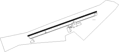
Runway info
| Runway 8 / 26 | ||
| length | 1524m (5000ft) | |
| bearing | 77° / 257° | |
| width | 23m (75ft) | |
| surface | asphalt | |
| blast zone | 32m (105ft) / 33m (108ft) | |
Nearby beacons
| code | identifier | dist | bearing | frequency |
|---|---|---|---|---|
| BHC | BAXLEY NDB | 0.2 | 117° | 376 |
| AMG | ALMA VORTAC | 12.1 | 213° | 115.10 |
| AZE | HAZLEHURST NDB | 16.3 | 303° | 414 |
| AY | WIKET (WAYCROSS) NDB | 23.3 | 181° | 219 |
| AYS | WAYCROSS VORTAC | 27.9 | 200° | 110.20 |
| UQN | ONYUN (VIDALIA) NDB | 31 | 11° | 372 |
| OWC | COFFEE COUNTY (DOUGLAS) NDB | 32.8 | 240° | 390 |
| MQW | MC RAE NDB | 33.8 | 308° | 280 |
| HOE | HOMERVILLE NDB | 44 | 210° | 209 |
| MOQ | MC INTOSH (HINESVILLE) NDB | 45.6 | 82° | 263 |
| EZM | EASTMAN NDB | 46.1 | 299° | 366 |
| SUR | FITZGERALD NDB | 46.2 | 264° | 362 |
| DBN | DUBLIN VORTAC | 55.6 | 333° | 113.10 |
| DB | CREKE (DUBLIN) NDB | 55.8 | 321° | 251 |
| BZ | BULLO (STATESBORO) NDB | 56.1 | 46° | 407 |
| EEX | EMANUEL COUNTY (SWAINSBORO) NDB | 57.2 | 356° | 309 |
| VAD | MOODY (VALDOSTA) TACAN | 61 | 227° | 113.30 |
| SSI | BRUNSWICK (ST SIMONS I) VORTAC | 62.8 | 125° | 109.80 |
| JYL | SYLVANIA NDB | 69.3 | 41° | 245 |
| OTK | VALDOSTA VOR/DME | 72.1 | 224° | 114.80 |
Instrument approach procedures
| runway | airway (heading) | route (dist, bearing) |
|---|---|---|
| RW08 | KIVEC (77°) | KIVEC 2300ft |
| RW08 | ZAVDA (111°) | ZAVDA 2300ft KIVEC (10mi, 162°) 2300ft |
| RW08 | ZOPMI (40°) | ZOPMI 2300ft KIVEC (10mi, 342°) 2300ft |
| RNAV | KIVEC 2300ft FATEX (7mi, 77°) 1800ft KUSKE (2mi, 77°) 1020ft KBHC (3mi, 77°) 260ft (5017mi, 111°) 1200ft KIVEC (5028mi, 291°) 2300ft KIVEC (turn) | |
| RW26 | REIDS (224°) | REIDS BOCAC (8mi, 165°) 2700ft |
| RW26 | WABIT (276°) | WABIT BOCAC (10mi, 298°) 2700ft |
| RNAV | BOCAC 2700ft CAVKO (7mi, 257°) 1600ft ZATKI (2mi, 257°) 920ft KBHC (3mi, 257°) 232ft (5017mi, 111°) 540ft KIVEC (5028mi, 291°) 2300ft KIVEC (turn) |
Disclaimer
The information on this website is not for real aviation. Use this data with the X-Plane flight simulator only! Data taken with kind consent from X-Plane 12 source code and data files. Content is subject to change without notice.