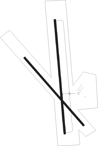
Beatrice - Beatrice Municipal Airport
Airport details
| Country | United States of America |
| State | Nebraska |
| Region | K3 |
| Airspace | Minneapolis Ctr |
| Municipality | Beatrice |
| Elevation | 1324ft (404m) |
| Timezone | GMT -6 |
| Coordinates | 40.30128, -96.75411 |
| Magnetic var | |
| Type | land |
| Available since | X-Plane v10.40 |
| ICAO code | KBIE |
| IATA code | BIE |
| FAA code | BIE |
Communication
| Beatrice Municipal Airport AWOS | 125.325 |
| Beatrice Municipal Airport CTAF/UNICOM | 122.800 |
Nearby Points of Interest:
Rachel Kilpatrick Purdy House
-Christ Church Episcopal
-Gage County Courthouse
-Beatrice Downtown Historic District
-Beatrice Chautauqua Pavilion
-Elijah Filley Stone Barn
-Lake Bridenthal House
-Sokol Pavilion
-Colman House
-Saline County Courthouse
-First Commercial Bank
-Telocvicna Jednota Sokol
-William H. Charlton House
-Harold Lloyd Birthplace
-Doane College Historic Buildings
-Frank J. Rademacher House
-Fairbury Public Library
-IOOF Temple Building
-Jefferson County Courthouse
-Rad Saline Center cis. 389 Z.C.B.J.
-Z.C.B.J. Rad Tabor No. 74
-Ehlers Round Barn
-Tecumseh Opera House
-Johnson County Courthouse
-Marshall County Courthouse
Nearby beacons
| code | identifier | dist | bearing | frequency |
|---|---|---|---|---|
| BIE | BEATRICE VOR | 0 | 286° | 110.60 |
| FBY | FAIRBURY NDB | 20.3 | 253° | 293 |
| PWE | PAWNEE CITY VORTAC | 25.8 | 100° | 112.40 |
| LN | POTTS (LINCOLN) NDB | 26.7 | 359° | 385 |
| LNK | LINCOLN VORTAC | 37.3 | 1° | 116.10 |
| FMZ | BEKLOF (FAIRMONT) NDB | 41 | 290° | 392 |
| AFK | NEBRASKA CITY NDB | 44.7 | 71° | 347 |
| JYR | YORK NDB | 53.2 | 305° | 257 |
| PMV | PLATTSMOUTH NDB | 54.4 | 53° | 329 |
| AHQ | WAHOO NDB | 56.7 | 9° | 400 |
| OFF | OFFUTT (OMAHA) TACAN | 62.5 | 46° | 111.70 |
Instrument approach procedures
| runway | airway (heading) | route (dist, bearing) |
|---|---|---|
| RW14 | GADWY (101°) | GADWY MIDIE (12mi, 70°) 3600ft |
| RW14 | MIDIE (135°) | MIDIE 3600ft |
| RW14 | PANNY (219°) | PANNY DADAC (15mi, 254°) 4000ft MIDIE (7mi, 240°) 3600ft |
| RNAV | MIDIE 3600ft TADGE (7mi, 136°) 3000ft WUBIL (3mi, 136°) 1960ft KBIE (2mi, 134°) 1364ft (5714mi, 113°) 1569ft SHIRS (5707mi, 293°) 3600ft SHIRS (turn) | |
| RW18 | HAMUL (180°) | HAMUL 3900ft |
| RW18 | KOPFY (101°) | KOPFY SIJGE (10mi, 12°) 3900ft HAMUL (10mi, 90°) 3900ft |
| RW18 | PWE (280°) | PWE WEKOV (24mi, 314°) 3900ft HAMUL (10mi, 270°) 3900ft |
| RNAV | HAMUL 3900ft ZABRA (8mi, 180°) 3000ft JIPIP (3mi, 180°) 2000ft KBIE (3mi, 180°) 1369ft (5714mi, 113°) 1574ft KUDDS (5715mi, 292°) 3600ft KUDDS (turn) | |
| RW32 | PWE (280°) | PWE SHIRS (18mi, 259°) 3600ft |
| RW32 | SHIRS (316°) | SHIRS 3600ft |
| RW32 | STEEL (55°) | STEEL WILRT (20mi, 86°) 3600ft SHIRS (7mi, 60°) 3600ft |
| RNAV | SHIRS 3600ft SARDR (7mi, 316°) 3000ft RUNEY (3mi, 316°) 1940ft KBIE (2mi, 317°) 1357ft (5714mi, 113°) 1562ft MIDIE (5721mi, 293°) 3600ft MIDIE (turn) | |
| RW36 | KUDDS (359°) | KUDDS 3100ft |
| RW36 | PWE (280°) | PWE MARXN (19mi, 251°) 4000ft KUDDS (8mi, 270°) 3100ft |
| RW36 | STEEL (55°) | STEEL KUDDS (18mi, 83°) 3100ft |
| RNAV | KUDDS 3100ft ANDRS (8mi, 360°) 3000ft KBIE (6mi, 359°) 1346ft (5714mi, 113°) 1505ft HAMUL (5713mi, 293°) 3900ft HAMUL (turn) |
Disclaimer
The information on this website is not for real aviation. Use this data with the X-Plane flight simulator only! Data taken with kind consent from X-Plane 12 source code and data files. Content is subject to change without notice.

