Bishop - Eastern Sierra Regl
Airport details
| Country | United States of America |
| State | California |
| Region | K2 |
| Airspace | Oakland Ctr |
| Municipality | CAL Fire San Bernardino Unit |
| Elevation | 4124ft (1257m) |
| Timezone | GMT -8 |
| Coordinates | 37.37163, -118.37064 |
| Magnetic var | |
| Type | land |
| Available since | X-Plane v10.40 |
| ICAO code | KBIH |
| IATA code | BIH |
| FAA code | BIH |
Communication
| Eastern Sierra Regl ASOS | 119.025 |
| Eastern Sierra Regl CTAF/UNICOM | 123.000 |
| Eastern Sierra Regl OAKLAND CNTR | 125.750 |
Approach frequencies
| LDA | RW17 | 109.1 | 18.00mi |
Nearby Points of Interest:
John Muir Memorial Shelter
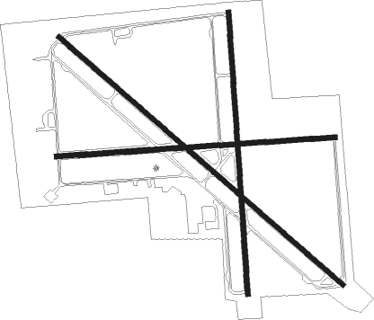
Runway info
Runway 8 / 26  | ||
| length | 1693m (5554ft) | |
| bearing | 90° / 270° | |
| width | 30m (100ft) | |
| surface | asphalt | |
| Runway 12 / 30 | ||
| length | 2285m (7497ft) | |
| bearing | 129° / 309° | |
| width | 30m (100ft) | |
| surface | asphalt | |
| Runway 17 / 35 | ||
| length | 1710m (5610ft) | |
| bearing | 181° / 1° | |
| width | 30m (100ft) | |
| surface | asphalt | |
Nearby beacons
| code | identifier | dist | bearing | frequency |
|---|---|---|---|---|
| BIH | BISHOP VOR/DME | 0.3 | 38° | 109.60 |
| OAL | COALDALE VORTAC | 47.4 | 44° | 117.70 |
Instrument approach procedures
| runway | airway (heading) | route (dist, bearing) |
|---|---|---|
| RW12-Y | NIKOL (152°) | NIKOL FAVEK (18mi, 170°) 12700ft HEGIT (7mi, 170°) 9700ft |
| RW12-Y | RBRTS (126°) | RBRTS CORUB (6mi, 124°) 12700ft HEGIT (12mi, 124°) 9700ft |
| RNAV | HEGIT 9700ft MUBOE (3mi, 124°) 8700ft JAAKE (3mi, 124°) 7900ft HOSUM (9mi, 129°) 4564ft (6738mi, 108°) 4524ft KUPLE (6736mi, 288°) ROCOS (7mi, 173°) PULIE (9mi, 124°) WEBAT (7mi, 71°) TEVOC (5mi, 356°) NEBSE (5mi, 332°) BIH (13mi, 278°) 13000ft BIH (turn) | |
| RW12-Z | NIKOL (152°) | NIKOL FAVEK (18mi, 170°) 12700ft HEGIT (7mi, 170°) 9700ft |
| RW12-Z | RBRTS (126°) | RBRTS CORUB (6mi, 124°) 12700ft HEGIT (12mi, 124°) 9700ft |
| RNAV | HEGIT 9700ft MUBOE (3mi, 124°) 8700ft JAAKE (3mi, 124°) 7900ft CIMOS (5mi, 129°) 6200ft FOLMA (2mi, 129°) 5200ft HOSUM (2mi, 129°) 4578ft (6738mi, 108°) 4524ft KUPLE (6736mi, 288°) ROCOS (7mi, 173°) PULIE (9mi, 124°) WEBAT (7mi, 71°) TEVOC (5mi, 356°) NEBSE (5mi, 332°) BIH (13mi, 278°) 13000ft BIH (turn) | |
| RW30 | EVERR (153°) | EVERR PEMKE (11mi, 167°) 10000ft FOMES (10mi, 167°) 9000ft |
| RNAV | FOMES 9000ft WALLE (6mi, 129°) 7000ft BEAVE (4mi, 52°) KBIH (3mi, 304°) 4152ft CASPU (4mi, 313°) GULSE (5mi, 335°) HARVU (4mi, 6°) JARUT (6mi, 349°) KIPSE (2mi, 332°) MOTSE (4mi, 346°) NUBIC (4mi, 359°) FASBI (9mi, 320°) NIKOL (4mi, 288°) 13000ft NIKOL (turn) |
Disclaimer
The information on this website is not for real aviation. Use this data with the X-Plane flight simulator only! Data taken with kind consent from X-Plane 12 source code and data files. Content is subject to change without notice.