Wooster - Wayne Co
Airport details
| Country | United States of America |
| State | Ohio |
| Region | K5 |
| Airspace | Cleveland Ctr |
| Municipality | Wayne County |
| Elevation | 1136ft (346m) |
| Timezone | GMT -5 |
| Coordinates | 40.87483, -81.88825 |
| Magnetic var | |
| Type | land |
| Available since | X-Plane v10.40 |
| ICAO code | KBJJ |
| IATA code | BJJ |
| FAA code | BJJ |
Communication
| Wayne Co ASOS | 118.075 |
| Wayne Co CTAF/UNICOM | 122.800 |
| Wayne Co AKRON CANTON Approach/Departure | 118.600 |
Nearby Points of Interest:
Wayne County Courthouse District
-Ezekiel B. Zimmerman Octagon House
-Ault-Weygandt Farm
-Joseph Armstrong Farm
-Brown's Lake Bog
-Anna-Dean Farm
-Croco House
-O. C. Barber Piggery
-O. C. Barber Barn No. 1
-O. C. Barber Creamery
-James Akey Farm
-Medina Masonic Temple and Medina Theater
-O. C. Barber Colt Barn
-Frank Mason Raymond House
-Boyd School
-Brightman House
-Millersburg Christian Church
-Holmes County Courthouse
-Ashland County Courthouse
-St. Paul's Reformed Church
-Huntington Grange
-Dr. Robert Smith House
-United Church of Huntington
-Akron Jewish Center
-Grace Reformed Church
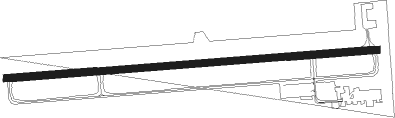
Runway info
| Runway 10 / 28 | ||
| length | 1578m (5177ft) | |
| bearing | 90° / 270° | |
| width | 30m (98ft) | |
| surface | asphalt | |
| displ threshold | 0m (0ft) / 67m (220ft) | |
Nearby beacons
| code | identifier | dist | bearing | frequency |
|---|---|---|---|---|
| BSV | BRIGGS VOR/DME | 22.2 | 106° | 112.40 |
| AK | AKRON NDB | 25.5 | 69° | 362 |
| MF | MANNS (MANSFIELD) NDB | 26.1 | 259° | 372 |
| DJB | DRYER VOR/DME | 31.5 | 330° | 113.60 |
| MFD | MANSFIELD VORTAC | 31.9 | 269° | 108.80 |
| ACO | AKRON VOR/DME | 34.1 | 71° | 114.40 |
| CTW | DME | 43 | 147° | 111.80 |
| BF | TABEY (CLEVELAND) NDB | 44 | 24° | 248 |
| CXR | CHARDON VOR/DME | 50.6 | 48° | 112.70 |
| LQL | LAKELAND (WILLOUGHBY) NDB | 53.6 | 32° | 263 |
| APE | APPLETON VORTAC | 53.9 | 224° | 116.70 |
| CFX | CADIZ NDB | 55.3 | 126° | 239 |
| ZZV | ZANESVILLE VOR/DME | 56 | 180° | 114.95 |
| PCW | PORT CLINTON NDB | 58.8 | 303° | 423 |
| LC | PICKL (COLUMBUS) NDB | 73.7 | 224° | 376 |
Instrument approach procedures
| runway | airway (heading) | route (dist, bearing) |
|---|---|---|
| RW10 | FESEK (72°) | FESEK 3000ft JAVNE (5mi, 360°) 3000ft |
| RW10 | JAVNE (90°) | JAVNE 3000ft |
| RW10 | PONOC (108°) | PONOC 3000ft JAVNE (5mi, 180°) 3000ft |
| RNAV | JAVNE 3000ft TONSR (6mi, 90°) 2800ft COPAK (3mi, 90°) 1860ft KBJJ (3mi, 90°) 1152ft DEHYY (11mi, 90°) 3000ft DEHYY (turn) | |
| RW28 | DEHYY (270°) | DEHYY 3000ft |
| RW28 | EBEKY (288°) | EBEKY 3000ft DEHYY (5mi, 0°) 3000ft |
| RW28 | GIMMU (252°) | GIMMU 3100ft DEHYY (5mi, 180°) 3000ft |
| RNAV | DEHYY 3000ft COMWE (6mi, 270°) 2800ft HENKO (3mi, 270°) 1800ft KBJJ (2mi, 270°) 1169ft JAVNE (12mi, 270°) 3000ft JAVNE (turn) |
Disclaimer
The information on this website is not for real aviation. Use this data with the X-Plane flight simulator only! Data taken with kind consent from X-Plane 12 source code and data files. Content is subject to change without notice.