Breckenridge - Stephens Co
Airport details
| Country | United States of America |
| State | Texas |
| Region | K4 |
| Airspace | Ft Worth Ctr |
| Municipality | Stephens County |
| Elevation | 1284ft (391m) |
| Timezone | GMT -6 |
| Coordinates | 32.71875, -98.89159 |
| Magnetic var | |
| Type | land |
| Available since | X-Plane v10.40 |
| ICAO code | KBKD |
| IATA code | BKD |
| FAA code | BKD |
Communication
| Stephens Co CTAF/UNICOM | 122.800 |
Nearby Points of Interest:
Shackelford County Courthouse Historic District
-Fort Griffin
-Throckmorton County Courthouse and Jail
Runway info
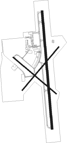
Runway 17 / 35  | ||
| length | 1527m (5010ft) | |
| bearing | 180° / 360° | |
| width | 30m (100ft) | |
| surface | asphalt | |
| Runway 13 / 31 | ||
| length | 732m (2402ft) | |
| bearing | 130° / 310° | |
| width | 15m (50ft) | |
| surface | asphalt | |
| Runway 4 / 22 | ||
| length | 734m (2408ft) | |
| bearing | 49° / 229° | |
| width | 15m (50ft) | |
| surface | asphalt | |
Nearby beacons
| code | identifier | dist | bearing | frequency |
|---|---|---|---|---|
| GHX | GRAHAM NDB | 33.4 | 41° | 371 |
| MQP | MILLSAP (MINERAL WELLS) VORTAC | 45.1 | 90° | 117.70 |
| AB | TOMHI (ABILENE) NDB | 46.9 | 242° | 353 |
| BWD | BROWNWOOD VOR/DME | 49.7 | 185° | 108.60 |
| ABI | ABILENE VORTAC | 51.1 | 256° | 113.70 |
| DYS | DYESS (ABILENE) TACAN | 52 | 253° | 133.60 |
| TQA | TUSCOLA (ABILENE) VOR/DME | 55.1 | 242° | 111.60 |
Instrument approach procedures
| runway | airway (heading) | route (dist, bearing) |
|---|---|---|
| RW17 | AJAHO (157°) | AJAHO TISEE (15mi, 141°) 3600ft |
| RW17 | CIYAL (196°) | CIYAL TISEE (9mi, 215°) 3600ft |
| RW17 | WAPEV (39°) | WAPEV TISEE (19mi, 17°) 3600ft TISEE (turn) 3600ft |
| RNAV | TISEE 3600ft LEVYY (6mi, 180°) 2800ft AYONA (3mi, 180°) 1920ft KBKD (2mi, 180°) 1298ft (5854mi, 108°) 1580ft RUCOS (5855mi, 288°) 3600ft RUCOS (turn) | |
| RW35 | HEPLO (340°) | HEPLO RUCOS (7mi, 310°) 3600ft |
| RW35 | HUSNI (19°) | HUSNI RUCOS (7mi, 49°) 3600ft |
| RW35 | WAPEV (39°) | WAPEV RUCOS (7mi, 126°) 4000ft RUCOS (turn) 3600ft |
| RNAV | RUCOS 3600ft LADIY (6mi, 360°) 2800ft DIDCE (2mi, 360°) 2020ft KBKD (3mi, 359°) 1324ft (5854mi, 108°) 1680ft TISEE (5853mi, 288°) 3600ft TISEE (turn) |
Disclaimer
The information on this website is not for real aviation. Use this data with the X-Plane flight simulator only! Data taken with kind consent from X-Plane 12 source code and data files. Content is subject to change without notice.