Falfurrias - Brooks Co
Airport details
| Country | United States of America |
| State | Texas |
| Region | K4 |
| Airspace | Houston Oceanic Ctr |
| Municipality | Brooks County |
| Elevation | 110ft (34m) |
| Timezone | GMT -6 |
| Coordinates | 27.20605, -98.12103 |
| Magnetic var | |
| Type | land |
| Available since | X-Plane v10.40 |
| ICAO code | KBKS |
| IATA code | n/a |
| FAA code | BKS |
Communication
| Brooks Co AWOS 3 | 118.125 |
| Brooks Co CTAF/UNICOM | 122.800 |
| Brooks Co KINGSVILLE Approach | 119.900 |
| Brooks Co KINGSVILLE Departure | 119.900 |
Nearby Points of Interest:
Brooks County Courthouse
-King Ranch
-John B. Ragland Mercantile Company Building
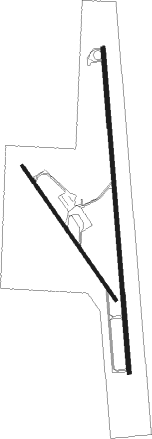
Runway info
Runway 17 / 35  | ||
| length | 1837m (6027ft) | |
| bearing | 180° / 360° | |
| width | 23m (75ft) | |
| surface | asphalt | |
| Runway 14 / 32 | ||
| length | 922m (3025ft) | |
| bearing | 147° / 327° | |
| width | 18m (60ft) | |
| surface | asphalt | |
Nearby beacons
| code | identifier | dist | bearing | frequency |
|---|---|---|---|---|
| EOC | COYOTE (ENCINO) NDB | 21.8 | 195° | 232 |
| NQI | KINGSVILLE TACAN | 24.3 | 47° | 117.80 |
| ALI | ALICE VOR | 32.4 | 11° | 114.50 |
| NOG | ORANGE GROVE TACAN | 41.6 | 6° | 133.60 |
| NGP | TRUAX (CORPUS CHRISTI) TACAN | 52.6 | 60° | 114 |
| CRP | CORPUS CHRISTI VORTAC | 55.2 | 44° | 115.50 |
| MF | MISSI (MC ALLEN) NDB | 58 | 191° | 330 |
| HR | SEBAS (HARLINGEN) NDB | 59.5 | 153° | 338 |
| HRL | HARLINGEN VOR/DME | 63.8 | 154° | 113.65 |
Instrument approach procedures
| runway | airway (heading) | route (dist, bearing) |
|---|---|---|
| RW17 | CRP (224°) | CRP WISOL (41mi, 226°) 3000ft SALUM (8mi, 270°) 3000ft |
| RW17 | LOCOE (259°) | LOCOE WISOL (21mi, 284°) 3000ft SALUM (8mi, 270°) 3000ft |
| RW17 | NELEE (87°) | NELEE TEBSE (48mi, 74°) 3000ft SALUM (8mi, 90°) 3000ft |
| RW17 | SALUM (180°) | SALUM 3000ft |
| RNAV | SALUM 3000ft UWHIP (6mi, 180°) 1700ft KBKS (5mi, 180°) 156ft (5839mi, 105°) 361ft VAGBY (5839mi, 285°) 3000ft VAGBY (turn) | |
| RW35 | JIMIE (321°) | JIMIE ZELIS (20mi, 320°) 3000ft VAGBY (8mi, 270°) 3000ft |
| RW35 | LOCOE (259°) | LOCOE ZELIS (26mi, 232°) 3000ft VAGBY (8mi, 270°) 3000ft |
| RW35 | NELEE (87°) | NELEE YEBUD (46mi, 99°) 3000ft VAGBY (8mi, 90°) 3000ft |
| RW35 | VAGBY (360°) | VAGBY 3000ft |
| RNAV | VAGBY 3000ft VATSY (6mi, 360°) 1700ft WAVUS (3mi, 360°) 820ft KBKS (3mi, 359°) 156ft (5839mi, 105°) 362ft SALUM (5838mi, 286°) 3000ft SALUM (turn) |
Disclaimer
The information on this website is not for real aviation. Use this data with the X-Plane flight simulator only! Data taken with kind consent from X-Plane 12 source code and data files. Content is subject to change without notice.