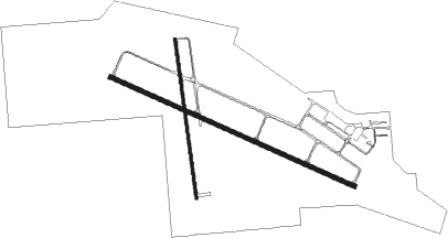
Brookings - Brookings Regl
Airport details
| Country | United States of America |
| State | South Dakota |
| Region | K3 |
| Airspace | Minneapolis Ctr |
| Municipality | Brookings |
| Elevation | 1646ft (502m) |
| Timezone | GMT -6 |
| Coordinates | 44.30453, -96.81892 |
| Magnetic var | |
| Type | land |
| Available since | X-Plane v10.40 |
| ICAO code | KBKX |
| IATA code | BKX |
| FAA code | BKX |
Communication
| Brookings Regl CTAF/UNICOM | 123.000 |
Approach frequencies
| IGS | RW12 | 111.35 | 18.00mi |
| 3° GS | RW12 | 111.35 | 18.00mi |
Nearby Points of Interest:
Brookings Commercial Historic District
-Brookings County Courthouse
-Horticulture Building
-Herman F. Micheel Gothic Arched-Roof Barn
-Chicago, Milwaukee, St. Paul and Pacific Railroad Depot
-Chapel Emmanuel Railroad Car
-Pipestone Public Library
-Pipestone County Courthouse
-William G. Milne House
Nearby beacons
| code | identifier | dist | bearing | frequency |
|---|---|---|---|---|
| BK | CHRLZ (BROOKINGS) NDB | 6.2 | 291° | 335 |
| FSD | SIOUX FALLS VORTAC | 39.3 | 177° | 115 |
| GB | GARNO (MARSHALL) NDB | 40.7 | 78° | 253 |
| ATY | WATERTOWN VORTAC | 42.8 | 334° | 116.60 |
| MML | MARSHALL VOR/DME | 43.5 | 82° | 111 |
| FS | ROKKY (SIOUX FALLS) NDB | 48.6 | 181° | 245 |
Instrument approach procedures
| runway | airway (heading) | route (dist, bearing) |
|---|---|---|
| RW12 | ASTOE (228°) | ASTOE DRAVE (14mi, 284°) 3500ft CYMOL (10mi, 217°) 3500ft |
| RW12 | ZOTBY (103°) | ZOTBY CYMOL (19mi, 97°) 3500ft |
| RNAV | CYMOL 3500ft HAPMU (6mi, 111°) 3400ft PAPRE (3mi, 111°) 2500ft KBKX (3mi, 111°) 1653ft (5698mi, 115°) 1821ft REEKY (5688mi, 295°) 3500ft REEKY (turn) | |
| RW30 | ASTOE (228°) | ASTOE SEEPS (10mi, 128°) 3500ft REEKY (9mi, 217°) 3500ft |
| RW30 | FSD (357°) | FSD REEKY (35mi, 20°) 3500ft |
| RNAV | REEKY 3500ft ZURPA (6mi, 291°) 3300ft KBKX (6mi, 291°) 1682ft (5698mi, 115°) 1887ft CYMOL (5708mi, 295°) 3500ft CYMOL (turn) |
Disclaimer
The information on this website is not for real aviation. Use this data with the X-Plane flight simulator only! Data taken with kind consent from X-Plane 12 source code and data files. Content is subject to change without notice.

