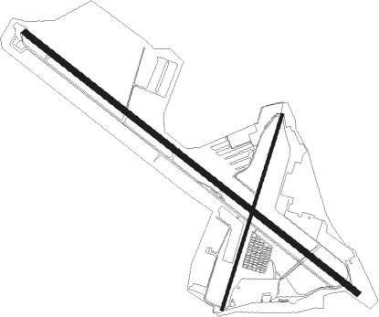
Belmar/farmingdale - Monmouth Executive
Airport details
| Country | United States of America |
| State | New Jersey |
| Region | K6 |
| Airspace | New York Ctr |
| Municipality | Wall Township |
| Elevation | 159ft (48m) |
| Timezone | GMT -5 |
| Coordinates | 40.18388, -74.11807 |
| Magnetic var | |
| Type | land |
| Available since | X-Plane v10.40 |
| ICAO code | KBLM |
| IATA code | BLM |
| FAA code | BLM |
Communication
| Monmouth Executive AWOS 3 | 121.625 |
| Monmouth Executive CTAF/UNICOM | 123.000 |
| Monmouth Executive MC GUIRE Approach/Departure | 124.150 |
Nearby Points of Interest:
Manasquan Friends Meetinghouse and Burying Ground
-Frederic A. Duggan First Aid and Emergency Squad Building
-Audenried Cottage
-Martin Maloney Cottage
-Winsor Building
-Glimmer Glass Bridge
-Asbury Park Convention Hall
-Orient Baptist Church
-Probasco-Dittner Farmstead
-Bay Head Historic District
-Church of the Presidents
-Shadow Lawn
-Murry Guggenheim House
-Wardell House
-Hankinson-Moreau-Covenhoven House
-Church Street School
-Court Street School
-T. Thomas Fortune House
-Parker Homestead
-Upper Meeting House of the Baptist Church of Middletown
-Holmdel Dutch Reformed Church
-North Long Branch School-Primary No. 3
-Union Schoolhouse
-Fisk Chapel
-Kovenhoven

Nearby beacons
| code | identifier | dist | bearing | frequency |
|---|---|---|---|---|
| COL | COLTS NECK VOR/DME | 7.9 | 342° | 115.40 |
| NEL | LAKEHURST NDB | 13 | 237° | 396 |
| NEL | LAKEHURST TACAN | 13.9 | 238° | 111.80 |
| RBV | ROBBINSVILLE VORTAC | 17.3 | 273° | 113.80 |
| GXU | MC GUIRE (WRIGHTSTOWN) VORTAC | 24.3 | 250° | 110.60 |
| CYN | COYLE VORTAC | 26.3 | 221° | 113.40 |
| CRI | CANARSIE VOR/DME | 27.6 | 28° | 112.30 |
| JFK | KENNEDY (NEW YORK) VOR/DME | 31.2 | 38° | 115.90 |
| CAT | CHATHAM NDB | 36.3 | 331° | 254 |
| ARD | YARDLEY VOR/DME | 36.4 | 275° | 108.20 |
| SBJ | SOLBERG VOR/DME | 37.2 | 303° | 112.90 |
| TE | TORBY (TETERBORO) NDB | 37.2 | 359° | 214 |
| LGA | LA GUARDIA (NEW YORK) VOR/DME | 37.7 | 23° | 113.10 |
| TEB | TETERBORO VOR/DME | 40 | 5° | 108.40 |
| MM | MOREE (MORRISTOWN) NDB | 42.9 | 343° | 392 |
| FR | FRIKK (FARMINGDALE) NDB | 45.9 | 47° | 407 |
| ACY | ATLANTIC CITY VORTAC | 48.5 | 212° | 108.60 |
| BWZ | BROADWAY (SCHOOLEY'S MT) VOR/DME | 48.9 | 311° | 114.20 |
| DPK | DEER PARK VOR/DME | 52.1 | 53° | 117.70 |
| VCN | CEDAR LAKE (MILLVILLE) VOR/DME | 55.1 | 233° | 115.20 |
| SAX | SPARTA VORTAC | 56.4 | 335° | 115.70 |
| STW | STILLWATER VOR/DME | 59.5 | 317° | 109.60 |
| BDR | BRIDGEPORT VOR/DME | 74 | 45° | 108.80 |
Departure and arrival routes
| Transition altitude | 18000ft |
| Transition level | 18000ft |
| STAR starting points | distance | inbound heading | |
|---|---|---|---|
| ALL | |||
| WAALK2 | 65.8 | 23° | |
Instrument approach procedures
| runway | airway (heading) | route (dist, bearing) |
|---|---|---|
| RW14 | NANCI (181°) | NANCI YOPUK (9mi, 230°) 2000ft CINUP (5mi, 230°) 2000ft |
| RW14 | RBV (93°) | RBV ZUXEM (6mi, 56°) 2000ft CINUP (5mi, 56°) 2000ft |
| RNAV | CINUP 2000ft ZOTIM (7mi, 125°) 1600ft WOSAR (2mi, 125°) 880ft KBLM (3mi, 124°) 155ft (4680mi, 118°) 600ft ZIGGI (4674mi, 298°) 2000ft ZIGGI (turn) | |
| RW32 | FALON (359°) | FALON WOVNO (11mi, 37°) 2000ft WUDAB (5mi, 37°) 2000ft |
| RW32 | SATES (277°) | SATES YINON (4mi, 241°) 2000ft WUDAB (5mi, 241°) 2000ft |
| RNAV | WUDAB 2000ft JOMIP (7mi, 305°) 1600ft KBLM (5mi, 306°) 198ft (4680mi, 118°) 600ft RBV (4698mi, 298°) 2000ft RBV (turn) |
Holding patterns
| STAR name | hold at | type | turn | heading* | altitude | leg | speed limit |
|---|---|---|---|---|---|---|---|
| WAALK2 | BUKYY | VHF | right | 248 (68)° | DME 10.0mi | ICAO rules | |
| WAALK2 | JAYBO | VHF | right | 267 (87)° | DME 8.0mi | ICAO rules | |
| WAALK2 | WAALK | VHF | right | 219 (39)° | DME 7.0mi | ICAO rules | |
| *) magnetic outbound (inbound) holding course | |||||||
Disclaimer
The information on this website is not for real aviation. Use this data with the X-Plane flight simulator only! Data taken with kind consent from X-Plane 12 source code and data files. Content is subject to change without notice.