Bloomington/normal - Central Illinois Rgnl
Airport details
| Country | United States of America |
| State | Illinois |
| Region | K5 |
| Airspace | Chicago Ctr |
| Municipality | McLean County |
| Elevation | 871ft (265m) |
| Timezone | GMT -6 |
| Coordinates | 40.47711, -88.91592 |
| Magnetic var | |
| Type | land |
| Available since | X-Plane v10.40 |
| ICAO code | KBMI |
| IATA code | BMI |
| FAA code | BMI |
Communication
| Central Illinois Rgnl ATIS | 135.350 |
| Central Illinois Rgnl CTAF | 124.600 |
| Central Illinois Rgnl UNICOM | 122.950 |
| Central Illinois Rgnl Ground Control | 121.650 |
| Central Illinois Rgnl BLOOMINGTON Tower | 124.600 |
| Central Illinois Rgnl PEORIA Approach/Departure | 118.050 |
Approach frequencies
| ILS-cat-II | RW20 | 111.55 | 18.00mi |
| ILS-cat-I | RW29 | 110.95 | 18.00mi |
| ILS-cat-I | RW02 | 111.55 | 18.00mi |
| 3° GS | RW29 | 110.95 | 18.00mi |
| 3° GS | RW20 | 111.55 | 18.00mi |
| 3° GS | RW02 | 111.55 | 18.00mi |
Nearby Points of Interest:
David Davis III & IV House
-Holy Trinity Church Rectory and Convent
-John M. Hamilton House
-George H. Cox House
-Vrooman Mansion Bed & Breakfast
-Miller-Davis Law Buildings
-Stevenson House
-Robert Greenlee House
-George H. Miller House
-Ruben M. Benjamin House
-East Grove Street District
-White Building
-State Farm Downtown Building
-Bloomington Central Business District
-Sprague's Super Service
-John W. Cook Hall
-Benjaminville Friends Meeting House and Burial Ground
-Duncan Manor
-Hubbard House (Illinois)
-Grand Village of the Kickapoo
-Le Roy Commercial Historic District
-David Hyatt Van Dolah House
-John Patton Log Cabin
-El Paso freight station
-El Paso Public Library
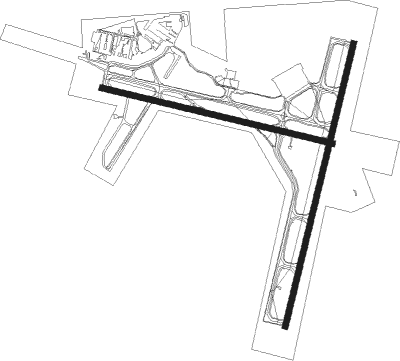
Runway info
Runway 2 / 20  | ||
| length | 2441m (8009ft) | |
| bearing | 23° / 203° | |
| width | 46m (150ft) | |
| surface | concrete | |
| blast zone | 91m (299ft) / 91m (299ft) | |
| Runway 11 / 29 | ||
| length | 1991m (6532ft) | |
| bearing | 104° / 284° | |
| width | 46m (150ft) | |
| surface | asphalt | |
| blast zone | 0m (0ft) / 91m (299ft) | |
Nearby beacons
| code | identifier | dist | bearing | frequency |
|---|---|---|---|---|
| BMI | BLOOMINGTON VOR/DME | 0.7 | 284° | 108.20 |
| LH | EGROW (BLOOMINGTON-NORMAL) NDB | 5.3 | 26° | 334 |
| PNT | PONTIAC VOR/DME | 22.2 | 28° | 109.60 |
| AAA | ABRAHAM (LINCOLN) NDB | 27.1 | 233° | 329 |
| PI | TUNGG (PEORIA) NDB | 31.8 | 281° | 356 |
| RBS | ROBERTS VOR/DME | 34.8 | 82° | 116.80 |
| CMI | CHAMPAIGN VORTAC | 39.5 | 125° | 110 |
| DE | ELWIN (DECATUR) NDB | 41.2 | 183° | 275 |
| PIA | PEORIA VORTAC | 41.8 | 283° | 115.20 |
| AXC | ADDERS VORTAC | 44.5 | 175° | 117.20 |
| DTG | DWIGHT NDB | 45 | 36° | 344 |
| CM | VEALS (CHAMPAIGN/URBANA) NDB | 45.5 | 125° | 407 |
| LQ | LICOL (SPRINGFIELD) NDB | 46.3 | 231° | 375 |
| BDF | BRADFORD VORTAC | 51.1 | 315° | 114.70 |
| CJ | CALDE (SPRINGFIELD) NDB | 51.4 | 225° | 240 |
| SPI | SPINNER (SPRINGFIELD) VORTAC | 51.8 | 230° | 112.70 |
| SP | HUSKK (SPRINGFIELD) NDB | 57.3 | 230° | 382 |
| MTO | DME | 66.6 | 148° | 109.40 |
Instrument approach procedures
| runway | airway (heading) | route (dist, bearing) |
|---|---|---|
| RW02 | ALAND (58°) | ALAND HUPAD (15mi, 80°) 3000ft |
| RW02 | EWITT (338°) | EWITT HUPAD (10mi, 295°) 3000ft |
| RW02 | MCLEN (72°) | MCLEN REKYO (6mi, 153°) 3000ft HUPAD (5mi, 104°) 3000ft |
| RW02 | THEME (330°) | THEME HUPAD (9mi, 275°) 3000ft HUPAD (turn) 3000ft |
| RNAV | HUPAD 3000ft CIGIG (6mi, 23°) 2500ft YABUG (3mi, 23°) 1520ft KBMI (3mi, 17°) 911ft (5356mi, 114°) 1214ft ZEMEN (5354mi, 295°) KAPPA (5mi, 325°) 3000ft KAPPA (turn) | |
| RW11 | HUMUL (154°) | HUMUL TUGUY (10mi, 203°) 3000ft ZEXED (5mi, 203°) 2800ft |
| RW11 | NINIC (82°) | NINIC ZEXED (7mi, 23°) 2800ft |
| RW11 | ZEXED (104°) | ZEXED 2800ft |
| RNAV | ZEXED 2800ft WAGOR (6mi, 104°) 2500ft RAKOY (3mi, 104°) 1680ft KBMI (3mi, 105°) 914ft (5356mi, 114°) 1121ft WAPIX (5343mi, 295°) 3100ft WAPIX (turn) | |
| RW20 | HUMUL (154°) | HUMUL YABUN (8mi, 127°) 2500ft RUNAE (5mi, 104°) 2500ft |
| RW20 | JILLY (238°) | JILLY HUGUD (11mi, 245°) 2500ft RUNAE (5mi, 284°) 2500ft |
| RW20 | MCLEN (72°) | MCLEN RUNAE (21mi, 50°) 2500ft RUNAE (turn) 2500ft |
| RW20 | PNT (208°) | PNT RUNAE (11mi, 212°) 2500ft |
| RNAV | RUNAE 2500ft UDIYO (6mi, 203°) 2500ft KBMI (5mi, 206°) 918ft (5356mi, 114°) 1121ft JINUB (5357mi, 294°) MCLEN (9mi, 281°) 3000ft MCLEN (turn) | |
| RW29 | EWITT (338°) | EWITT JULEL (10mi, 45°) 3100ft WAPIX (5mi, 23°) 3100ft |
| RW29 | JILLY (238°) | JILLY LIPIC (15mi, 201°) 3100ft WAPIX (5mi, 203°) 3100ft |
| RW29 | WAPIX (284°) | WAPIX 3100ft |
| RNAV | WAPIX 3100ft TEDOY (6mi, 284°) 3100ft KBMI (7mi, 283°) 927ft (5356mi, 114°) 1121ft ZEXED (5367mi, 294°) 2500ft ZEXED (turn) |
Disclaimer
The information on this website is not for real aviation. Use this data with the X-Plane flight simulator only! Data taken with kind consent from X-Plane 12 source code and data files. Content is subject to change without notice.