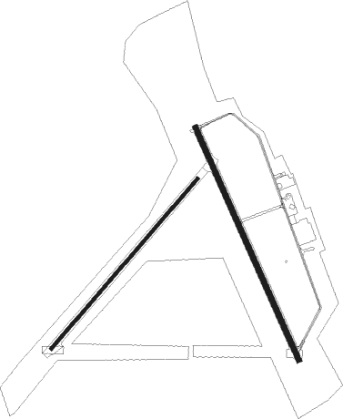
Barnwell - Barnwell Regl
Airport details
| Country | United States of America |
| State | South Carolina |
| Region | K7 |
| Airspace | Jacksonville Ctr |
| Municipality | Barnwell County |
| Elevation | 246ft (75m) |
| Timezone | GMT -5 |
| Coordinates | 33.25767, -81.38822 |
| Magnetic var | |
| Type | land |
| Available since | X-Plane v10.35 |
| ICAO code | KBNL |
| IATA code | BNL |
| FAA code | BNL |
Communication
| Barnwell Regl AWOS 3 | 119.775 |
| Barnwell Regl CTAF/UNICOM | 122.800 |
| Barnwell Regl JACKSONVILLE Approach/Departure | 132.925 |
Nearby Points of Interest:
Banksia Hall
-Church of the Holy Apostles Rectory
-Ashley-Willis House
-Colding-Walker House
-American Telephone and Telegraph Company Building
-Denmark High School
-Springfield High School
-Roselawn (Allendale, South Carolina)
-Gen. Francis Marion Bamberg House
-Gravel Hill Plantation (Allendale, South Carolina)
-Bamberg City Hall
-Bamberg Post Office
-Erwin House (Allendale, South Carolina)
-Salley Historic District
-Virginia Durant Young House
-Copeland House
-Georgia Welcome Center
-Oak Grove
-Graniteville Historic District
-McCanaan Missionary Baptist Church and Cemetery
-Crossways
-Woodlands
-Aiken Mile Track
-Aiken Training Track
-Whitehall, Aiken County, South Carolina
Nearby beacons
| code | identifier | dist | bearing | frequency |
|---|---|---|---|---|
| ALD | ALLENDALE VOR | 15.4 | 159° | 116.70 |
| AIK | AIKEN NDB | 27.7 | 324° | 347 |
| AG | BUSHE (AUGUSTA) NDB | 28.1 | 273° | 233 |
| EMR | EMORY (AUGUSTA) NDB | 32.9 | 289° | 385 |
| JYL | SYLVANIA NDB | 37.9 | 199° | 245 |
| CAE | COLUMBIA VORTAC | 39.7 | 29° | 114.70 |
| CA | MURRY (COLUMBIA) NDB | 43.2 | 11° | 362 |
| IRQ | COLLIERS VORTAC | 47.2 | 300° | 113.90 |
| VAN | VANCE VORTAC | 48.8 | 77° | 110.40 |
| MMT | MC ENTIRE (COLUMBIA) VORTAC | 49.6 | 41° | 113.20 |
| BZ | BULLO (STATESBORO) NDB | 52.4 | 198° | 407 |
| NBC | BEAUFORT TACAN | 57.7 | 139° | 110.50 |
| SSC | SHAW (SUMTER) TACAN | 63.2 | 52° | 110.10 |
| GIW | CORONACA (GREENWOOD) NDB | 69.2 | 325° | 239 |
| GRD | GREENWOOD VORTAC | 70.8 | 322° | 115.50 |
Instrument approach procedures
| runway | airway (heading) | route (dist, bearing) |
|---|---|---|
| RW17 | CATAV (185°) | CATAV FATSU (5mi, 253°) 2200ft |
| RW17 | ENANE (133°) | ENANE FATSU (5mi, 73°) 2200ft |
| RW17 | FATSU (158°) | FATSU 6000ft FATSU (turn) 2200ft |
| RNAV | FATSU 2200ft HIKEL (7mi, 157°) 1900ft LODSE (2mi, 157°) 1100ft KBNL (3mi, 161°) 289ft (4973mi, 112°) 496ft CULPA (4968mi, 292°) 2100ft CULPA (turn) | |
| RW35 | CULPA (336°) | CULPA 2100ft |
| RW35 | HORIR (311°) | HORIR 2100ft CULPA (5mi, 253°) 2100ft |
| RW35 | ICUTE (4°) | ICUTE 3000ft CULPA (5mi, 73°) 2100ft |
| RNAV | CULPA 2100ft NANIE (6mi, 337°) 1800ft KBNL (5mi, 335°) 287ft (4973mi, 112°) 646ft FATSU (4978mi, 292°) 2200ft FATSU (turn) |
Disclaimer
The information on this website is not for real aviation. Use this data with the X-Plane flight simulator only! Data taken with kind consent from X-Plane 12 source code and data files. Content is subject to change without notice.

