Bastrop - Morehouse Memorial
Airport details
| Country | United States of America |
| State | Louisiana |
| Region | K4 |
| Airspace | Ft Worth Ctr |
| Municipality | Bastrop |
| Elevation | 166ft (51m) |
| Timezone | GMT -6 |
| Coordinates | 32.75608, -91.88058 |
| Magnetic var | |
| Type | land |
| Available since | X-Plane v10.40 |
| ICAO code | KBQP |
| IATA code | n/a |
| FAA code | BQP |
Communication
| Morehouse Memorial CTAF/UNICOM | 122.800 |
| Morehouse Memorial MONROE Approach/Departure | 126.900 |
Nearby Points of Interest:
Morehouse Parish Courthouse
-Rose Theatre
-Masur Museum of Art
-First United Methodist Church
-Crossett Municipal Building
-Crossett Post Office
-Crossett Municipal Auditorium
-Logtown Plantation
-Parkdale Methodist Church
-Watson-Sawyer House
-Hamburg Cemetery
-Watson House (Hamburg, Arkansas)
-Hamburg Commercial Historic District
-W.R. Bunckley House
-Dual State Monument
-Boscobel Cottage
-Bosco Plantation House
-John P. Fisher House
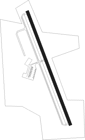
Runway info
| Runway 16 / 34 | ||
| length | 1222m (4009ft) | |
| bearing | 161° / 341° | |
| width | 30m (100ft) | |
| surface | asphalt | |
Nearby beacons
| code | identifier | dist | bearing | frequency |
|---|---|---|---|---|
| BQP | BASTROP NDB | 0.1 | 244° | 329 |
| MLU | MONROE VORTAC | 16.3 | 213° | 117.20 |
| ML | SABAR (MONROE) NDB | 21.3 | 217° | 392 |
| FWV | TRUXNO (FARMERVILLE) NDB | 24.5 | 276° | 379 |
| ROQ | RUSTON NDB | 36.8 | 258° | 368 |
| MON | MONTICELLO VOR/DME | 49.1 | 12° | 111.60 |
| ELD | EL DORADO VOR/DME | 52.8 | 300° | 115.50 |
| TKH | TALLULAH (VICKSBURG/TALLULAH) NDB | 53 | 121° | 344 |
| EL | LADOS (EL DORADO) NDB | 53.2 | 302° | 418 |
| MTQ | METCALF (GREENVILLE) NDB | 60.4 | 53° | 359 |
| SWB | SAWMILL (WINNFIELD) VOR/DME | 61.9 | 225° | 113.75 |
| GLH | GREENVILLE VOR/DME | 64.5 | 49° | 114.25 |
Instrument approach procedures
| runway | airway (heading) | route (dist, bearing) |
|---|---|---|
| RW16 | FAREX (161°) | FAREX 1800ft |
| RW16 | GETGE (189°) | GETGE 1800ft FAREX (5mi, 256°) 1800ft |
| RW16 | POSOE (135°) | POSOE 2200ft FAREX (5mi, 76°) 1800ft |
| RNAV | FAREX 1800ft HALAN (6mi, 161°) 1800ft KBQP (5mi, 161°) 209ft FEKOV (11mi, 161°) 1800ft FEKOV (turn) | |
| RW34 | FEKOV (341°) | FEKOV 1900ft |
| RW34 | HOBAK (315°) | HOBAK 1900ft FEKOV (5mi, 256°) 1900ft |
| RW34 | TIVEE (9°) | TIVEE 2200ft FEKOV (5mi, 76°) 1900ft |
| RNAV | FEKOV 1900ft GUCES (6mi, 341°) 1800ft KBQP (5mi, 341°) 212ft FAREX (11mi, 341°) 1800ft FAREX (turn) |
Disclaimer
The information on this website is not for real aviation. Use this data with the X-Plane flight simulator only! Data taken with kind consent from X-Plane 12 source code and data files. Content is subject to change without notice.