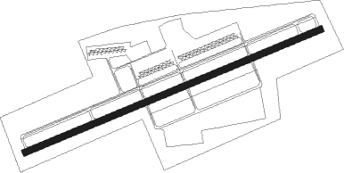
Butler - Pittsburgh Butler Regl
Airport details
| Country | United States of America |
| State | Pennsylvania |
| Region | K6 |
| Airspace | Cleveland Ctr |
| Municipality | Penn Township |
| Elevation | 1248ft (380m) |
| Timezone | GMT -5 |
| Coordinates | 40.77658, -79.95108 |
| Magnetic var | |
| Type | land |
| Available since | X-Plane v10.40 |
| ICAO code | KBTP |
| IATA code | BTP |
| FAA code | BTP |
Communication
| Pittsburgh Butler Regl AWOS 3 | 133.825 |
| Pittsburgh Butler Regl CTAF/UNICOM | 122.800 |
| Pittsburgh Butler Regl PITTSBURGH Approach/Departure | 124.750 |
Approach frequencies
| ILS-cat-I | RW08 | 111.5 | 18.00mi |
| 3° GS | RW08 | 111.5 | 18.00mi |
Nearby Points of Interest:
Sen. Walter Lowrie House
-Butler County Courthouse
-Butler County National Bank
-Butler Historic District
-Butler Armory
-Elm Court
-Saxonburg Historic District
-John Roebling House
-Harmony Historic District
-Passavant House
-Allegheny River Lock and Dam No. 5
-Pennsalt Historic District
-James Beach Clow House
-Isaac Lightner House
-St. Patrick's Roman Catholic Church
-Allegheny River Lock and Dam No. 4
-Captain William Vicary House
-New Kensington Production Works Historic District
-New Kensington Downtown Historic District
-Allegheny River Lock and Dam No. 3
-Legionville
-Oakmont Country Club
-Evergreen Hamlet
-Bridgewater Historic District
-Aliquippa Station
Nearby beacons
| code | identifier | dist | bearing | frequency |
|---|---|---|---|---|
| EWC | ELLWOOD CITY VOR/DME | 12.1 | 281° | 115.80 |
| MMJ | (PITTSBURGH) DME | 20.5 | 220° | 112 |
| UCP | CASTLE (NEW CASTLE) NDB | 25.7 | 298° | 272 |
| AGC | ALLEGHENY (PITTSBURGH) VOR/DME | 30.1 | 190° | 110 |
| CIP | DME | 31.5 | 53° | 112.90 |
| YN | FETCH (YOUNGSTOWN/WARREN) NDB | 38.7 | 303° | 338 |
| FKL | FRANKLIN VOR | 39.9 | 8° | 109.60 |
| HLG | WHEELING VOR/DME | 41.9 | 230° | 112.20 |
| YNG | YOUNGSTOWN VORTAC | 46.7 | 307° | 109 |
| VV | CAMOR (CONNELLSVILLE) NDB | 54.5 | 167° | 299 |
| IHD | INDIAN HEAD VORTAC | 55.2 | 144° | 108.20 |
| AIR | BELLAIRE VOR/DME | 60.4 | 229° | 117.10 |
| TDT | DME | 61.1 | 30° | 117.60 |
| JFN | JEFFERSON VOR/DME | 69.1 | 321° | 115.20 |
Instrument approach procedures
| runway | airway (heading) | route (dist, bearing) |
|---|---|---|
| RW08 | CETPU (53°) | CETPU WOTID (10mi, 15°) 3000ft |
| RW08 | CUTTA (98°) | CUTTA WOTID (22mi, 110°) 3000ft |
| RW08 | EWC (101°) | EWC WOTID (7mi, 173°) 3000ft WOTID (turn) 3000ft |
| RNAV | WOTID 3000ft ZUGOP (6mi, 76°) 3000ft KBTP (6mi, 76°) 1282ft (4949mi, 117°) 1497ft DEFLU (4938mi, 297°) 3100ft DEFLU (turn) | |
| RW26 | EARED (236°) | EARED DEFLU (7mi, 191°) 3000ft |
| RW26 | TALLS (262°) | TALLS DEFLU (12mi, 267°) 3000ft |
| RNAV | DEFLU 3000ft WEBVU (6mi, 256°) 3000ft XUFIB (4mi, 256°) 1860ft KBTP (2mi, 256°) 1295ft (4949mi, 117°) 1648ft WOTID (4960mi, 297°) 3000ft WOTID (turn) |
Disclaimer
The information on this website is not for real aviation. Use this data with the X-Plane flight simulator only! Data taken with kind consent from X-Plane 12 source code and data files. Content is subject to change without notice.
