Burlington - Burlington Intl
Airport details
| Country | United States of America |
| State | Vermont |
| Region | K6 |
| Airspace | Boston Ctr |
| Municipality | South Burlington |
| Elevation | 333ft (101m) |
| Timezone | GMT -5 |
| Coordinates | 44.47195, -73.15327 |
| Magnetic var | |
| Type | land |
| Available since | X-Plane v10.40 |
| ICAO code | KBTV |
| IATA code | BTV |
| FAA code | BTV |
Communication
| Burlington Intl ATIS | 123.800 |
| Burlington Intl UNICOM | 122.950 |
| Burlington Intl CTAF | 118.300 |
| Burlington Intl CLEARANCE DELIVERY | 119.150 |
| Burlington Intl BURLINGTON GROUND | 126.300 |
| Burlington Intl BURLINGTON TOWER | 118.300 |
| Burlington Intl BURLINGTON APCH/Departure | 121.100 |
| Burlington Intl BURLINGTON APCH/Departure | 278.800 |
Approach frequencies
| ILS-cat-I | RW15 | 110.3 | 18.00mi |
| ILS-cat-I | RW33 | 110.3 | 18.00mi |
| 3.2° GS | RW33 | 110.3 | 18.00mi |
| 3° GS | RW15 | 110.3 | 18.00mi |
Nearby Points of Interest:
Old Stone House
-Porter Screen Company
-Winooski Block
-Methodist Episcopal Church of Winooski
-Morrill Hall
-Lucy Ruggles House
-Fort Ethan Allen
-University Green Historic District
-Edward Wells House
-Grasse Mount
-Daniel Webster Robinson House
-Downtown Essex Junction Commercial Historic District
-Winterbotham Estate
-Main Street-College Street Historic District
-South Union Street Historic District
-Pearl Street Historic District
-Buell Street-Bradley Street Historic District
-Charles R. Palmer House
-Fletcher Free Library
-Saltus Grocery Store
-United States Post Office and Customhouse
-Old Chittenden County Courthouse
-Head of Church Street Historic District
-Montgomery Ward Building
-Battery Street Historic District
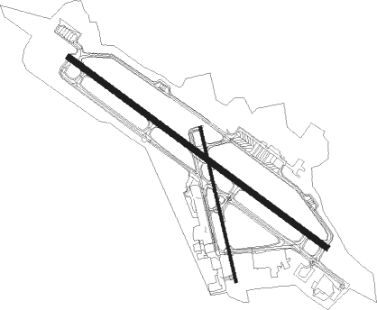
Runway info
Runway 15 / 33  | ||
| length | 2534m (8314ft) | |
| bearing | 122° / 302° | |
| width | 46m (150ft) | |
| surface | asphalt | |
| displ threshold | 0m (0ft) / 152m (499ft) | |
| blast zone | 149m (489ft) / 154m (505ft) | |
| Runway 1 / 19 | ||
| length | 1254m (4114ft) | |
| bearing | 348° / 168° | |
| width | 23m (75ft) | |
| surface | asphalt | |
| displ threshold | 69m (226ft) / 152m (499ft) | |
Nearby beacons
| code | identifier | dist | bearing | frequency |
|---|---|---|---|---|
| BJA | BURLINGTON TACAN | 0.3 | 325° | 112.40 |
| BTV | BURLINGTON VOR/DME | 4.6 | 201° | 117.50 |
| BT | HERRO (BURLINGTON) NDB | 5.4 | 302° | 382 |
| MPV | MONTPELIER VOR/DME | 38.1 | 119° | 116.90 |
| DYO | SMUTO (RUTLAND) NDB | 46.7 | 166° | 221 |
| YJN | DME | 47.6 | 348° | 115.80 |
| RUT | DME | 57.4 | 168° | 111 |
| LEB | DME | 62.4 | 130° | 113.70 |
| LAH | HANOVER (LEBANON) NDB | 62.5 | 128° | 276 |
Departure and arrival routes
| Transition altitude | 18000ft |
| Transition level | 18000ft |
| SID end points | distance | outbound heading | |
|---|---|---|---|
| RW01 | |||
| BTV1 | 14mi | 122° | |
| RW15 | |||
| BTV1 | 14mi | 122° | |
| RW19 | |||
| BTV1 | 14mi | 122° | |
| RW33 | |||
| BTV1 | 14mi | 122° | |
Instrument approach procedures
| runway | airway (heading) | route (dist, bearing) |
|---|---|---|
| RW01 | FOBUX (3°) | FOBUX 4000ft |
| RW01 | JENAX (32°) | JENAX 4000ft FOBUX (5mi, 92°) 4000ft |
| RNAV | FOBUX 4000ft CESAL (6mi, 5°) 2400ft OBRIE (3mi, 5°) 1220ft HEPES (2mi, 5°) 536ft (4688mi, 121°) 735ft HERRO (4693mi, 301°) 3000ft HERRO (turn) | |
| RW15 | STAEV (122°) | STAEV 3200ft |
| RW15 | WULEB (158°) | WULEB STAEV (8mi, 230°) 3200ft |
| RW15 | YUNUD (96°) | YUNUD STAEV (8mi, 50°) 3200ft |
| RNAV | STAEV 3200ft FOVES (6mi, 122°) 2000ft JUNEL (3mi, 122°) 1020ft KBTV (3mi, 122°) 357ft (4688mi, 121°) 1000ft YUNUD (4703mi, 301°) 5600ft YUNUD (turn) 5600ft | |
| RW33-Y | POROE (303°) | POROE SILDE (6mi, 34°) 6000ft |
| RW33-Y | SILDE (290°) | SILDE 10000ft SILDE (turn) 6000ft |
| RNAV | SILDE 6000ft FOGMO (8mi, 289°) 4600ft ZABOX (3mi, 289°) 3900ft WENKI (5mi, 289°) 2120ft IRAGE (2mi, 289°) 1320ft NASEE (turn) 940ft HABOK (turn) 566ft (4687mi, 121°) 735ft MANIF (4690mi, 301°) STAEV (11mi, 304°) 3000ft STAEV (turn) | |
| RW33-Z | ALOKY (288°) | ALOKY 6000ft JANUD (6mi, 231°) 6000ft NIDUQ (5mi, 302°) 5400ft HONIB (2mi, 302°) 4800ft |
| RW33-Z | DONGY (318°) | DONGY 6400ft JANUD (6mi, 50°) 6000ft NIDUQ (5mi, 302°) 5400ft HONIB (2mi, 302°) 4800ft |
| RW33-Z | JANUD (302°) | JANUD 6000ft NIDUQ (5mi, 302°) 5400ft HONIB (2mi, 302°) 4800ft |
| RNAV | HONIB 4800ft EHIKO (3mi, 302°) 3800ft KBTV (10mi, 302°) 389ft STAEV (12mi, 302°) 3000ft STAEV (turn) |
Disclaimer
The information on this website is not for real aviation. Use this data with the X-Plane flight simulator only! Data taken with kind consent from X-Plane 12 source code and data files. Content is subject to change without notice.