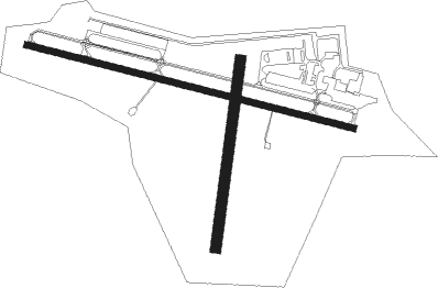
Burlington - Burlington Muni
Airport details
| Country | United States of America |
| State | Wisconsin |
| Region | K5 |
| Airspace | Chicago Ctr |
| Municipality | Burlington |
| Elevation | 776ft (237m) |
| Timezone | GMT -6 |
| Coordinates | 42.69072, -88.30468 |
| Magnetic var | |
| Type | land |
| Available since | X-Plane v10.40 |
| ICAO code | KBUU |
| IATA code | BUU |
| FAA code | BUU |
Communication
| Burlington Muni CTAF/UNICOM | 123.050 |
| Burlington Muni MILWAUKEE Approach/Departure | 125.350 |
Nearby Points of Interest:
Burlington Community Swimming Pools and Bathhouse
-John and Margaret Bell House
-Franklyn Hazelo House
-Sheboygan Light, Power and Railway Company Car #26
-Meyerhofer Cobblestone House
-Horticultural Hall
-Main Street Historic District
-Redwood Cottage
-The Riviera
-United Unitarian and Universalist Church
-Elkhorn Municipal Building
-Reynolds-Weed House
-Edward Elderkin House
-Lucien Boneparte Covell House
-Haseltine Cobblestone House
-Memorial Hall
-Reformed Presbyterian Church of Vernon
-Fred B. Jones House
-A. P. Johnson House
-A. H. Allyn House
-Delavan Post Office
-Delavan's Vitrified Brick Street
-Israel Stowell Temperance House
-Freewill Baptist Church
-Ten Chimneys

Nearby beacons
| code | identifier | dist | bearing | frequency |
|---|---|---|---|---|
| BUU | (BURLINGTON) DME | 0.1 | 116° | 114.50 |
| ENW | DME | 17.3 | 104° | 109.20 |
| RA | PASER (RACINE) NDB | 17.8 | 91° | 206 |
| HRK | (RACINE) DME | 22 | 82° | 117.70 |
| BAE | BADGER (MILWAUKEE) VOR/DME | 25.6 | 3° | 116.40 |
| UG | WAUKE (CHICAGO/WAUKEGAN) NDB | 26 | 114° | 379 |
| LJT | (MILWAUKEE) DME | 27.7 | 33° | 115.65 |
| OBK | NORTHBROOK VOR/DME | 32.2 | 143° | 113 |
| RYV | ROCK RIVER (WATERTOWN) NDB | 34.3 | 319° | 371 |
| JVL | JANESVILLE VOR/DME | 36.2 | 261° | 114.30 |
| BJB | WEST BEND VOR | 44.6 | 14° | 109.80 |
| GCO | DME | 45.4 | 150° | 108.25 |
| UNU | JUNEAU NDB | 47.6 | 332° | 344 |
| DPA | DUPAGE (CHICAGO) VOR/DME | 48.1 | 183° | 108.40 |
| RFD | DME | 48.4 | 243° | 110.80 |
| MX | KEDZI (CHICAGO) NDB | 63.2 | 147° | 248 |
Departure and arrival routes
| Transition altitude | 18000ft |
| Transition level | 18000ft |
| SID end points | distance | outbound heading | |
|---|---|---|---|
| ALL | |||
| UECKR6 | 57mi | 130° | |
| ACCRA5 | 47mi | 159° | |
Instrument approach procedures
| runway | airway (heading) | route (dist, bearing) |
|---|---|---|
| RW11 | JIGTA (104°) | JIGTA 6000ft JIGTA (turn) 2600ft |
| RNAV | JIGTA 2600ft LUCIP (7mi, 104°) 2600ft HEVEM (3mi, 104°) 1660ft KBUU (3mi, 105°) 827ft (5330mi, 116°) 1180ft SONOY (5319mi, 296°) 2500ft SONOY (turn) | |
| RW29 | SONOY (284°) | SONOY 6000ft SONOY (turn) 2500ft |
| RNAV | SONOY 2500ft WABEL (6mi, 284°) 2500ft FOBOR (2mi, 284°) 1820ft KBUU (4mi, 284°) 826ft (5330mi, 116°) 1160ft JIGTA (5342mi, 296°) 2600ft JIGTA (turn) |
Holding patterns
| STAR name | hold at | type | turn | heading* | altitude | leg | speed limit |
|---|---|---|---|---|---|---|---|
| GOPAC2 | LEEDN | VHF | right | 181 (1)° | DME 10.0mi | ICAO rules | |
| GOPAC2 | ZOWRO | VHF | right | 273 (93)° | DME 10.0mi | ICAO rules | |
| *) magnetic outbound (inbound) holding course | |||||||
Disclaimer
The information on this website is not for real aviation. Use this data with the X-Plane flight simulator only! Data taken with kind consent from X-Plane 12 source code and data files. Content is subject to change without notice.