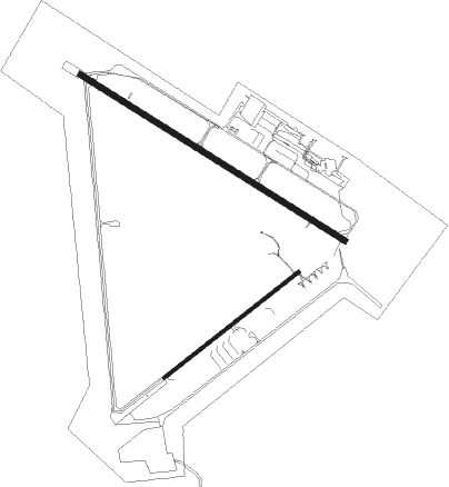
Burlington/mount Vernon - Skagit Regl
Airport details
| Country | United States of America |
| State | Washington |
| Region | K1 |
| Airspace | Seattle Ctr |
| Municipality | Skagit County |
| Elevation | 144ft (44m) |
| Timezone | GMT -8 |
| Coordinates | 48.47053, -122.42169 |
| Magnetic var | |
| Type | land |
| Available since | X-Plane v10.40 |
| ICAO code | KBVS |
| IATA code | MVW |
| FAA code | BVS |
Communication
| Skagit Regl AWOS 3 | 121.125 |
| Skagit Regl CTAF/UNICOM | 123.075 |
| Skagit Regl WHIDBEY Approach/Departure | 120.700 |
Nearby Points of Interest:
Bethsaida Swedish Evangelical Lutheran Church Parsonage
-Deception Pass Bridge
-Stanwood IOOF Public Hall
-Lairmont Manor
-Gamwell House
-Old Main
-J. J. Donovan House
-Bellingham National Bank Building
-United States Post Office and Courthouse
-B. P. O. E. Building
-Flatiron Building
-T. G. Richards and Company Store
-Lottie Roth Block
-Aftermath Clubhouse
-Ebey's Landing National Historical Reserve
-Moran State Park
-Cama Beach State Park
-Fort Flagler State Park
-Rothschild House
-St. Anne's Roman Catholic Church
-Capt. Enoch S. Fowler House
-Jefferson County Courthouse
-Indian Shaker Church

Nearby beacons
| code | identifier | dist | bearing | frequency |
|---|---|---|---|---|
| BVS | SKAGIT/BAY VIEW (BURLINGTON) NDB | 0.1 | 120° | 240 |
| NUW | WHIDBEY ISLAND (OAK HARBO TACAN | 11.8 | 244° | 113.80 |
| CVV | PENN COVE VOR/DME | 18.1 | 233° | 117.20 |
| FHR | FRIDAY HARBOR NDB | 24 | 274° | 284 |
| AW | WATON (ARLINGTON) NDB | 25.9 | 146° | 382 |
| HUH | WHATCOM VORTAC | 29.1 | 342° | 113 |
| XX | ABBOTSFORD NDB | 32.8 | 353° | 344 |
| PAE | PAINE (EVERETT) VOR/DME | 33.5 | 165° | 110.60 |
| WC | WHITE ROCK NDB | 34.5 | 328° | 332 |
| YJ | VICTORIA NDB | 40.2 | 280° | 200 |
| AP | ACTIVE PASS NDB | 42.1 | 295° | 378 |
| NOW | EDIZ HOOK (PORT ANGELES) NDB | 43.9 | 251° | 338 |
| YPK | PITT MEADOWS VOR | 46.2 | 339° | 112.40 |
| YVR | VANCOUVER VOR/DME | 46.4 | 310° | 115.90 |
| VR | VANCOUVER NDB | 49 | 318° | 266 |
| HE | HOPE NDB | 67.6 | 47° | 245 |
Instrument approach procedures
| runway | airway (heading) | route (dist, bearing) |
|---|---|---|
| RW11 | CANDL (140°) | CANDL SOCLO (7mi, 211°) 3900ft |
| RW11 | ISLND (79°) | ISLND SOCLO (11mi, 359°) 3900ft SOCLO (turn) 3900ft |
| RNAV | SOCLO 3900ft ENSEW (3mi, 116°) 3100ft BRENN (4mi, 116°) 2200ft AMHER (3mi, 116°) 1160ft KBVS (4mi, 118°) 188ft (6656mi, 112°) 1000ft SOCLO (6662mi, 292°) 3900ft SOCLO (turn) | |
| RW29 | PAE (345°) | PAE BARKL (15mi, 16°) 5000ft KIREC (10mi, 16°) 4300ft |
| RNAV | KIREC 4300ft ENNGL (2mi, 310°) 3500ft OPIXE (2mi, 310°) 3000ft TOKSE (2mi, 296°) 2400ft ECARI (2mi, 296°) 1600ft KBVS (5mi, 295°) 145ft (6656mi, 112°) 377ft SOCLO (6662mi, 292°) 4000ft SOCLO (turn) |
Disclaimer
The information on this website is not for real aviation. Use this data with the X-Plane flight simulator only! Data taken with kind consent from X-Plane 12 source code and data files. Content is subject to change without notice.