Beverly - Beverly Regl
Airport details
| Country | United States of America |
| State | Massachusetts |
| Region | K6 |
| Airspace | Boston Ctr |
| Municipality | Beverly |
| Elevation | 104ft (32m) |
| Timezone | GMT -5 |
| Coordinates | 42.58414, -70.91615 |
| Magnetic var | |
| Type | land |
| Available since | X-Plane v10.40 |
| ICAO code | KBVY |
| IATA code | BVY |
| FAA code | BVY |
Communication
| Beverly Regl Beverly ATIS | 119.200 |
| Beverly Regl Beverly CTAF | 125.200 |
| Beverly Regl Beverly UNICOM | 122.950 |
| Beverly Regl DREAM & GRAYM STAR | 119.000 |
| Beverly Regl Beverly Ground | 121.600 |
| Beverly Regl Beverly Tower | 125.200 |
| Beverly Regl Boston Approach | 124.400 |
| Beverly Regl Boston Departure | 124.400 |
Approach frequencies
| LOC | RW16 | 110.5 | 18.00mi |
Nearby Points of Interest:
Rea-Proctor Homestead
-James Friend House
-Old Farm
-Rea Putnam Fowler House
-Exercise Conant House
-Solomon Kimball House
-Newman-Fiske-Dodge House
-Peter Woodbury House
-Wenham Historic District
-United Shoe Machinery Corporation Clubhouse
-James Putnam, Jr. House
-Fowler House
-Peabody Institute Library
-Prince Osborne House
-John Balch House
-Claflin-Richards House
-Larch Farm
-Sprague House
-John Perkins House
-Salem Village Historic District
-General Israel Putnam House
-Derby Summer House
-Hazadiah Smith House
-Danvers State Hospital
-Community House
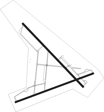
Runway info
Runway 9 / 27  | ||
| length | 1450m (4757ft) | |
| bearing | 78° / 258° | |
| width | 30m (100ft) | |
| surface | asphalt | |
| displ threshold | 0m (0ft) / 76m (249ft) | |
| Runway 16 / 34 | ||
| length | 1526m (5007ft) | |
| bearing | 132° / 312° | |
| width | 30m (100ft) | |
| surface | asphalt | |
| displ threshold | 73m (240ft) / 0m (0ft) | |
Nearby beacons
| code | identifier | dist | bearing | frequency |
|---|---|---|---|---|
| LWM | DME | 12.2 | 311° | 112.50 |
| BOS | BOSTON VOR/DME | 13.9 | 198° | 112.70 |
| MHT | MANCHESTER VOR/DME | 26.3 | 302° | 114.40 |
| OW | STOGE (NORWOOD) NDB | 29.4 | 205° | 397 |
| PSM | (PORTSMOUTH) DME | 30.2 | 10° | 116.50 |
| MJ | FITZY (MANCHESTER) NDB | 31.8 | 295° | 209 |
| ESG | ROLLINS (ROLLINSFORD) NDB | 38.3 | 8° | 260 |
| CO | EPSOM (CONCORD) NDB | 39.8 | 315° | 216 |
| PVC | PROVINCETOWN NDB | 43.6 | 127° | 389 |
| SF | SANFD (SANFORD) NDB | 45.1 | 6° | 349 |
| CON | CONCORD VOR/DME | 47.9 | 314° | 112.90 |
| LFV | MARCONI (NORTH TRURO) VOR/DME | 51.8 | 123° | 114.70 |
| ENE | KENNEBUNK VOR/DME | 52.2 | 20° | 117.10 |
| PUT | PUTNAM VOR/DME | 55.9 | 236° | 117.40 |
| PVD | PROVIDENCE VOR/DME | 56.4 | 211° | 115.60 |
| FMH | OTIS (FALMOUTH) TACAN | 58.3 | 156° | 115.80 |
| HY | BOGEY (HYANNIS) NDB | 61 | 141° | 342 |
| LC | BLNAP (LACONIA) NDB | 63.3 | 327° | 328 |
| CQX | NAUSET (CHATHAM) NDB | 67.6 | 134° | 279 |
Departure and arrival routes
| Transition altitude | 18000ft |
| Transition level | 18000ft |
| SID end points | distance | outbound heading | |
|---|---|---|---|
| RW09 | |||
| BVY2 | 38mi | 246° | |
| RW16 | |||
| BVY2 | 38mi | 246° | |
| RW27 | |||
| BVY2 | 38mi | 246° | |
| RW34 | |||
| BVY2 | 38mi | 246° | |
| STAR starting points | distance | inbound heading | |
|---|---|---|---|
| ALL | |||
| GRAYM6 | 57.3 | 67° | |
| DREEM2 | 38.9 | 75° | |
| ZELKA2 | 28.7 | 82° | |
Instrument approach procedures
| runway | airway (heading) | route (dist, bearing) |
|---|---|---|
| RW09 | COLLE (102°) | COLLE 2000ft EXXRO (6mi, 138°) 2000ft |
| RW09 | RIKAH (86°) | RIKAH 3000ft EXXRO (10mi, 83°) 2000ft |
| RNAV | EXXRO 2000ft DIXNN (7mi, 90°) 1800ft ZAPOB (4mi, 89°) 680ft MEMAE (1mi, 90°) 290ft (4569mi, 121°) 500ft WAKBI (4569mi, 301°) 2000ft WAKBI (turn) | |
| RW16 | HAGET (107°) | HAGET LADTI (7mi, 59°) 2000ft |
| RW16 | LADTI (132°) | LADTI 2000ft |
| RW16 | NUVZA (166°) | NUVZA LADTI (7mi, 239°) 2000ft |
| RNAV | LADTI 2000ft ZINDU (7mi, 132°) 1800ft KBVY (6mi, 133°) 147ft (4569mi, 121°) 600ft WAKBI (4569mi, 301°) 2000ft WAKBI (turn) | |
| RW27 | SNOOH (259°) | SNOOH 1800ft |
| RNAV | SNOOH 1800ft VOVCU (7mi, 258°) 1800ft MIAOU (3mi, 258°) 660ft KBVY (2mi, 262°) 151ft (4569mi, 121°) 700ft WAKBI (4569mi, 301°) 2000ft WAKBI (turn) | |
| RW34 | CROCR (312°) | CROCR 2000ft |
| RNAV | CROCR 2000ft WUSUP (7mi, 312°) 1800ft UNIRE (3mi, 312°) 760ft KBVY (2mi, 310°) 136ft (4569mi, 121°) 382ft HOMUX (4572mi, 301°) WAKBI (10mi, 37°) 2000ft WAKBI (turn) |
Holding patterns
| STAR name | hold at | type | turn | heading* | altitude | leg | speed limit |
|---|---|---|---|---|---|---|---|
| DREEM2 | DREEM | VHF | left | 233 (53)° | 1.0min timed | ICAO rules | |
| GRAYM6 | DREEM | VHF | left | 233 (53)° | 1.0min timed | ICAO rules | |
| *) magnetic outbound (inbound) holding course | |||||||
Disclaimer
The information on this website is not for real aviation. Use this data with the X-Plane flight simulator only! Data taken with kind consent from X-Plane 12 source code and data files. Content is subject to change without notice.