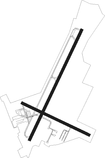
Bowling Green - Bowling Green Warren Co Rgnl
Airport details
| Country | United States of America |
| State | Kentucky |
| Region | K5 |
| Airspace | Memphis Ctr |
| Municipality | Bowling Green |
| Elevation | 543ft (166m) |
| Timezone | GMT -6 |
| Coordinates | 36.95809, -86.42045 |
| Magnetic var | |
| Type | land |
| Available since | X-Plane v10.30 |
| ICAO code | KBWG |
| IATA code | BWG |
| FAA code | BWG |
Communication
| Bowling Green Warren Co Rgnl ASOS | 127.825 |
| Bowling Green Warren Co Rgnl CTAF/UNICOM | 123.000 |
Approach frequencies
| ILS-cat-I | RW03 | 108.75 | 18.00mi |
| 3° GS | RW03 | 108.75 | 18.00mi |
Nearby Points of Interest:
William F. Perry Monument
-Henry Hardin Cherry Hall
-Downtown Commercial District
-Cecilia Memorial Christian Church
-First Colored Baptist Church
-Van Meter Hall
-Standard Oil Company Filling Station
-Western Kentucky University Heating Plant
-Eloise B. Houchens Center
-Hines House
-St. Joseph Roman Catholic Church
-Bowling Green Organizational Maintenance Shop No. 10
-Shaker Museum at South Union
-South Union Shaker Center House and Preservatory
-Smiths Grove Presbyterian Church
-Smiths Grove Baptist Church
-Young's Ferry House
-Mitchell-Estes Farmstead
-Reed-Dossey House
-Hargis House
-Franklin Downtown Commercial District
-Simpson County Courthouse
-Scottsville Downtown Commercial Historic District
-Dr. Pellie G. Graves House
-J.L. Turner and Son Building

Nearby beacons
| code | identifier | dist | bearing | frequency |
|---|---|---|---|---|
| BWG | GREEN DME | 2 | 218° | 117.90 |
| BW | NOORA (BOWLING GREEN) NDB | 5.5 | 218° | 236 |
| CCT | CITY DME | 47.7 | 297° | 109.80 |
| FK | AIRBE(FT CAMPBELL/HOPKINSVILLE NDB | 49.5 | 257° | 273 |
| BNA | NASHVILLE VORTAC | 50.9 | 198° | 114.10 |
| CKV | CLARKSVILLE VOR/DME | 51.8 | 251° | 110.60 |
| CK | SNUFF(FT CAMPBELL (CLARKSVILLE NDB | 53.2 | 246° | 335 |
| EWO | NEW HOPE VOR/DME | 53.8 | 48° | 110.80 |
| MYS | MYSTIC VOR | 56.8 | 11° | 108.20 |
| OWB | OWENSBORO VOR/DME | 59 | 316° | 108.60 |
| FQW | WALTER HILL (MURFREESBORO) NDB | 59.9 | 177° | 371 |
| FTK | FORT KNOX VOR/DME | 60.8 | 25° | 109.60 |
| HEM | HUCHN NDB | 70.8 | 139° | 233 |
Instrument approach procedures
| runway | airway (heading) | route (dist, bearing) |
|---|---|---|
| RW03 | QONXE (14°) | QONXE 3100ft WEDVO (9mi, 341°) 3100ft |
| RW03 | WEDVO (37°) | WEDVO 3100ft |
| RW03 | ZOVID (56°) | ZOVID 3100ft WEDVO (9mi, 78°) 3100ft |
| RNAV | WEDVO 3100ft UCIBI (6mi, 35°) 2400ft LIGYE (4mi, 36°) 1160ft KBWG (2mi, 42°) 591ft (5233mi, 113°) 747ft UGATE (5228mi, 293°) 3100ft UGATE (turn) | |
| RW21 | JIBIP (194°) | JIBIP 3100ft UGATE (9mi, 161°) 3100ft |
| RW21 | UGATE (215°) | UGATE 3100ft |
| RW21 | XOMYU (234°) | XOMYU 3100ft UGATE (9mi, 258°) 3100ft |
| RNAV | UGATE 3100ft ZEZTA (6mi, 216°) 2400ft WISLI (4mi, 216°) 1240ft KBWG (3mi, 211°) 575ft (5233mi, 113°) 805ft WEDVO (5239mi, 293°) 3100ft WEDVO (turn) |
Disclaimer
The information on this website is not for real aviation. Use this data with the X-Plane flight simulator only! Data taken with kind consent from X-Plane 12 source code and data files. Content is subject to change without notice.