Bogalusa - George R Carr Memorial
Airport details
| Country | United States of America |
| State | Louisiana |
| Region | K4 |
| Airspace | Houston Oceanic Ctr |
| Municipality | Washington Parish |
| Elevation | 119ft (36m) |
| Timezone | GMT -6 |
| Coordinates | 30.81369, -89.86497 |
| Magnetic var | |
| Type | land |
| Available since | X-Plane v10.40 |
| ICAO code | KBXA |
| IATA code | BXA |
| FAA code | BXA |
Communication
| George R Carr Memorial AWOS 3 | 118.025 |
| George R Carr Memorial CTAF/UNICOM | 122.800 |
Approach frequencies
| LOC | RW18 | 111.1 | 18.00mi |
Nearby Points of Interest:
Bogalusa City Hall
-Bogalusa Post Office
-Robert "Bob" Hicks House
-John Ford Home
-Thomas M. Babington House
-Greenlaw House
-Abita Springs Historic District
-Christ Episcopal Church
-Madisonville Town Hall
-Fontainebleau State Park
-Johnson House
-Dew Drop Social and Benevolent Hall
-Griffin's Bakery
-Francois Cousin House
-Green Shutters
-Arcola Presbyterian Church
Runway info
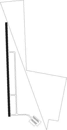
| Runway 18 / 36 | ||
| length | 1526m (5007ft) | |
| bearing | 183° / 3° | |
| width | 30m (100ft) | |
| surface | asphalt | |
Nearby beacons
| code | identifier | dist | bearing | frequency |
|---|---|---|---|---|
| GVB | BOGALUSA NDB | 4 | 2° | 353 |
| PCU | PICAYUNE VOR/DME | 16.6 | 152° | 113.95 |
| HS | HANCO (BAY ST LOUIS) NDB | 30.3 | 132° | 221 |
| HP | ANGER (HAMMOND) NDB | 31.3 | 250° | 212 |
| MCB | MC COMB VORTAC | 35.7 | 321° | 116.70 |
| GP | BAYOU NDB | 41.3 | 115° | 360 |
| MC | FERNI (MCCOMB) NDB | 42.4 | 304° | 413 |
| LBY | EATON (HATTIESBURG) VORTAC | 45.3 | 41° | 110.60 |
| GPT | GULFPORT VORTAC | 47.5 | 117° | 109 |
| BIX | KEESLER (BILOXI) TACAN | 54.1 | 113° | 111.80 |
| MS | KINTE (NEW ORLEANS) NDB | 54.8 | 214° | 338 |
| RQR | RESERVE VOR/DME | 57.4 | 225° | 110.80 |
| HRV | HARVEY (NEW ORLEANS) VORTAC | 58.3 | 188° | 114.10 |
Instrument approach procedures
| runway | airway (heading) | route (dist, bearing) |
|---|---|---|
| RW18 | OSTOE (183°) | OSTOE 2000ft |
| RNAV | OSTOE 2000ft APALY (7mi, 183°) 1500ft BAPAY (2mi, 183°) 760ft KBXA (2mi, 183°) 169ft (5398mi, 109°) 387ft LOCHS (5399mi, 289°) 2000ft LOCHS (turn) | |
| RW36 | LOCHS (3°) | LOCHS 2000ft |
| RNAV | LOCHS 2000ft FLOID (7mi, 3°) 2000ft KBXA (6mi, 3°) 171ft (5398mi, 109°) 421ft OSTOE (5398mi, 289°) 2000ft OSTOE (turn) |
Disclaimer
The information on this website is not for real aviation. Use this data with the X-Plane flight simulator only! Data taken with kind consent from X-Plane 12 source code and data files. Content is subject to change without notice.