Waynesboro - Burke County
Airport details
| Country | United States of America |
| State | Georgia |
| Region | K7 |
| Airspace | Atlanta Ctr |
| Municipality | Burke County |
| Elevation | 299ft (91m) |
| Timezone | GMT -5 |
| Coordinates | 33.04128, -82.00278 |
| Magnetic var | |
| Type | land |
| Available since | X-Plane v10.40 |
| ICAO code | KBXG |
| IATA code | n/a |
| FAA code | BXG |
Communication
| Burke County CTAF | 122.900 |
| Burke County AUGUSTA Approach/Departure | 126.800 |
Nearby Points of Interest:
John James Jones House
-Burke County Courthouse
-Waynesboro Historic District
-Camp Lawton
-Sapp Plantation
-Birdsville Plantation
-Jenkins County Courthouse
-Downtown Millen Historic District
-McCanaan Missionary Baptist Church and Cemetery
-Bath Presbyterian Church and Cemetery
-Jefferson County Courthouse
-Old Market
-Louisville Commercial Historic District
-Seclusaval and Windsor Spring
-Seaborn Goodall House
-Graniteville Historic District
-The Cedars
-Shiloh Orphanage
-Georgia Welcome Center
-College Hill
-Brahe House
-Old Government House
-Oakland Plantation (Beech Island, South Carolina)
-Woodrow Wilson Boyhood Home
-Augusta Downtown Historic District
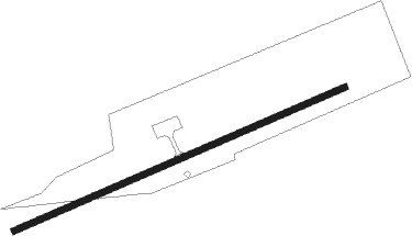
Runway info
| Runway 8 / 26 | ||
| length | 1224m (4016ft) | |
| bearing | 74° / 254° | |
| width | 23m (75ft) | |
| surface | asphalt | |
| displ threshold | 0m (0ft) / 31m (102ft) | |
| blast zone | 25m (82ft) / 29m (95ft) | |
Nearby beacons
| code | identifier | dist | bearing | frequency |
|---|---|---|---|---|
| AG | BUSHE (AUGUSTA) NDB | 15 | 13° | 233 |
| EMR | EMORY (AUGUSTA) NDB | 25.3 | 1° | 385 |
| JYL | SYLVANIA NDB | 31.2 | 134° | 245 |
| EEX | EMANUEL COUNTY (SWAINSBORO) NDB | 31.9 | 230° | 309 |
| ALD | ALLENDALE VOR | 35.8 | 92° | 116.70 |
| AIK | AIKEN NDB | 40.1 | 28° | 347 |
| IRQ | COLLIERS VORTAC | 40.7 | 347° | 113.90 |
| BZ | BULLO (STATESBORO) NDB | 41.3 | 152° | 407 |
| AA | CEDAR (THOMSON) NDB | 42.6 | 309° | 341 |
| DBN | DUBLIN VORTAC | 50.6 | 240° | 113.10 |
| UQN | ONYUN (VIDALIA) NDB | 51.3 | 200° | 372 |
| CA | MURRY (COLUMBIA) NDB | 67.3 | 39° | 362 |
| SAV | SAVANNAH VORTAC | 67.4 | 138° | 115.95 |
| CAE | COLUMBIA VORTAC | 68.2 | 49° | 114.70 |
| MQW | MC RAE NDB | 72.1 | 223° | 280 |
Instrument approach procedures
| runway | airway (heading) | route (dist, bearing) |
|---|---|---|
| RW08 | ALD (272°) | ALD NEDPE (47mi, 268°) 3000ft NEDPE (turn) 2000ft |
| RW08 | BEANS (234°) | BEANS NEDPE (24mi, 244°) 3000ft NEDPE (turn) 2000ft |
| RNAV | NEDPE 2000ft EGECE (6mi, 74°) 2000ft KBXG (5mi, 74°) 327ft (5003mi, 112°) 800ft HEDIL (4991mi, 292°) 2000ft HEDIL (turn) | |
| RW26 | HEDIL (254°) | HEDIL 2000ft |
| RNAV | HEDIL 2000ft CEVGU (8mi, 254°) 2000ft KBXG (5mi, 254°) 347ft (5003mi, 112°) 702ft NEDPE (5013mi, 292°) 2000ft NEDPE (turn) |
Disclaimer
The information on this website is not for real aviation. Use this data with the X-Plane flight simulator only! Data taken with kind consent from X-Plane 12 source code and data files. Content is subject to change without notice.