Naval Air Station Brunswick - Brunswick Executive
Airport details
| Country | United States of America |
| State | Maine |
| Region | K6 |
| Airspace | Boston Ctr |
| Municipality | Brunswick |
| Elevation | 75ft (23m) |
| Timezone | GMT -5 |
| Coordinates | 43.89236, -69.93883 |
| Magnetic var | |
| Type | land |
| Available since | X-Plane v10.40 |
| ICAO code | KBXM |
| IATA code | n/a |
| FAA code | n/a |
Communication
| Brunswick Executive ATIS | 120.550 |
| Brunswick Executive Clearance DEL | 134.100 |
| Brunswick Executive Ground Control | 134.550 |
| Brunswick Executive Tower | 119.600 |
| Brunswick Executive Approach/Departure | 118.150 |
Approach frequencies
| ILS-cat-I | RW01R | 109.3 | 18.00mi |
| 3° GS | RW01R | 109.3 | 18.00mi |
Nearby Points of Interest:
Parker Cleaveland House
-Massachusetts Hall
-Henry Boody House
-John Dunlap House
-Crystal Spring Farm
-East Harpswell Free Will Baptist Church
-Elijah Kellogg House
-Mill Cove School
-Union Church
-John E.L. Huse Memorial School
-Hyde Mansion
-Trufant Historic District
-United States Customhouse and Post Office
-Tarr-Eaton House
-Fiddler's Reach Fog Signal
-Cold Spring Farm
-Pettengill House and Farm
-Capt. Greenfield Pote House
-Robert P. Carr House
-Viola Coombs House
-E.B. Mallett Office Building
-Nathaniel Osgood House
-St. Cyril and St. Methodius Church
-Lisbon Falls High School
-Bagley-Bliss House
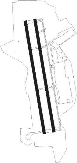
Runway info
Runway 1R / 19L  | ||
| length | 2441m (8009ft) | |
| bearing | 353° / 173° | |
| width | 61m (200ft) | |
| surface | asphalt | |
| displ threshold | 3m (10ft) / 0m (0ft) | |
| blast zone | 15m (49ft) / 46m (151ft) | |
| Runway 1L / 19R | ||
| length | 2441m (8009ft) | |
| bearing | 353° / 173° | |
| width | 61m (200ft) | |
| surface | asphalt | |
| blast zone | 14m (46ft) / 17m (56ft) | |
Nearby beacons
| code | identifier | dist | bearing | frequency |
|---|---|---|---|---|
| LE | LEWIE (AUBURN-LEWISTON) NDB | 17.7 | 280° | 240 |
| AUG | AUGUSTA VOR/DME | 26.4 | 18° | 114.95 |
| AU | DUNNS (AUGUSTA) NDB | 31.3 | 9° | 366 |
| SUH | SPRUCEHEAD (OWLS HEAD) NDB | 37.2 | 79° | 356 |
| ENE | KENNEBUNK VOR/DME | 40.5 | 235° | 117.10 |
| SF | SANFD (SANFORD) NDB | 51.3 | 238° | 349 |
| BUP | BURNHAM (PITTSFIELD) NDB | 54.4 | 36° | 348 |
| ESG | ROLLINS (ROLLINSFORD) NDB | 55.9 | 233° | 260 |
| PSM | (PORTSMOUTH) DME | 62.1 | 228° | 116.50 |
Instrument approach procedures
| runway | airway (heading) | route (dist, bearing) |
|---|---|---|
| RW01R | MESHL (21°) | MESHL BAILI (25mi, 34°) 2000ft |
| RW01R | NOLLI (139°) | NOLLI BAILI (28mi, 152°) 2200ft BAILI (turn) 2000ft |
| RW01R | RAZZR (227°) | RAZZR EMHOV (32mi, 194°) 2000ft BAILI (9mi, 266°) 2000ft |
| RNAV | BAILI 2000ft CARMR (7mi, 353°) 1700ft ZETGU (2mi, 353°) 900ft KBXM (3mi, 351°) 112ft (4546mi, 122°) 263ft WODGI (4550mi, 302°) 2500ft WODGI (turn) | |
| RW19L | MESHL (21°) | MESHL WODGI (48mi, 14°) 2500ft WODGI (turn) 2500ft |
| RW19L | NOLLI (139°) | NOLLI WODGI (8mi, 96°) 2500ft |
| RW19L | RAZZR (227°) | RAZZR WODGI (18mi, 253°) 2500ft |
| RNAV | WODGI 2500ft JOXET (6mi, 173°) 2100ft FISAL (4mi, 173°) 780ft KBXM (3mi, 175°) 127ft (4546mi, 122°) 331ft BAILI (4541mi, 302°) 2000ft BAILI (turn) |
Disclaimer
The information on this website is not for real aviation. Use this data with the X-Plane flight simulator only! Data taken with kind consent from X-Plane 12 source code and data files. Content is subject to change without notice.