Williamsburg - Williamsburg Whitley Co
Airport details
| Country | United States of America |
| State | Kentucky |
| Region | K5 |
| Airspace | Indianapolis Ctr |
| Municipality | Whitley County |
| Elevation | 1178ft (359m) |
| Timezone | GMT -5 |
| Coordinates | 36.79500, -84.19953 |
| Magnetic var | |
| Type | land |
| Available since | X-Plane v10.40 |
| ICAO code | KBYL |
| IATA code | n/a |
| FAA code | n/a |
Communication
| Williamsburg Whitley Co CTAF | 122.700 |
Approach frequencies
| LOC | RW20 | 108.3 | 18.00mi |
Nearby Points of Interest:
Lane Theater
-First Christian Church
-Carnegie Library
-Saint Camillus Academy
-U.S. Post Office and Mine Rescue Station
-Stearns Administrative and Commercial District
-Old Classroom Building, Union College
-Barbourville Commercial District
-Speed Hall
-Mitchell Building-First State Bank Building
-Soldiers and Sailors Memorial Gymnasium
-Federal Building-Courthouse
-Poynter Building
-First Evangelical Reformed Church
-Burnside Methodist Church
-Kincaid-Howard House
-Pineville Courthouse Square Historic District
-American Association, Limited, Office Building
-Middlesboro Downtown Commercial District
-Kincaid-Ausmus House
-Somerset Downtown Commercial District
-Kincaid House
-Battle of Dutton's Hill Monument
-A.E. Perkins House
-Black Creek Fire Lookout Tower
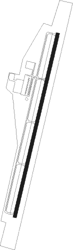
Runway info
| Runway 2 / 20 | ||
| length | 1679m (5509ft) | |
| bearing | 22° / 202° | |
| width | 30m (100ft) | |
| surface | asphalt | |
Nearby beacons
| code | identifier | dist | bearing | frequency |
|---|---|---|---|---|
| LOZ | LONDON VOR/DME | 14.9 | 21° | 116.55 |
| CDX | CUMBERLAND RIVER (SOMERSET) NDB | 26.1 | 293° | 388 |
| SCX | SCOTT (ONEIDA) NDB | 27.6 | 229° | 403 |
| LVT | LIVINGSTON VOR/DME | 48.2 | 258° | 108.40 |
| JXT | JEFFERSON (MORRISTOWN) NDB | 53.9 | 133° | 346 |
| DVK | GOODALL (DANVILLE) NDB | 54.1 | 324° | 311 |
| VXV | VOLUNTEER (KNOXVILLE) VORTAC | 55.4 | 161° | 116.40 |
| AZQ | DME | 57.4 | 58° | 111.20 |
Instrument approach procedures
| runway | airway (heading) | route (dist, bearing) |
|---|---|---|
| RW02 | ICIKO (22°) | ICIKO 4600ft |
| RNAV | ICIKO 4600ft GUCGE (8mi, 22°) 3100ft KICEK (2mi, 22°) 2520ft KBYL (5mi, 22°) 1191ft (5126mi, 114°) 1406ft LIKCI (5123mi, 294°) 4000ft LIKCI (turn) | |
| RW20 | LIKCI (202°) | LIKCI 4000ft |
| RNAV | LIKCI 4000ft JUBKA (7mi, 202°) 3100ft NUYIV (3mi, 202°) 2100ft KBYL (3mi, 202°) 1223ft (5126mi, 114°) 1578ft ICIKO (5130mi, 293°) 4900ft ICIKO (turn) 4900ft |
Disclaimer
The information on this website is not for real aviation. Use this data with the X-Plane flight simulator only! Data taken with kind consent from X-Plane 12 source code and data files. Content is subject to change without notice.