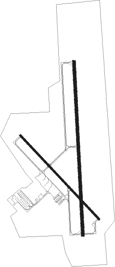
Council Bluffs - Council Bluffs Muni
Airport details
| Country | United States of America |
| State | Iowa |
| Region | K3 |
| Airspace | Minneapolis Ctr |
| Municipality | Council Bluffs |
| Elevation | 1245ft (379m) |
| Timezone | GMT -5 |
| Coordinates | 41.26011, -95.75864 |
| Magnetic var | |
| Type | land |
| Available since | X-Plane v10.40 |
| ICAO code | KCBF |
| IATA code | CBF |
| FAA code | CBF |
Communication
| Council Bluffs Muni AWOS 3 | 126.575 |
| Council Bluffs Muni CTAF/UNICOM | 122.800 |
| Council Bluffs Muni OMAHA Approach/Departure | 124.500 |
Approach frequencies
| ILS-cat-I | RW36 | 111.35 | 18.00mi |
| 3° GS | RW36 | 111.35 | 18.00mi |
Nearby Points of Interest:
Park/Glen Avenues Historic District
-Lysander Tulleys House
-Hughes-Irons Motor Company
-Pottawattamie County Jail
-Willow–Bluff–3rd Street Historic District
-August Beresheim House
-Wickham-De Vol House
-Martin Hughes House
-Bennett Building
-Jean and Inez Bregant House
-State Savings Bank
-Chieftain Hotel
-Haymarket Commercial Historic District
-Thomas Jefferis House
-Reverend Little's Young Ladies Seminary
-Pioneer Implement Company
-Sandwich–Marseilles Manufacturing Building
-YMCA Building
-Anheuser-Busch Beer Depot
-Beebe and Runyan Furniture Showroom and Warehouse
-Nash Block
-Omaha Union Station
-Hospe Music Warehouse
-Burlington Station
-Poppleton Block

Nearby beacons
| code | identifier | dist | bearing | frequency |
|---|---|---|---|---|
| OVR | OMAHA VORTAC | 5.6 | 167° | 116.30 |
| OFF | OFFUTT (OMAHA) TACAN | 10.6 | 225° | 111.70 |
| PMV | PLATTSMOUTH NDB | 20.2 | 206° | 329 |
| AHQ | WAHOO NDB | 37.9 | 269° | 400 |
| AFK | NEBRASKA CITY NDB | 39.5 | 189° | 347 |
| SCB | SCRIBNER VOR/DME | 44.3 | 292° | 111 |
| LNK | LINCOLN VORTAC | 48.8 | 251° | 116.10 |
| BIE | BEATRICE VOR | 73.2 | 226° | 110.60 |
Instrument approach procedures
| runway | airway (heading) | route (dist, bearing) |
|---|---|---|
| RW14 | QECQI (132°) | QECQI 3600ft |
| RNAV | QECQI 3600ft KAJQU (7mi, 133°) 2900ft KCBF (5mi, 132°) 1280ft (5665mi, 113°) 1495ft EVHAP (5658mi, 293°) 3900ft EVHAP (turn) | |
| RW18 | GLENE (233°) | GLENE YUFZU (5mi, 271°) 3000ft IPORE (6mi, 271°) 3000ft |
| RW18 | OVR (347°) | OVR IPORE (17mi, 357°) 3000ft IPORE (turn) 3000ft |
| RW18 | ZISIX (149°) | ZISIX IPORE (6mi, 100°) 3000ft |
| RNAV | IPORE 3000ft HODER (6mi, 182°) 2900ft FEDES (4mi, 182°) 1780ft KCBF (2mi, 184°) 1276ft (5665mi, 113°) 1491ft WAMET (5666mi, 293°) 3000ft WAMET (turn) | |
| RW32 | EVHAP (314°) | EVHAP 3900ft |
| RNAV | EVHAP 3900ft FEHEV (7mi, 313°) 2900ft CAVPI (3mi, 313°) 1820ft KCBF (2mi, 316°) 1282ft (5665mi, 113°) 2000ft EVHAP (5658mi, 293°) 3900ft EVHAP (turn) | |
| RW36 | EMEND (300°) | EMEND VOHBU (9mi, 268°) 3000ft WAMET (6mi, 271°) 3000ft |
| RW36 | MEPWE (61°) | MEPWE CAVIP (8mi, 95°) 3000ft WAMET (6mi, 91°) 3000ft |
| RW36 | OVR (347°) | OVR WAMET (6mi, 195°) 3000ft WAMET (turn) 3000ft |
| RNAV | WAMET 3000ft JATIN (6mi, 2°) 2900ft HODIN (3mi, 2°) 1820ft KCBF (2mi, 1°) 1292ft (5665mi, 113°) 1445ft IPORE (5664mi, 293°) 3000ft IPORE (turn) |
Disclaimer
The information on this website is not for real aviation. Use this data with the X-Plane flight simulator only! Data taken with kind consent from X-Plane 12 source code and data files. Content is subject to change without notice.