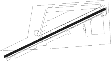
Upland - Cable
Airport details
| Country | United States of America |
| State | California |
| Region | K2 |
| Airspace | Los Angeles Ctr |
| Municipality | Upland |
| Elevation | 1441ft (439m) |
| Timezone | GMT -8 |
| Coordinates | 34.11285, -117.68195 |
| Magnetic var | |
| Type | land |
| Available since | X-Plane v10.40 |
| ICAO code | KCCB |
| IATA code | CCB |
| FAA code | CCB |
Communication
| Cable CTAF/UNICOM | 123.000 |
| Cable SOCAL Approach/Departure | 125.500 |
Nearby Points of Interest:
Old San Antonio Hospital
-Russian Village District
-Carnegie Library (Upland, California)
-Ygnacio Palomares Adobe
-Frankish Building
-Ontario State Bank Block
-Lincoln Park Historic District
-La Casa Primera de Rancho San Jose
-La Casa Alvarado
-Cucamonga Service Station
-Sam and Alfreda Maloof Compound
-Pomona Fox Theater
-Pomona City Stables
-Moyse Building
-Hofer Ranch
-Phillips Mansion
-Rubel Castle
-Bono's Restaurant and Deli
-La Puente Valley Woman's Club
-George Key Ranch
-Upton Sinclair House
-The Oaks
-A. S. Bradford House
-Arlington Branch Library and Fire Hall
-Harada House
Nearby beacons
| code | identifier | dist | bearing | frequency |
|---|---|---|---|---|
| POM | POMONA VORTAC | 5.6 | 252° | 110.40 |
| PDZ | PARADISE (ONTARIO) VORTAC | 13.9 | 142° | 112.20 |
| RAL | RIVERSIDE VOR | 14.9 | 124° | 112.40 |
| SB | PETIS (SAN BERNARDINO) NDB | 16 | 100° | 397 |
| RIV | MARCH (RIVERSIDE) TACAN | 23.7 | 117° | 113 |
| ELB | EL TORO (SANTA ANA) VOR/DME | 26.3 | 186° | 117.20 |
| SLI | SEAL BEACH (LOS ALAMITOS) VORTAC | 27.1 | 229° | 115.70 |
| HDF | HOMELAND (RIVERSIDE) VOR | 31.9 | 124° | 113.40 |
| VCV | VICTORVILLE VOR/DME | 32.3 | 31° | 109.05 |
| PMD | PALMDALE VORTAC | 36.4 | 324° | 114.50 |
| LAX | LOS ANGELES VORTAC | 38.8 | 257° | 113.60 |
| SMO | SANTA MONICA VOR/DME | 39 | 262° | 110.80 |
| VNY | VAN NUYS VOR/DME | 40.7 | 278° | 113.10 |
| EDW | EDWARDS VORTAC | 52.2 | 357° | 116.40 |
| NFG | CAMP PENDLETON (OCEANSIDE TACAN | 52.4 | 161° | 111.80 |
| OCN | OCEANSIDE VORTAC | 54 | 163° | 115.30 |
| LHS | LAKE HUGHES VORTAC | 56 | 302° | 114.35 |
| SXC | SANTA CATALINA VORTAC | 57.6 | 225° | 111.40 |
Instrument approach procedures
| runway | airway (heading) | route (dist, bearing) |
|---|---|---|
| RW06 | ELMOO (88°) | ELMOO HOPUN (9mi, 97°) 4500ft |
| RNAV | HOPUN 4500ft POM (6mi, 89°) 3100ft TOVQU (5mi, 72°) 1566ft (6765mi, 106°) 1900ft ADAMM (6772mi, 286°) 5500ft ADAMM (turn) |
Disclaimer
The information on this website is not for real aviation. Use this data with the X-Plane flight simulator only! Data taken with kind consent from X-Plane 12 source code and data files. Content is subject to change without notice.