Concord - Buchanan Field
Airport details
| Country | United States of America |
| State | California |
| Region | K2 |
| Airspace | Oakland Ctr |
| Municipality | Contra Costa County |
| Elevation | 24ft (7m) |
| Timezone | GMT -8 |
| Coordinates | 37.98302, -122.05809 |
| Magnetic var | |
| Type | land |
| Available since | X-Plane v10.40 |
| ICAO code | KCCR |
| IATA code | CCR |
| FAA code | CCR |
Communication
| Buchanan Field ATIS | 124.700 |
| Buchanan Field CTAF | 119.700 |
| Buchanan Field UNICOM | 122.950 |
| Buchanan Field DEL | 118.750 |
| Buchanan Field Ground Control | 121.900 |
| Buchanan Field Tower | 119.700 |
| Buchanan Field Travis Approach/Departure | 119.900 |
Approach frequencies
| LDA | RW19R | 108.5 | 18.00mi |
Nearby Points of Interest:
William T. Hendrick House
-Don Francisco Galindo House
-Patrick Rodgers Farm
-Tucker House
-Port Chicago Naval Magazine National Memorial
-Benicia Arsenal
-Old Borges Ranch
-Benicia Southern Pacific Railroad Passenger Depot
-USCGC Storis
-Old Masonic Hall
-Charles W. Merrill House
-Maynard Buehler House
-Moraga Adobe
-Black Diamond Mines Regional Preserve
-Danville station
-Bank of Pinole
-Riverview Union High School Building
-Bowles Hall
-Bernardo Fernandez House
-Donald and Helen Olsen House
-Hearst Memorial Mining Building
-Senior Hall
-Thorsen House
-LeConte Hall
-Gilman Hall
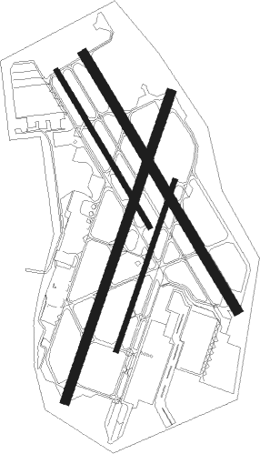
Runway info
Runway 1L / 19R  | ||
| length | 1526m (5007ft) | |
| bearing | 29° / 209° | |
| width | 46m (151ft) | |
| surface | asphalt | |
| displ threshold | 0m (0ft) / 183m (600ft) | |
| blast zone | 61m (200ft) / 46m (151ft) | |
| Runway 14L / 32R | ||
| length | 1404m (4606ft) | |
| bearing | 148° / 328° | |
| width | 46m (151ft) | |
| surface | asphalt | |
| displ threshold | 91m (299ft) / 107m (351ft) | |
| Runway 14R / 32L | ||
| length | 855m (2805ft) | |
| bearing | 148° / 328° | |
| width | 23m (75ft) | |
| surface | asphalt | |
| Runway 1R / 19L | ||
| length | 845m (2772ft) | |
| bearing | 29° / 209° | |
| width | 23m (75ft) | |
| surface | asphalt | |
Nearby beacons
| code | identifier | dist | bearing | frequency |
|---|---|---|---|---|
| CCR | CONCORD VOR/DME | 3.7 | 12° | 117 |
| SUU | TRAVIS (FAIRFIELD) TACAN | 16.6 | 23° | 116.60 |
| OAK | OAKLAND VOR/DME | 17.3 | 213° | 116.80 |
| SGD | SCAGGS ISLAND (NAPA) VORTAC | 18.9 | 302° | 112.10 |
| SAU | SAUSALITO VOR/DME | 23.3 | 255° | 116.20 |
| LV | REIGA (LIVERMORE) NDB | 24.8 | 128° | 374 |
| SFO | SAN FRANCISCO VOR/DME | 26.4 | 221° | 115.80 |
| NUQ | MOFFETT (MOUNTAIN VIEW) TACAN | 33 | 180° | 117.60 |
| SAC | SACRAMENTO VORTAC | 36.5 | 48° | 115.20 |
| SJC | SAN JOSE VOR/DME | 36.9 | 169° | 114.10 |
| OSI | WOODSIDE VOR/DME | 37 | 201° | 113.90 |
| PYE | POINT REYES VOR/DME | 38.7 | 277° | 113.70 |
| STS | ROSA DME | 47.4 | 305° | 116.15 |
| MCC | MC CLELLAN (SACRAMENTO) VOR/DME | 51.3 | 44° | 109.20 |
Departure and arrival routes
| Transition altitude | 18000ft |
| Transition level | 18000ft |
| SID end points | distance | outbound heading | |
|---|---|---|---|
| RW01L | |||
| BCHN2 | 19mi | 302° | |
| RW14L | |||
| BCHN2 | 19mi | 302° | |
| RW19R | |||
| BCHN2 | 19mi | 302° | |
| RW32R | |||
| BCHN2 | 19mi | 302° | |
| STAR starting points | distance | inbound heading | |
|---|---|---|---|
| ALL | |||
| BMBER1 | 55.7 | 271° | |
Instrument approach procedures
| runway | airway (heading) | route (dist, bearing) |
|---|---|---|
| RW19R | REJOY (237°) | REJOY FEVTA (9mi, 264°) 2000ft |
| RNAV | FEVTA 2000ft MUPNE (6mi, 209°) 1300ft KCCR (4mi, 207°) 67ft (6890mi, 107°) 500ft HASPS (6886mi, 287°) REJOY (12mi, 74°) 3000ft REJOY (turn) |
Disclaimer
The information on this website is not for real aviation. Use this data with the X-Plane flight simulator only! Data taken with kind consent from X-Plane 12 source code and data files. Content is subject to change without notice.