Lyndonville - Caledonia County
Airport details
| Country | United States of America |
| State | Vermont |
| Region | K6 |
| Airspace | Boston Ctr |
| Municipality | Lyndon |
| Elevation | 1187ft (362m) |
| Timezone | GMT -5 |
| Coordinates | 44.56911, -72.01797 |
| Magnetic var | |
| Type | land |
| Available since | X-Plane v10.30 |
| ICAO code | KCDA |
| IATA code | LLX |
| FAA code | CDA |
Communication
| Caledonia County AWOS 3 | 119.275 |
| Caledonia County CTAF/UNICOM | 122.800 |
| Caledonia County BOSTON Approach/Departure | 125.700 |
Nearby Points of Interest:
District 6 School House
-Mathewson Block
-Burklyn Hall
-Darling Estate Historic District
-Union Meeting House
-Toll House
-Methodist Episcopal Church
-Stannard Schoolhouse
-Shearer and Corser Double House
-Maple Street-Clarks Avenue Historic District
-Cote Apartment House
-Caleb H. Marshall House
-Morency Paint Shop and Apartment Building
-Judge David Hibbard Homestead
-William and Agnes Gilkerson Farm
-Franklin Fairbanks House
-Lee Farm
-West View Farm
-Greensboro Depot
-Phineas Thurston House
-Whittier House
-Fox Hall
-Crystal Lake Falls Historic District
-King Block
-Christian Union Society Meetinghouse
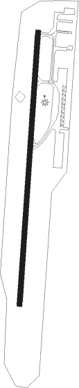
Runway info
| Runway 2 / 20 | ||
| length | 1007m (3304ft) | |
| bearing | 12° / 192° | |
| width | 18m (60ft) | |
| surface | asphalt | |
Nearby beacons
| code | identifier | dist | bearing | frequency |
|---|---|---|---|---|
| GMA | MAHN (WHITEFIELD) NDB | 18.8 | 122° | 386 |
| MPV | MONTPELIER VOR/DME | 34.4 | 222° | 116.90 |
| BML | DME | 35.7 | 86° | 116.55 |
| YSC | DME | 45.9 | 17° | 113.20 |
| LAH | HANOVER (LEBANON) NDB | 52.5 | 190° | 276 |
| LEB | DME | 54.1 | 193° | 113.70 |
| DYO | SMUTO (RUTLAND) NDB | 65.7 | 227° | 221 |
Instrument approach procedures
| runway | airway (heading) | route (dist, bearing) |
|---|---|---|
| RW02 | AYZOO (293°) | AYZOO ECAVO (12mi, 258°) 4000ft CEVEY (5mi, 276°) 4000ft |
| RW02 | CEVEY (12°) | CEVEY 4000ft |
| RW02 | MPV (42°) | MPV DETFI (22mi, 42°) 5000ft CEVEY (5mi, 96°) 4000ft |
| RNAV | CEVEY 4000ft AXTER (6mi, 12°) 2800ft KCDA (5mi, 12°) 1218ft (4642mi, 122°) 1588ft CEVEY (4641mi, 302°) 4000ft CEVEY (turn) |
Disclaimer
The information on this website is not for real aviation. Use this data with the X-Plane flight simulator only! Data taken with kind consent from X-Plane 12 source code and data files. Content is subject to change without notice.