Chadron - Chadron Muni
Airport details
| Country | United States of America |
| State | Nebraska |
| Region | K3 |
| Airspace | Denver Ctr |
| Municipality | Dawes County |
| Elevation | 3296ft (1005m) |
| Timezone | GMT -7 |
| Coordinates | 42.83756, -103.09541 |
| Magnetic var | |
| Type | land |
| Available since | X-Plane v10.40 |
| ICAO code | KCDR |
| IATA code | CDR |
| FAA code | CDR |
Communication
| Chadron Muni ASOS | 118.050 |
| Chadron Muni CTAF/UNICOM | 122.800 |
| Chadron Muni DENVER ApproachROACH | 127.950 |
| Chadron Muni DENVER DepartureARTURE | 127.950 |
Approach frequencies
| ILS-cat-I | RW03 | 110.9 | 18.00mi |
| 3° GS | RW03 | 110.9 | 18.00mi |
Nearby Points of Interest:
Edna Work Hall
-Chadron Public Library
-Crites Hall
-Sparks Hall
-Miller Hall
-Dawes County Courthouse
-Henry Wohlers Sr. Homestead
-United States Post Office
-Co-operative Block Building
-Hudson-Meng Bison Kill
-Plains Theatre
-Sheridan County Courthouse
Runway info
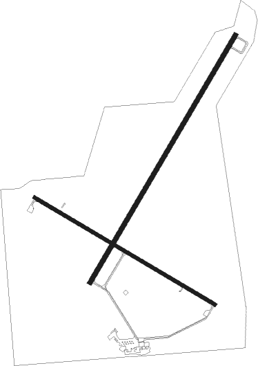
Runway 3 / 21  | ||
| length | 1828m (5997ft) | |
| bearing | 44° / 224° | |
| width | 30m (100ft) | |
| surface | concrete | |
| displ threshold | 88m (289ft) / 152m (499ft) | |
| Runway 12 / 30 | ||
| length | 1339m (4393ft) | |
| bearing | 117° / 297° | |
| width | 23m (75ft) | |
| surface | concrete | |
Nearby beacons
| code | identifier | dist | bearing | frequency |
|---|---|---|---|---|
| HIN | WHITNEY (CHADRON) NDB | 0.5 | 169° | 275 |
| CD | DAWES (CHADRON) NDB | 6 | 224° | 362 |
| TST | TOADSTOOL VOR/DME | 19.2 | 218° | 113.40 |
| GRN | GORDON NDB | 40.4 | 92° | 414 |
| AIA | ALLIANCE VOR/DME | 48.6 | 160° | 111.80 |
| BFF | SCOTTSBLUFF VORTAC | 59.1 | 202° | 112.60 |
Instrument approach procedures
| runway | airway (heading) | route (dist, bearing) |
|---|---|---|
| RW03 | HADIR (44°) | HADIR 7500ft |
| RW03 | JUVEB (14°) | JUVEB HADIR (10mi, 322°) 7500ft |
| RW03 | PETYO (66°) | PETYO HADIR (9mi, 97°) 7500ft |
| RNAV | HADIR 7500ft IDXUL (8mi, 43°) 5500ft ZAMAT (4mi, 44°) 4140ft KCDR (3mi, 44°) 3354ft (5980mi, 113°) 3494ft EDUQA (5970mi, 293°) 5100ft EDUQA (turn) | |
| RW12 | CABAX (116°) | CABAX 6300ft |
| RNAV | CABAX 6300ft AJIRE (7mi, 117°) 4500ft IGOKY (2mi, 117°) 4000ft KCDR (2mi, 113°) 3336ft (5980mi, 113°) 3544ft ECOPO (5970mi, 293°) 5900ft ECOPO (turn) | |
| RW21 | EDUQA (224°) | EDUQA 5100ft |
| RNAV | EDUQA 5100ft AXOYY (7mi, 224°) 5000ft DEWOK (3mi, 224°) 3900ft KCDR (2mi, 223°) 3310ft (5980mi, 113°) 3536ft HADIR (5990mi, 292°) 7500ft HADIR (turn) | |
| RW30 | ECOPO (298°) | ECOPO 5900ft |
| RNAV | ECOPO 5900ft GEDVE (7mi, 297°) 5000ft BAFJE (2mi, 297°) 4300ft KCDR (3mi, 300°) 3324ft (5980mi, 113°) 3540ft CABAX (5988mi, 293°) 6300ft CABAX (turn) |
Disclaimer
The information on this website is not for real aviation. Use this data with the X-Plane flight simulator only! Data taken with kind consent from X-Plane 12 source code and data files. Content is subject to change without notice.