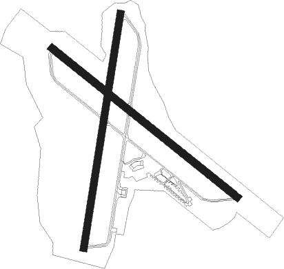
Crescent City - Crescent City Mcnamara
Airport details
| Country | United States of America |
| State | California |
| Region | K2 |
| Airspace | Seattle Ctr |
| Municipality | Del Norte County |
| Elevation | 61ft (19m) |
| Timezone | GMT -8 |
| Coordinates | 41.78017, -124.23653 |
| Magnetic var | |
| Type | land |
| Available since | X-Plane v10.40 |
| ICAO code | KCEC |
| IATA code | CEC |
| FAA code | CEC |
Communication
| Crescent City McNamara ASOS | 119.925 |
| Crescent City McNamara CTAF | 122.800 |
| Crescent City McNamara UNICOM | 122.800 |
Approach frequencies
| ILS-cat-I | RW12 | 108.7 | 18.00mi |
| 3° GS | RW12 | 108.7 | 18.00mi |
Nearby Points of Interest:
Gasquet Ranger Station Historic District
-Radar Station B-71
-Mount Emily
-Prairie Creek Fish Hatchery
-Osgood Ditch
Nearby beacons
| code | identifier | dist | bearing | frequency |
|---|---|---|---|---|
| CEC | CRESCENT CITY VORTAC | 0.1 | 262° | 109 |
| ACV | ARCATA VOR/DME | 48.3 | 171° | 115.05 |
Instrument approach procedures
| runway | airway (heading) | route (dist, bearing) |
|---|---|---|
| RW12 | ANAJE (20°) | ANAJE HUVEX (25mi, 328°) 2600ft FURNS (9mi, 61°) 2600ft |
| RW12 | CEC (82°) | CEC FURNS (12mi, 306°) 2600ft FURNS (turn) 2600ft |
| RW12 | WIPOG (182°) | WIPOG CIMEL (7mi, 245°) 4000ft FURNS (6mi, 221°) 2600ft |
| RNAV | FURNS 2600ft SLAMM (7mi, 125°) 1600ft KCEC (5mi, 126°) 112ft (6895mi, 109°) 600ft CHIDE (6900mi, 289°) 3000ft CHIDE (turn) | |
| RW36 | CEC (82°) | CEC CIGCA (10mi, 197°) 2400ft CIGCA (turn) 2400ft |
| RW36 | OLJEK (0°) | OLJEK CIGCA (8mi, 339°) 2400ft |
| RNAV | CIGCA 2400ft KAWIS (5mi, 17°) 1600ft KCEC (5mi, 18°) 109ft (6895mi, 109°) 1300ft CIGCA (6901mi, 289°) 2400ft CIGCA (turn) |
Disclaimer
The information on this website is not for real aviation. Use this data with the X-Plane flight simulator only! Data taken with kind consent from X-Plane 12 source code and data files. Content is subject to change without notice.

