Springfield/chicopee - Westover Arb
Airport details
| Country | United States of America |
| State | Massachusetts |
| Region | K6 |
| Airspace | Boston Ctr |
| Municipality | Chicopee |
| Elevation | 241ft (73m) |
| Timezone | GMT -5 |
| Coordinates | 42.19402, -72.53478 |
| Magnetic var | |
| Type | land |
| Available since | X-Plane v10.40 |
| ICAO code | KCEF |
| IATA code | CEF |
| FAA code | CEF |
Communication
| Westover ARB Westover ATIS | 127.525 |
| Westover ARB UNICOM | 134.850 |
| Westover ARB Ground Control | 118.350 |
| Westover ARB Tower | 134.850 |
| Westover ARB Yankee Approach | 125.350 |
| Westover ARB Yankee Departure | 125.350 |
Approach frequencies
| ILS-cat-I | RW23 | 109.9 | 18.00mi |
| ILS-cat-I | RW05 | 109.9 | 18.00mi |
| 3° GS | RW23 | 109.9 | 18.00mi |
| 3° GS | RW05 | 109.9 | 18.00mi |
Nearby Points of Interest:
Hadley Falls Company Housing District
-Myrtle Street School
-Indian Orchard Branch Library
-Al's Diner
-Thomas D. Page House
-Holyoke Canal System
-Clovis Robert Block
-North High Street Historic District
-Holyoke City Hall
-Caledonia Building
-Friedrich Block
-Carreau Block
-United States Post Office–Holyoke Main
-Ames Manufacturing Company
-Valentine School
-United States Post Office–South Hadley Main
-Polish National Home
-Dwight Manufacturing Company Housing District
-Ludlow Village Historic District
-City Hall
-McKnight District
-Federal Square Historic District
-Belle and Franklin Streets Historic District
-Gunn and Hubbard Blocks
-Hooker Apartments
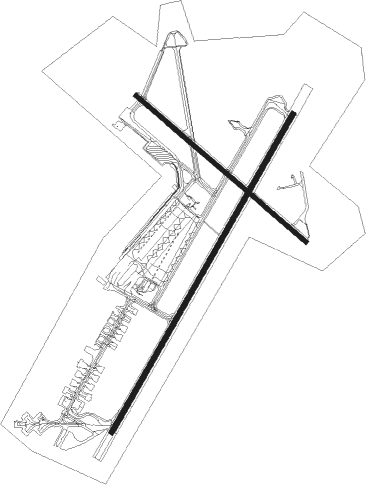
Runway info
Runway 5 / 23  | ||
| length | 3535m (11598ft) | |
| bearing | 42° / 222° | |
| width | 50m (164ft) | |
| surface | asphalt | |
| displ threshold | 366m (1201ft) / 0m (0ft) | |
| blast zone | 255m (837ft) / 255m (837ft) | |
| Runway 15 / 33 | ||
| length | 2162m (7093ft) | |
| bearing | 127° / 307° | |
| width | 46m (150ft) | |
| surface | asphalt | |
Nearby beacons
| code | identifier | dist | bearing | frequency |
|---|---|---|---|---|
| CEF | WESTOVER(SPRINGFIELD/CHIC TACAN | 0.4 | 67° | 114 |
| BAF | BARNES (WESTFIELD/SPRINGF VORTAC | 8.3 | 260° | 113 |
| CTR | CHESTER VOR/DME | 19.3 | 283° | 115.10 |
| GDM | GARDNER VOR/DME | 29.8 | 54° | 110.60 |
| HFD | HARTFORD VOR/DME | 33.2 | 181° | 114.90 |
| PUT | PUTNAM VOR/DME | 33.9 | 109° | 117.40 |
| EEN | DME | 37.6 | 22° | 109.40 |
| ORW | NORWICH VOR/DME | 45.1 | 140° | 110 |
| MAD | MADISON VOR/DME | 53.3 | 190° | 110.40 |
| GON | GROTON VOR/DME | 56.1 | 151° | 110.85 |
| HVN | HAVEN DME | 58.1 | 201° | 109.80 |
| CAM | CAMBRIDGE VOR/DME | 59.9 | 315° | 115 |
Departure and arrival routes
| Transition altitude | 18000ft |
| Transition level | 18000ft |
| STAR starting points | distance | inbound heading | |
|---|---|---|---|
| ALL | |||
| STELA1 | 44.2 | 108° | |
Holding patterns
| STAR name | hold at | type | turn | heading* | altitude | leg | speed limit |
|---|---|---|---|---|---|---|---|
| DPK3 | BRISS | VHF | right | 161 (341)° | < 14000ft | 1.0min timed | ICAO rules |
| STELA1 | STELA | VHF | right | 327 (147)° | < 14000ft | 1.0min timed | ICAO rules |
| *) magnetic outbound (inbound) holding course | |||||||
Disclaimer
The information on this website is not for real aviation. Use this data with the X-Plane flight simulator only! Data taken with kind consent from X-Plane 12 source code and data files. Content is subject to change without notice.