Crestview - Bob Sikes
Airport details
| Country | United States of America |
| State | Florida |
| Region | K7 |
| Airspace | Jacksonville Ctr |
| Municipality | Okaloosa County |
| Elevation | 209ft (64m) |
| Timezone | GMT -6 |
| Coordinates | 30.77883, -86.52211 |
| Magnetic var | |
| Type | land |
| Available since | X-Plane v10.40 |
| ICAO code | KCEW |
| IATA code | CEW |
| FAA code | CEW |
Communication
| Bob Sikes ASOS | 119.275 |
| Bob Sikes CTAF/UNICOM | 122.950 |
| Bob Sikes EGLIN Approach/Departure | 124.050 |
Approach frequencies
| ILS-cat-I | RW17 | 111.9 | 18.00mi |
| 3° GS | RW17 | 111.9 | 18.00mi |
Nearby Points of Interest:
Crestview Commercial Historic District
-Eglin Field Historic District
-McKinley Climatic Laboratory
-Camp Pinchot Historic District
-Sun Bright
-Perry L. Biddle House
-St. Agatha's Episcopal Church
-DeFuniak Springs Historic District
-Gulfview Hotel Historic District
-Governor Stone
-Louisville and Nashville Depot
-Ollinger-Cobb House
-Milton Historic District
-Mt. Pilgrim African Baptist Church
-Arcadia Sawmill and Arcadia Cotton Mill
-Bank of Andalusia
-Covington County Courthouse and Jail
-Avant House (Andalusia, Alabama)
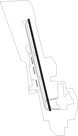
Runway info
| Runway 17 / 35 | ||
| length | 2448m (8031ft) | |
| bearing | 170° / 350° | |
| width | 46m (150ft) | |
| surface | asphalt | |
| blast zone | 62m (203ft) / 63m (207ft) | |
Nearby beacons
| code | identifier | dist | bearing | frequency |
|---|---|---|---|---|
| CE | KOBRA (CRESTVIEW) NDB | 4.5 | 349° | 201 |
| CEW | CRESTVIEW VORTAC | 8.5 | 287° | 115.90 |
| DWG | WARRINGTON (VALPARAISO) TACAN | 18 | 180° | 134.50 |
| HRT | HURLBURT (MARY ESTHER) TACAN | 22.7 | 206° | 110.80 |
| NGS | SANTA ROSA (MILTON) TACAN | 23.5 | 248° | 133.60 |
| NSE | WHITING (MILTON) TACAN | 25.8 | 264° | 112.30 |
| JUY | JUDD (ANDALUSIA) NDB | 32.3 | 14° | 264 |
| PKZ | PICKENS (PENSACOLA) NDB | 39.6 | 242° | 326 |
| BVG | BOLL WEEVIL (ENTERPRISE) NDB | 43.6 | 44° | 352 |
| EDN | ENTERPRISE VOR | 44.5 | 50° | 116.60 |
| OZ | RUCKR (FT RUCKER) NDB | 45.1 | 58° | 212 |
| NUN | SAUFLEY (PENSACOLA) VOR | 45.9 | 249° | 108.80 |
| PFN | LYNNE (PANAMA CITY) NDB | 46.9 | 121° | 278 |
| NPA | PENSACOLA TACAN | 48.2 | 242° | 117.20 |
| OZR | CAIRNS (FT RUCKER) VOR/DME | 50.4 | 58° | 111.20 |
| LOR | LOWE (FORT RUCKER) NDB | 53.1 | 53° | 269 |
| HEY | HANCHEY (FT RUCKER) VOR | 57.2 | 56° | 110.60 |
| HYE | HANCHEY (FT RUCKER) NDB | 57.2 | 55° | 221 |
| MVC | MONROEVILLE VORTAC | 59.1 | 309° | 116.80 |
| PAM | TYNDALL (PANAMA CITY) TACAN | 64.8 | 127° | 133.70 |
Instrument approach procedures
| runway | airway (heading) | route (dist, bearing) |
|---|---|---|
| RW17 | CEW (107°) | CEW WEDOM (10mi, 45°) 2000ft WEDOM (turn) 2000ft |
| RW17 | ROMEK (160°) | ROMEK WEDOM (15mi, 153°) 2000ft |
| RNAV | WEDOM 2000ft GIYAT (6mi, 170°) 1500ft KCEW (5mi, 170°) 264ft (5226mi, 110°) 470ft HEKLU (5224mi, 289°) 2000ft HEKLU (turn) | |
| RW35 | CEW (107°) | CEW HEKLU (17mi, 140°) 2000ft HEKLU (turn) 2000ft |
| RNAV | HEKLU 2000ft GEBKE (6mi, 350°) 1600ft KCEW (5mi, 350°) 205ft (5226mi, 110°) 450ft WEDOM (5228mi, 290°) 2000ft WEDOM (turn) |
Disclaimer
The information on this website is not for real aviation. Use this data with the X-Plane flight simulator only! Data taken with kind consent from X-Plane 12 source code and data files. Content is subject to change without notice.