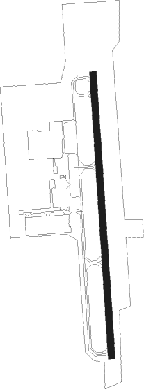
Buffalo - Buffalo Muni
Airport details
| Country | United States of America |
| State | Minnesota |
| Region | K3 |
| Airspace | Minneapolis Ctr |
| Municipality | Buffalo |
| Elevation | 962ft (293m) |
| Timezone | GMT -6 |
| Coordinates | 45.15883, -93.84331 |
| Magnetic var | |
| Type | land |
| Available since | X-Plane v10.40 |
| ICAO code | KCFE |
| IATA code | n/a |
| FAA code | CFE |
Communication
| Buffalo Muni AWOS | 120.450 |
| Buffalo Muni CTAF | 122.800 |
| Buffalo Muni App | 126.500 |
| Buffalo Muni Dep | 126.500 |
Nearby Points of Interest:
Marysville Swedesburg Lutheran Church
-District No. 48 School
-Dr. E.P. Hawkins Clinic, Hospital, and House
-Ames-Florida House
-Delano Village Hall
-Waverly Village Hall
-Tobias G. Mealey House
-Howard Lake City Hall
-Hagel Family Farm
-the thayer
-Oliver H. Kelley Homestead
-St. Mark's Episcopal Chapel
-Cokato Temperance Hall
-Thompson Summer House
-First Congregational Church of Clearwater
-Great Northern Depot
-Clearwater Masonic Lodge
-William W. Webster House
-Andrew Peterson Farmstead
-Peter Gideon Farmhouse
-Laketown Moravian Brethren's Church
-Osseo Water Tower
-Sparre Barn
-Anoka-Champlin Mississippi River Bridge
-Windego Park Auditorium/Open Air Theater
Runway info
| Runway 18 / 36 | ||
| length | 976m (3202ft) | |
| bearing | 181° / 1° | |
| width | 23m (75ft) | |
| surface | asphalt | |
Nearby beacons
| code | identifier | dist | bearing | frequency |
|---|---|---|---|---|
| GEP | GOPHER (MINNEAPOLIS) VORTAC | 19.9 | 92° | 117.30 |
| ST | HUSSK (ST CLOUD) NDB | 19.9 | 339° | 342 |
| STC | SAINT CLOUD VOR/DME | 25.1 | 331° | 112.10 |
| DWN | DARWIN VORTAC | 26.2 | 263° | 109 |
| FCM | FLYING CLOUD (MINNEAPOLIS VOR/DME | 26.2 | 130° | 117.70 |
| PNM | PRINCETON NDB | 26.3 | 30° | 368 |
| MSP | MINNEAPOLIS VOR/DME | 30.1 | 113° | 115.30 |
| FGT | FARMINGTON VORTAC | 42.3 | 129° | 115.70 |
| ROS | RUSH CITY NDB | 49.4 | 59° | 282 |
| MKT | MANKATO VOR/DME | 56.4 | 184° | 110.80 |
| XCR | RIPLEY NDB | 59.1 | 331° | 404 |
| FOW | HALFWAY (MORRISTOWN) VOR/DME | 60.7 | 154° | 111.20 |
Departure and arrival routes
| Transition altitude | 18000ft |
| Transition level | 18000ft |
| STAR starting points | distance | inbound heading | |
|---|---|---|---|
| ALL | |||
| AGUDE5 | 61.5 | 271° | |
Instrument approach procedures
| runway | airway (heading) | route (dist, bearing) |
|---|---|---|
| RW36 | DRAIL (14°) | DRAIL HUBEV (9mi, 28°) 3000ft |
| RW36 | HUBEV (1°) | HUBEV 3000ft |
| RW36 | JONNA (338°) | JONNA HUBEV (11mi, 316°) 3000ft |
| RW36 | MAYER (29°) | MAYER HUBEV (6mi, 68°) 3000ft |
| RNAV | HUBEV 3000ft YABFE (6mi, 1°) 2600ft KCFE (5mi, 1°) 994ft (5568mi, 116°) 1280ft ZIKPO (5567mi, 296°) SODIE (6mi, 343°) 3400ft SODIE (turn) |
Holding patterns
| STAR name | hold at | type | turn | heading* | altitude | leg | speed limit |
|---|---|---|---|---|---|---|---|
| AGUDE5 | BEERI | VHF | right | 127 (307)° | 1.0min timed | ICAO rules | |
| *) magnetic outbound (inbound) holding course | |||||||
Disclaimer
The information on this website is not for real aviation. Use this data with the X-Plane flight simulator only! Data taken with kind consent from X-Plane 12 source code and data files. Content is subject to change without notice.
