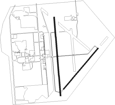
Coffeyville - Coffeyville Muni
Airport details
| Country | United States of America |
| State | Kansas |
| Region | K3 |
| Airspace | Kansas City Ctr |
| Municipality | Montgomery County |
| Elevation | 751ft (229m) |
| Timezone | GMT -5 |
| Coordinates | 37.09400, -95.57200 |
| Magnetic var | |
| Type | land |
| Available since | X-Plane v10.40 |
| ICAO code | KCFV |
| IATA code | CFV |
| FAA code | CFV |
Communication
| Coffeyville Muni ASOS | 121.275 |
| Coffeyville Muni CTAF/UNICOM | 123.000 |
Nearby Points of Interest:
Onion Creek Bridge (Coffeyville, Kansas)
-Union Implement and Hardware Building-Masonic Temple
-Booth Theater
-Diamond Point School
-Old Washington County Courthouse
-LaQuinta
Nearby beacons
| code | identifier | dist | bearing | frequency |
|---|---|---|---|---|
| OSW | OSWEGO VOR/DME | 18 | 80° | 117.60 |
| BV | DEWIE (BARTLESVILLE) NDB | 26.1 | 240° | 201 |
| BVO | BARTLESVILLE VOR/DME | 26.4 | 240° | 117.90 |
| CNU | CHANUTE VOR/DME | 31.9 | 358° | 109.20 |
| TUL | TULSA VORTAC | 54.9 | 194° | 114.40 |
| TU | OILLR (TULSA) NDB | 61.7 | 198° | 338 |
Instrument approach procedures
| runway | airway (heading) | route (dist, bearing) |
|---|---|---|
| RW17 | HOLIG (224°) | HOLIG ZOMAX (9mi, 270°) 3000ft |
| RW17 | WOLIK (135°) | WOLIK ZOMAX (9mi, 90°) 3000ft |
| RW17 | ZOMAX (179°) | ZOMAX 3000ft |
| RNAV | ZOMAX 3000ft KOYEY (6mi, 180°) 2400ft JOLRO (3mi, 180°) 1520ft KCFV (3mi, 177°) 786ft (5672mi, 111°) 1003ft NEIGH (5673mi, 291°) 2500ft NEIGH (turn) | |
| RW35 | DELAT (32°) | DELAT NEIGH (6mi, 90°) 2500ft NEIGH (turn) 2500ft |
| RW35 | OSW (260°) | OSW NEIGH (23mi, 236°) 2500ft NEIGH (turn) 2500ft |
| RNAV | NEIGH 2500ft IWATI (6mi, 360°) 2400ft KCFV (5mi, 1°) 774ft (5672mi, 111°) 1154ft NEIGH (5673mi, 291°) 2500ft NEIGH (turn) |
Disclaimer
The information on this website is not for real aviation. Use this data with the X-Plane flight simulator only! Data taken with kind consent from X-Plane 12 source code and data files. Content is subject to change without notice.

