Crystal River
Airport details
| Country | United States of America |
| State | Florida |
| Region | K7 |
| Airspace | Jacksonville Ctr |
| Municipality | Crystal River |
| Elevation | 7ft (2m) |
| Timezone | GMT -5 |
| Coordinates | 28.86761, -82.57411 |
| Magnetic var | |
| Type | land |
| Available since | X-Plane v10.40 |
| ICAO code | KCGC |
| IATA code | CGC |
| FAA code | CGC |
Communication
| Crystal River AWOS 3 | 118.325 |
| Crystal River CTAF/UNICOM | 122.725 |
| Crystal River JACKSONVILLE Approach/Departure | 118.600 |
Nearby Points of Interest:
Crystal River Old City Hall
-Crystal River Archaeological State Park
-Yulee Sugar Mill Ruins State Historic Site
-Old Hernando Elementary School
-Dunnellon Boomtown Historic District
-Masonic Temple of Citrus Lodge No. 118, F. and A.M.
-Floral City Historic District
-Chinsegut Hill Manor House
-John A. King House
-May-Stringer House
-Judge Willis Russell House
-Frank Saxon House
-William Sherman Jennings House
-Sinclair Service Station
-Spring Lake Community Center
-Thomas R. Pierce House
-Withlacoochee State Trail
-Robert W. Ferguson House
-West Ocala Historic District
-Ocala Historic Commercial District
-Ocala Historic District
-Ocala Union Station
-Tuscawilla Park Historic District
-Coca-Cola Bottling Plant
-E. C. Smith House
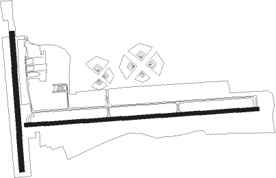
Runway info
Runway 9 / 27  | ||
| length | 1390m (4560ft) | |
| bearing | 90° / 270° | |
| width | 23m (75ft) | |
| surface | asphalt | |
| Runway 18 / 36 | ||
| length | 813m (2667ft) | |
| bearing | 180° / 0° | |
| width | 30m (100ft) | |
| surface | grass | |
| displ threshold | 59m (194ft) / 250m (820ft) | |
Nearby beacons
| code | identifier | dist | bearing | frequency |
|---|---|---|---|---|
| OCF | OCALA VORTAC | 26 | 48° | 113.70 |
| TP | COSME (TAMPA) NDB | 47 | 176° | 368 |
| CTY | CROSS CITY VORTAC | 50.4 | 327° | 112 |
| GNV | GATORS VORTAC | 51.9 | 20° | 116.20 |
| GN | WYNDS (GAINESVILLE) NDB | 52.5 | 27° | 269 |
| PI | CAPOK(ST PETERSBURG-CLEARWATER NDB | 52.8 | 188° | 360 |
| PIE | SAINT PETERSBURG VORTAC | 57.9 | 187° | 116.40 |
| LAL | LAKELAND VORTAC | 60.6 | 148° | 116 |
Instrument approach procedures
| runway | airway (heading) | route (dist, bearing) |
|---|---|---|
| RW09 | LEYZU (121°) | LEYZU 3000ft URTIC (8mi, 180°) 3000ft |
| RW09 | URTIC (90°) | URTIC 3000ft |
| RW09 | WUSUB (59°) | WUSUB 3000ft URTIC (8mi, 0°) 3000ft |
| RNAV | URTIC 3000ft MEEKE (6mi, 90°) 1800ft EXTAL (4mi, 90°) 560ft KCGC (2mi, 90°) 51ft (5015mi, 109°) 500ft LEYZU (5027mi, 289°) 3000ft LEYZU (turn) | |
| RW27 | EBERB (271°) | EBERB 3000ft |
| RW27 | OJOFY (240°) | OJOFY EBERB (8mi, 181°) 3000ft |
| RW27 | ZOXEL (301°) | ZOXEL EBERB (8mi, 1°) 3000ft |
| RNAV | EBERB 3000ft WEBBE (6mi, 271°) 1800ft UDIGY (3mi, 270°) 820ft KCGC (3mi, 271°) 58ft (5015mi, 109°) 700ft OJOFY (5003mi, 289°) 3000ft OJOFY (turn) |
Disclaimer
The information on this website is not for real aviation. Use this data with the X-Plane flight simulator only! Data taken with kind consent from X-Plane 12 source code and data files. Content is subject to change without notice.