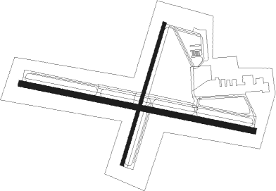
Cape Girardeau - Cape Girardeau Rgnl
Airport details
| Country | United States of America |
| State | Missouri |
| Region | K3 |
| Airspace | Memphis Ctr |
| Municipality | Cape Girardeau |
| Elevation | 339ft (103m) |
| Timezone | GMT -6 |
| Coordinates | 37.22531, -89.57075 |
| Magnetic var | |
| Type | land |
| Available since | X-Plane v10.40 |
| ICAO code | KCGI |
| IATA code | CGI |
| FAA code | CGI |
Communication
| CAPE GIRARDEAU RGNL ASOS | 120.550 |
| CAPE GIRARDEAU RGNL CTAF | 119.000 |
| CAPE GIRARDEAU RGNL UNICOM | 122.950 |
| CAPE GIRARDEAU RGNL Ground Control | 121.600 |
| CAPE GIRARDEAU RGNL Tower | 119.000 |
Approach frequencies
| ILS-cat-I | RW10 | 109.5 | 18.00mi |
| 3° GS | RW10 | 109.5 | 18.00mi |
Nearby Points of Interest:
Haarig Commercial Historic District
-Jefferson School
-Abraham Russell Ponder House
-South Middle Street Historic District
-Glenn House
-Colonel George C. Thilenius House
-Robert Felix and Elma Taylor Wichterich House
-Saint Vincent's College Building
-Courthouse-Seminary Neighborhood Historic District
-St. Vincent De Paul Catholic Church
-Klostermann Block
-B'Nai Israel Synagogue
-Broadway Theatre
-Wood Building
-Broadway Commercial Historic District
-Erlbacher Buildings
-Judith Crow House
-Frederick W. and Mary Karau Pott House
-Thebes Courthouse
-Cape Girardeau Court of Common Pleas
-Broadway-Middle Commercial Historic District
-Julius Vasterling Building
-Esquire Theater
-J. Maple and Grace Senne Wilson House
-Oliver-Leming House

Nearby beacons
| code | identifier | dist | bearing | frequency |
|---|---|---|---|---|
| CGI | GIRARDEAU DME | 0.1 | 323° | 112.90 |
| CG | DUTCH (CAPE GIRARDEAU) NDB | 6.4 | 282° | 248 |
| CIR | CAIRO NDB | 19.3 | 115° | 397 |
| CNG | CUNNINGHAM (PADUCAH) VOR/DME | 37.4 | 106° | 113.10 |
| MWA | DME | 41.4 | 47° | 110.40 |
| FAM | FARMINGTON VORTAC | 41.5 | 304° | 115.70 |
| MD | CABBI (CARBONDALE-MURPHYSBORO) NDB | 41.7 | 27° | 388 |
| MAW | MALDEN VORTAC | 43.4 | 207° | 111.20 |
| MW | JONNY (MARION) NDB | 46.6 | 44° | 382 |
| UC | OBION (UNION CITY) NDB | 62.2 | 148° | 212 |
Instrument approach procedures
| runway | airway (heading) | route (dist, bearing) |
|---|---|---|
| RW02 | ZUGUB (26°) | ZUGUB 3000ft |
| RNAV | ZUGUB 3000ft YOKUN (6mi, 26°) 2000ft JUXAV (3mi, 26°) 1040ft KCGI (2mi, 26°) 382ft (5385mi, 113°) 742ft UWALE (5381mi, 293°) 3500ft UWALE (turn) | |
| RW10 | IYIGO (103°) | IYIGO 3000ft |
| RNAV | IYIGO 3000ft GOGEC (6mi, 103°) 2000ft WELVA (3mi, 103°) 1060ft KCGI (3mi, 102°) 391ft (5385mi, 113°) 537ft FISAV (5373mi, 293°) 3000ft FISAV (turn) | |
| RW20 | UWALE (206°) | UWALE 3500ft |
| RNAV | UWALE 3500ft UFAVO (6mi, 206°) 2000ft ORUCE (3mi, 206°) 1040ft KCGI (2mi, 206°) 379ft (5385mi, 113°) 586ft ZUGUB (5389mi, 292°) 3000ft ZUGUB (turn) | |
| RW28 | FISAV (283°) | FISAV 3000ft |
| RNAV | FISAV 3000ft HEPEV (6mi, 283°) 2000ft OLACI (3mi, 283°) 1040ft KCGI (3mi, 283°) 379ft (5385mi, 113°) 723ft IYIGO (5396mi, 293°) 3000ft IYIGO (turn) |
Disclaimer
The information on this website is not for real aviation. Use this data with the X-Plane flight simulator only! Data taken with kind consent from X-Plane 12 source code and data files. Content is subject to change without notice.