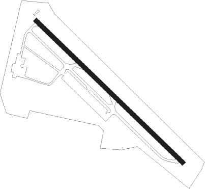
College Park
Airport details
| Country | United States of America |
| State | Maryland |
| Region | K6 |
| Airspace | Washington Ctr |
| Municipality | College Park |
| Elevation | 46ft (14m) |
| Timezone | GMT -5 |
| Coordinates | 38.98058, -76.92230 |
| Magnetic var | |
| Type | land |
| Available since | X-Plane v10.40 |
| ICAO code | KCGS |
| IATA code | CGS |
| FAA code | CGS |
Communication
| College Park AWOS 3 | 121.225 |
| College Park CTAF/UNICOM | 122.975 |
| College Park POTOMAC Approach | 125.650 |
| College Park DC FRZ | 124.700 |
| College Park POTOMAC Departure | 125.650 |
Nearby Points of Interest:
College Park Airport
-Marenka House
-O'Dea House
-Library of American Broadcasting
-Riverdale Park Historic District
-Old Town College Park
-University of Maryland Libraries
-University Park Historic District
-Harry Smith House
-University Town Center
-Ash Hill
-Hyattsville Historic District
-National Archives at College Park
-Hilltop Manor
-Greenbelt Historic District
-North Brentwood Historic District
-Market Master's House
-William Hilleary House
-Peace Cross
-Sligo Creek Trail
-Langley Park
-Davis-Warner House
-Beall's Pleasure
-Children's Country Home
-Mount Hope
Nearby beacons
| code | identifier | dist | bearing | frequency |
|---|---|---|---|---|
| DCA | WASHINGTON, D.C. VOR/DME | 9 | 223° | 111 |
| BUH | ANNE ARUNDEL (FT MEADE) NDB | 9.7 | 57° | 260 |
| GTN | GEORGETOWN (WASH., D.C.) NDB | 9.9 | 256° | 323 |
| ADW | ANDREWS (CAMP SPRINGS) VORTAC | 10.7 | 162° | 113.10 |
| DCA | OXONN (WASHINGTON) NDB | 13.7 | 206° | 332 |
| BAL | BALTIMORE VORTAC | 16.7 | 54° | 115.10 |
| OTT | NOTTINGHAM VORTAC | 18.4 | 147° | 113.70 |
| FND | ELLICOTT (BALTIMORE) NDB | 19.6 | 25° | 371 |
| DAA | DAVEE (FT BELVOIR) NDB | 21 | 210° | 223 |
| AML | ARMEL (WASH.,D.C.) VOR/DME | 25.5 | 265° | 113.50 |
| EMI | WESTMINSTER VORTAC | 31 | 354° | 117.90 |
| MTN | MARTIN (BALTIMORE) TACAN | 31.7 | 56° | 134.10 |
| FDK | FREDERICK VOR | 33.4 | 314° | 109 |
| BRV | BROOKE VORTAC | 43.6 | 214° | 114.50 |
| PXT | PATUXENT (PATUXENT RIVER) VORTAC | 48.2 | 143° | 117.60 |
| NHK | PATUXENT NDB | 48.3 | 143° | 400 |
| CSN | CASANOVA VORTAC | 48.6 | 250° | 116.30 |
| MRB | MARTINSBURG VORTAC | 49.4 | 294° | 112.10 |
| EZF | SHANNON (FREDERICKSBURG) NDB | 49.5 | 216° | 237 |
| MSQ | NAILR (CULPEPER) NDB | 55.8 | 242° | 351 |
| HGR | HAGERSTOWN VOR | 61.1 | 308° | 109.80 |
Disclaimer
The information on this website is not for real aviation. Use this data with the X-Plane flight simulator only! Data taken with kind consent from X-Plane 12 source code and data files. Content is subject to change without notice.
