Wauchula - Wauchula Muni
Airport details
| Country | United States of America |
| State | Florida |
| Region | K7 |
| Airspace | Miami Oceanic Ctr |
| Municipality | Hardee County |
| Elevation | 104ft (32m) |
| Timezone | GMT -5 |
| Coordinates | 27.51492, -81.88047 |
| Magnetic var | |
| Type | land |
| Available since | X-Plane v10.40 |
| ICAO code | KCHN |
| IATA code | n/a |
| FAA code | CHN |
Communication
| Wauchula Muni CTAF | 122.900 |
Nearby Points of Interest:
Albert Carlton Estate
-Fort Meade Historic District
-W.O. Williams/R.C. McClellan House
-Christ Church (Episcopal), Fort Meade, Florida
-Rev. Wm James Reid House
-W. Henry Lewis House
-Johnson-Smith House
-Micajah T. Singleton House
-Arcadia Historic District
-Homeland School
-Avon Park Historic District
-Harder Hall
-Elizabeth Haines House
-South Bartow Residential District
-Lawrence Brown House
-Benjamin Franklin Holland House
-Old Polk County Courthouse
-John J. Swearingen House
-Northeast Bartow Residential District
-Paul L. Vinson House
-Edward Hainz House
-H. Orvel Sebring House
-Sebring Downtown Historic District
-Central Station
-Highlands County Courthouse
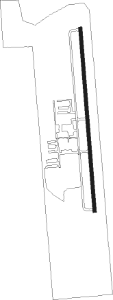
Runway info
| Runway 18 / 36 | ||
| length | 1225m (4019ft) | |
| bearing | 180° / 360° | |
| width | 23m (75ft) | |
| surface | asphalt | |
Nearby beacons
| code | identifier | dist | bearing | frequency |
|---|---|---|---|---|
| LAL | LAKELAND VORTAC | 29.1 | 344° | 116 |
| PGD | PUNTA GORDA VOR | 36.4 | 190° | 110.20 |
| SRQ | SARASOTA VOR/DME | 36.9 | 261° | 117 |
| MCF | MACDILL (TAMPA) TACAN | 39.5 | 299° | 111 |
| TP | COSME (TAMPA) NDB | 48.4 | 312° | 368 |
| LBV | LA BELLE VORTAC | 48.8 | 145° | 110.40 |
| PIE | SAINT PETERSBURG VORTAC | 48.8 | 296° | 116.40 |
| PI | CAPOK(ST PETERSBURG-CLEARWATER NDB | 52.4 | 300° | 360 |
| RSW | LEE COUNTY (FORT MYERS) VORTAC | 59.4 | 174° | 111.80 |
| FM | CALOO (FORT MYERS) NDB | 60.1 | 184° | 341 |
| OR | HERNY (ORLANDO) NDB | 64.1 | 24° | 221 |
Instrument approach procedures
| runway | airway (heading) | route (dist, bearing) |
|---|---|---|
| RW18 | GIBBS (98°) | GIBBS HUSMA (18mi, 66°) 2700ft ISUVE (5mi, 90°) 2300ft |
| RW18 | HALLR (264°) | HALLR JOBVA (14mi, 311°) 2300ft ISUVE (5mi, 270°) 2300ft |
| RW18 | ISUVE (180°) | ISUVE 2300ft |
| RW18 | LAL (164°) | LAL ISUVE (18mi, 154°) 2300ft |
| RNAV | ISUVE 2300ft WATPU (6mi, 180°) 1800ft XAMVY (3mi, 180°) 960ft KCHN (3mi, 180°) 144ft (4973mi, 109°) 508ft ITUYA (4972mi, 288°) 2000ft ITUYA (turn) | |
| RW36 | BRDGE (76°) | BRDGE JOXOB (12mi, 130°) 2000ft ITUYA (5mi, 90°) 2000ft |
| RW36 | ITUYA (360°) | ITUYA 2000ft |
| RW36 | RINSE (317°) | RINSE ITUYA (17mi, 292°) 2000ft |
| RNAV | ITUYA 2000ft WANUM (6mi, 360°) 1800ft XASEF (3mi, 360°) 960ft KCHN (3mi, 360°) 136ft (4973mi, 109°) 508ft ISUVE (4974mi, 289°) 2300ft ISUVE (turn) |
Disclaimer
The information on this website is not for real aviation. Use this data with the X-Plane flight simulator only! Data taken with kind consent from X-Plane 12 source code and data files. Content is subject to change without notice.