Chillicothe - Chillicothe Muni
Airport details
| Country | United States of America |
| State | Missouri |
| Region | K3 |
| Airspace | Kansas City Ctr |
| Municipality | Livingston County |
| Elevation | 783ft (239m) |
| Timezone | GMT -6 |
| Coordinates | 39.78200, -93.49625 |
| Magnetic var | |
| Type | land |
| Available since | X-Plane v10.40 |
| ICAO code | KCHT |
| IATA code | n/a |
| FAA code | CHT |
Communication
| Chillicothe Muni AWOS 3 | 118.175 |
| Chillicothe Muni CTAF/UNICOM | 122.800 |
Nearby Points of Interest:
Grace Episcopal Church
-Chillicothe Commercial Historic District
-Courthouse Square Historic District
-Linn County Courthouse
-Trenton High School
-Daviess County Courthouse
-A. Taylor Ray House
-Daviess County Rotary Jail and Sheriff's Residence
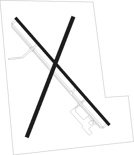
Runway info
Runway 14 / 32  | ||
| length | 1189m (3901ft) | |
| bearing | 136° / 316° | |
| width | 23m (75ft) | |
| surface | asphalt | |
| Runway 02 / 20 | ||
| length | 1068m (3504ft) | |
| bearing | 32° / 212° | |
| width | 34m (110ft) | |
| surface | grass | |
| displ threshold | 61m (200ft) / 105m (344ft) | |
Nearby beacons
| code | identifier | dist | bearing | frequency |
|---|---|---|---|---|
| BQS | BRAYMER VOR/DME | 19.7 | 248° | 115.35 |
| IRK | KIRKSVILLE VORTAC | 46.7 | 69° | 114.60 |
| ANX | NAPOLEON VORTAC | 50.6 | 223° | 114 |
| LMN | LAMONI VOR/DME | 53.4 | 330° | 116.70 |
Instrument approach procedures
| runway | airway (heading) | route (dist, bearing) |
|---|---|---|
| RW14 | ARKSS (163°) | ARKSS NOLIE (5mi, 240°) 2900ft |
| RW14 | FIGUN (114°) | FIGUN NOLIE (5mi, 60°) 2900ft |
| RW14 | NOLIE (136°) | NOLIE 6000ft NOLIE (turn) 2900ft |
| RNAV | NOLIE 2900ft BEVHI (6mi, 136°) 2500ft KCHT (5mi, 136°) 827ft (5566mi, 113°) 1183ft TUDEE (5560mi, 293°) 2900ft TUDEE (turn) | |
| RW32 | REDSE (294°) | REDSE TUDEE (5mi, 240°) 2900ft |
| RW32 | TUDEE (316°) | TUDEE 6000ft TUDEE (turn) 2900ft |
| RW32 | WERLI (342°) | WERLI TUDEE (5mi, 60°) 2900ft |
| RNAV | TUDEE 2900ft POSNE (6mi, 316°) 2500ft KCHT (6mi, 316°) 808ft (5566mi, 113°) 1148ft NOLIE (5573mi, 293°) 2900ft NOLIE (turn) |
Disclaimer
The information on this website is not for real aviation. Use this data with the X-Plane flight simulator only! Data taken with kind consent from X-Plane 12 source code and data files. Content is subject to change without notice.